
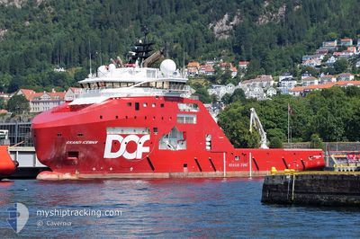
SKANDI ICEMAN
Anchor Handling Vessel
Current Trip
BROKK MJU
| Time Travelled | 15 h, 58 mins |
|---|---|
| Remaining Time | --- |
| Distance Travelled | 156.46 nm |
| Remaining Distance | --- |
| AVG Speed | 10 Knots |
| MAX Speed | 11.4 Knots |
| AVG Wind | 11.1 knots |
| MAX Wind | 28.8 knots |
| MIN Temp | 3.3°C / 37.94°F |
| MAX Temp | 5.7°C / 42.26°F |
| Draught | 7.2 m |
| Position Received | 23 m ago |
Current Position
| Longitude | 2.47716° |
|---|---|
| Latitude | 59.13359° |
| Status | Under way using engine |
| Speed | 10.1 Knots |
| Course | 237.3° |
| Area | North Sea |
| Station | T-AIS |
| Position Received | 23 m ago |
Info
Information
The current position of SKANDI ICEMAN is in North Sea with coordinates 59.13359° / 2.47716° as reported on 2024-04-20 06:00 by AIS to our vessel tracker app. The vessel's current speed is 10.1 Knots
The vessel SKANDI ICEMAN (IMO: 9660073, MMSI: 258738000) is a Anchor Handling Vessel that was built in 2013 ( 11 years old ). It's sailing under the flag of [NO] Norway.
In this page you can find informations about the vessels current position, last detected port calls, and current voyage information. If the vessels is not in coverage by AIS you will find the latest position.
The current position of SKANDI ICEMAN is detected by our AIS receivers and we are not responsible for the reliability of the data. The last position was recorded while the vessel was in Coverage by the Ais receivers of our vessel tracking app.
The current draught of SKANDI ICEMAN as reported by AIS is 7.2 meters
Weather
| Temperature | 5.3°C / 41.54°F |
|---|---|
| Wind Speed | 25 knots |
| Direction | 350° N |
| Pressure | 1022.5 hPa |
| Humidity | 60.2 % |
| Cloud Coverage | 100 % |
Featured Company
Last Port Calls
| Port | Arrival | Departure | Time In Port |
|---|---|---|---|
| 2024-04-19 05:30 | 2024-04-19 14:25 | 8 h | |
| 2024-04-18 22:56 | 2024-04-18 23:52 | 56 m | |
| 2024-04-16 09:49 | 2024-04-16 10:57 | 1 h | |
| 2024-04-13 13:42 | 2024-04-15 15:41 | 2 d | |
| 2024-04-12 16:22 | 2024-04-12 16:55 | 32 m | |
| 2024-04-12 15:12 | 2024-04-12 16:10 | 58 m | |
| 2024-04-11 15:53 | 2024-04-12 14:55 | 23 h | |
| 2024-04-11 11:12 | 2024-04-11 15:34 | 4 h | |
| 2024-04-05 21:29 | 2024-04-06 15:09 | 17 h | |
| 2024-04-02 09:31 | 2024-04-02 15:06 | 5 h |
Most Visited Ports (Last year)
| Port | Arrivals | |
|---|---|---|
| 76 | ||
| 26 | ||
| 15 | ||
| 10 | ||
| 6 | ||
| 2 |
Last Trips
| Origin | Departure | Destination | Arrival | Distance | |
|---|---|---|---|---|---|
| 2024-04-19 01:52 | 2024-04-19 07:30 | 0.98 nm | |||
| 2024-04-16 12:57 | 2024-04-19 00:56 | 177.55 nm | |||
| 2024-04-15 17:41 | 2024-04-16 11:49 | 71.03 nm | |||
| 2024-04-12 18:55 | 2024-04-13 15:42 | 52.44 nm | |||
| 2024-04-12 18:10 | 2024-04-12 18:22 | 2.09 nm | |||
| 2024-04-12 16:55 | 2024-04-12 17:12 | 2.14 nm | |||
| 2024-04-11 17:34 | 2024-04-11 17:53 | 2.88 nm | |||
| 2024-04-06 17:09 | 2024-04-11 13:12 | 526.27 nm | |||
| 2024-04-02 17:06 | 2024-04-05 23:29 | 340.84 nm | |||
| 2024-04-02 11:17 | 2024-04-02 11:31 | 0.61 nm |
Events
| Time | Event | Details | Position / Dest | Info |
|---|---|---|---|---|
| 2024-04-20 06:07 | Status Changed | Default Under way using engine |
59.12296 / 2.44764
BROKK MJU
|
Speed: 10.1 kn Course: 237.3° |
| 2024-04-20 05:55 | Status Changed | Under way using engine Default |
59.14101 / 2.49778
BROKK MJU
|
Speed: 10 kn Course: 218° |
| 2024-04-20 05:37 | Status Changed | Default Under way using engine |
59.16916 / 2.57622
BROKK MJU
|
Speed: 9.8 kn Course: 233.1° |
| 2024-04-20 05:12 | Status Changed | Under way using engine Default |
59.20855 / 2.68451
BROKK MJU
|
Speed: 10.2 kn Course: 204° |
| 2024-04-20 04:41 | Status Changed | Default Under way using engine |
59.28333 / 2.77833
BROKK MJU
|
Speed: 10.9 kn Course: 210.6° |
| 2024-04-20 04:40 | Status Changed | Under way using engine Default |
59.28721 / 2.78336
BROKK MJU
|
Speed: 10.3 kn Course: 234° |
| 2024-04-20 04:08 | Status Changed | Default Under way using engine |
59.34500 / 2.91167
BROKK MJU
|
Speed: 11.3 kn Course: 227.8° |
| 2024-04-20 04:07 | Status Changed | Under way using engine Default |
59.34712 / 2.91712
BROKK MJU
|
Speed: 9 kn Course: 240° |
| 2024-04-20 04:02 | Status Changed | Default Under way using engine |
59.35500 / 2.93833
BROKK MJU
|
Speed: 9.8 kn Course: 223.5° |
| 2024-04-20 03:57 | Status Changed | Under way using engine Default |
59.36484 / 2.96200
BROKK MJU
|
Speed: 10.5 kn Course: 230° |