
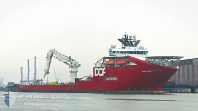
SKANDI ACERGY
Offshore Supply Ship
Current Trip
TORTUE FIELD
| Time Travelled | --- |
|---|---|
| Remaining Time | --- |
| Distance Travelled | 210.50 nm |
| Remaining Distance | --- |
| AVG Speed | 9 Knots |
| MAX Speed | 9 Knots |
| AVG Wind | 11.6 knots |
| MAX Wind | 13.9 knots |
| MIN Temp | 22.8°C / 73.04°F |
| MAX Temp | 25.4°C / 77.72°F |
| Draught | 7.1 m |
| Position Received | 3 d ago |
Current Position
| Longitude | -16.88717° |
|---|---|
| Latitude | 16.06780° |
| Status | Restricted manoeuverability |
| Speed | 0.1 Knots |
| Course | 345° |
| Area | North Atlantic Ocean |
| Station | T-AIS |
| Position Received | 3 d ago |
Info
Information
The current position of SKANDI ACERGY is in North Atlantic Ocean with coordinates 16.06780° / -16.88717° as reported on 2024-04-21 01:33 by AIS to our vessel tracker app. The vessel's current speed is 0.1 Knots
The vessel SKANDI ACERGY (IMO: 9387217, MMSI: 257691000) is a Offshore Supply Ship that was built in 2008 ( 16 years old ). It's sailing under the flag of [NO] Norway.
In this page you can find informations about the vessels current position, last detected port calls, and current voyage information. If the vessels is not in coverage by AIS you will find the latest position.
The current position of SKANDI ACERGY is detected by our AIS receivers and we are not responsible for the reliability of the data. The last position was recorded while the vessel was in Coverage by the Ais receivers of our vessel tracking app.
The current draught of SKANDI ACERGY as reported by AIS is 7.1 meters
Weather
| Temperature | 21.3°C / 70.34°F |
|---|---|
| Wind Speed | 19 knots |
| Direction | 334° NNW |
| Pressure | 1008.7 hPa |
| Humidity | 83.3 % |
| Cloud Coverage | 10 % |
Featured Company
Last Port Calls
Most Visited Ports (Last year)
| Port | Arrivals | |
|---|---|---|
| 4 | ||
| 2 | ||
| 1 | ||
| 1 | ||
| 1 |
Last Trips
| Origin | Departure | Destination | Arrival | Distance |
|---|
Events
| Time | Event | Details | Position / Dest | Info |
|---|---|---|---|---|
| 2024-04-21 01:33 | OUT of Coverage |
16.06780 / -16.88717
North Atlantic Ocean
|
Speed: 0.1 kn Course: 41.5° |
|
| 2024-04-21 01:33 | IN Coverage |
16.06780 / -16.88717
North Atlantic Ocean
|
Speed: 0.1 kn Course: 41.5° |
|
| 2024-04-20 22:22 | OUT of Coverage |
16.06723 / -16.88637
North Atlantic Ocean
|
Speed: 0.2 kn Course: 80.5° |
|
| 2024-04-20 13:41 | IN Coverage |
16.07001 / -16.89315
North Atlantic Ocean
|
Speed: 0.3 kn Course: 174.7° |
|
| 2024-04-20 11:22 | OUT of Coverage |
16.07037 / -16.89373
North Atlantic Ocean
|
Speed: 0.4 kn Course: 138.7° |
|
| 2024-04-20 10:37 | IN Coverage |
16.07035 / -16.89382
North Atlantic Ocean
|
Speed: 0.2 kn Course: 277.5° |
|
| 2024-04-20 07:19 | OUT of Coverage |
16.15482 / -17.10987
North Atlantic Ocean
|
Speed: 9 kn Course: 91° |
|
| 2024-04-20 06:14 | IN Coverage |
16.09640 / -17.22514
North Atlantic Ocean
|
Speed: 9.7 kn Course: 91.1° |
|
| 2024-04-20 03:52 | OUT of Coverage |
16.11932 / -17.60358
North Atlantic Ocean
|
Speed: 6.8 kn Course: 69.4° |
|
| 2024-04-20 03:52 | START Moving |
16.11932 / -17.60358
TORTUE FIELD
|
Speed: 6.8 kn Course: 69.4° |