
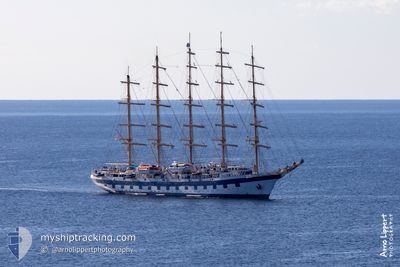
ROYAL CLIPPER
Passengers Ship
Current Trip
| Time Travelled | 1 day |
|---|---|
| Remaining Time | 9 h, 20 mins |
| Distance Travelled | 358.91 nm |
| Remaining Distance | 120.48 nm |
| AVG Speed | 12.6 Knots |
| MAX Speed | 16.1 Knots |
| AVG Wind | 7.5 knots |
| MAX Wind | 13.9 knots |
| MIN Temp | 15.1°C / 59.18°F |
| MAX Temp | 19.2°C / 66.56°F |
| Draught | 6.2 m |
| Position Received | 2 h, 37 m ago |
Current Position
| Longitude | -0.13088° |
|---|---|
| Latitude | 37.62322° |
| Status | Under way using engine |
| Speed | 12 Knots |
| Course | 53.5° |
| Area | Mediterranean Sea - Western Basin |
| Station | T-AIS |
| Position Received | 2 h, 37 m ago |
Info
Information
The current position of ROYAL CLIPPER is in Mediterranean Sea - Western Basin with coordinates 37.62322° / -0.13088° as reported on 2024-04-18 23:27 by AIS to our vessel tracker app. The vessel's current speed is 12 Knots and is heading at the port of IBIZA. The estimated time of arrival as calculated by MyShipTracking vessel tracking app is 2024-04-19 11:25 LT
The vessel ROYAL CLIPPER (IMO: 8712178, MMSI: 215813000) is a Passengers Ship that was built in 2000 ( 24 years old ). It's sailing under the flag of [MT] Malta.
In this page you can find informations about the vessels current position, last detected port calls, and current voyage information. If the vessels is not in coverage by AIS you will find the latest position.
The current position of ROYAL CLIPPER is detected by our AIS receivers and we are not responsible for the reliability of the data. The last position was recorded while the vessel was in Coverage by the Ais receivers of our vessel tracking app.
The current draught of ROYAL CLIPPER as reported by AIS is 6.2 meters
Weather
| Temperature | 17°C / 62.6°F |
|---|---|
| Wind Speed | 11 knots |
| Direction | 78° ENE |
| Pressure | 1019.3 hPa |
| Humidity | 75.9 % |
| Cloud Coverage | 100 % |
Featured Company
Last Port Calls
| Port | Arrival | Departure | Time In Port |
|---|---|---|---|
| 2024-04-17 06:26 | 2024-04-17 17:12 | 10 h | |
| 2024-04-16 10:29 | 2024-04-16 17:09 | 6 h | |
| 2024-04-15 04:35 | 2024-04-15 19:06 | 14 h | |
| 2024-03-30 09:40 | 2024-03-31 02:17 | 16 h | |
| 2024-03-28 11:22 | 2024-03-28 16:11 | 4 h | |
| 2024-03-25 22:08 | 2024-03-26 03:54 | 5 h | |
| 2024-03-23 09:53 | 2024-03-24 03:02 | 17 h | |
| 2024-03-17 15:56 | 2024-03-17 22:15 | 6 h | |
| 2024-03-14 11:16 | 2024-03-14 16:08 | 4 h | |
| 2024-03-09 11:03 | 2024-03-10 02:41 | 15 h |
Most Visited Ports (Last year)
| Port | Arrivals | |
|---|---|---|
| 17 | ||
| 9 | ||
| 8 | ||
| 8 | ||
| 7 | ||
| 5 |
Last Trips
| Origin | Departure | Destination | Arrival | Distance | |
|---|---|---|---|---|---|
| 2024-04-16 18:09 | 2024-04-17 08:26 | 115.97 nm | |||
| 2024-04-15 20:06 | 2024-04-16 11:29 | 157.20 nm | |||
| 2024-03-30 22:17 | 2024-04-15 05:35 | 3192.89 nm | |||
| 2024-03-28 12:11 | 2024-03-30 05:40 | 153.41 nm | |||
| 2024-03-25 23:54 | 2024-03-28 07:22 | 208.30 nm | |||
| 2024-03-23 23:02 | 2024-03-25 18:08 | 208.23 nm | |||
| 2024-03-17 18:15 | 2024-03-23 05:53 | 632.95 nm | |||
| 2024-03-14 12:08 | 2024-03-17 11:56 | 114.47 nm | |||
| 2024-03-09 22:41 | 2024-03-14 07:16 | 481.85 nm | |||
| 2024-03-03 18:22 | 2024-03-09 07:03 | 612.14 nm |
Events
| Time | Event | Details | Position / Dest | Info |
|---|---|---|---|---|
| 2024-04-18 23:27 | OUT of Coverage |
37.62322 / -.13088
Mediterranean Sea - Western Basin
ES IBZ
|
Speed: 12 kn Course: 53.5° |
|
| 2024-04-18 22:22 | Status Changed | Under way using engine Default |
37.52267 / -.31175
ES IBZ
|
Speed: 9 kn Course: 56° |
| 2024-04-18 22:06 | Status Changed | Default Under way using engine |
37.52167 / -.31167
ES IBZ
|
Speed: 9.6 kn Course: 39° |
| 2024-04-18 21:40 | Status Changed | Under way using engine Default |
37.47588 / -.39504
ES IBZ
|
Speed: 9 kn Course: 53° |
| 2024-04-18 21:40 | IN Coverage |
37.47588 / -.39504
Mediterranean Sea - Western Basin
ES IBZ
|
Speed: 9.6 kn Course: 39° |
|
| 2024-04-18 20:45 | Status Changed | Default Under way using engine |
37.39093 / -.52010
ES IBZ
|
Speed: 9.6 kn Course: 52.3° |
| 2024-04-18 20:16 | OUT of Coverage |
37.34251 / -.59587
Mediterranean Sea - Western Basin
ES IBZ
|
Speed: 9.6 kn Course: 52.3° |
|
| 2024-04-18 18:15 | Status Changed | Under way using engine Default |
37.13250 / -.94933
ES IBZ
|
Speed: 10 kn Course: 55° |
| 2024-04-18 17:52 | Status Changed | Default Under way using engine |
37.10542 / -.99359
ES IBZ
|
Speed: 10 kn Course: 54° |
| 2024-04-18 16:54 | Status Changed | Under way using engine Default |
37.00764 / -1.16154
ES IBZ
|
Speed: 10 kn Course: 54° |