
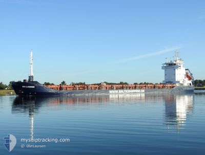
RIX LAGOON
General Cargo
Current Trip
PLPLC
| Time Travelled | 7 mins |
|---|---|
| Remaining Time | --- |
| Distance Travelled | --- |
| Remaining Distance | --- |
| AVG Speed | --- |
| MAX Speed | --- |
| AVG Wind | --- |
| MAX Wind | --- |
| MIN Temp | --- |
| MAX Temp | --- |
| Draught | 3.5 m |
| Position Received | 2 d ago |
Current Position
| Longitude | --- |
|---|---|
| Latitude | --- |
| Status | Under way using engine |
| Speed | 3.3 Knots |
| Course | 301° |
| Area | Baltic Sea |
| Station | T-AIS |
| Position Received | 2 d ago |
Info
Information
The current position of RIX LAGOON is in Baltic Sea with coordinates 53.55898° / 14.59586° as reported on 2025-12-05 10:16 by AIS to our vessel tracker app. The vessel's current speed is 3.3 Knots
The vessel RIX LAGOON (IMO: 9192624, MMSI: 210046000) is a General Cargo that was built in 1999 ( 26 years old ). It's sailing under the flag of [CY] Cyprus.
In this page you can find informations about the vessels current position, last detected port calls, and current voyage information. If the vessels is not in coverage by AIS you will find the latest position.
The current position of RIX LAGOON is detected by our AIS receivers and we are not responsible for the reliability of the data. The last position was recorded while the vessel was in Coverage by the Ais receivers of our vessel tracking app.
The current draught of RIX LAGOON as reported by AIS is 3.5 meters
Weather
| Temperature | 6.8°C / 44.24°F |
|---|---|
| Wind Speed | 7 knots |
| Direction | 191° S |
| Pressure | 1010.3 hPa |
| Humidity | 95 % |
| Cloud Coverage | 100 % |
Featured Company
Last Port Calls
| Port | Arrival | Departure | Time In Port |
|---|---|---|---|
| 2025-12-05 11:34 | 2025-12-07 14:45 | 2 d | |
| 2025-12-02 14:49 | 2025-12-04 09:29 | 1 d | |
| 2025-11-27 09:39 | 2025-11-29 00:22 | 1 d | |
| 2025-11-26 02:33 | 2025-11-26 16:22 | 13 h | |
| 2025-11-22 10:47 | 2025-11-23 19:15 | 1 d | |
| 2025-11-21 03:42 | 2025-11-21 04:25 | 43 m | |
| 2025-11-15 17:42 | 2025-11-20 22:26 | 5 d | |
| 2025-11-15 11:50 | 2025-11-15 12:11 | 21 m | |
| 2025-11-13 21:08 | |||
| 2025-11-10 22:12 | 2025-11-11 16:33 | 18 h |
Last Trips
| Origin | Departure | Destination | Arrival | Distance | |
|---|---|---|---|---|---|
| 2025-12-04 09:29 | 2025-12-05 11:34 | 245.83 nm | |||
| 2025-11-29 00:22 | 2025-12-02 14:49 | 263.38 nm | |||
| 2025-11-26 16:22 | 2025-11-27 09:39 | 154.70 nm | |||
| 2025-11-23 19:15 | 2025-11-26 02:33 | 532.89 nm | |||
| 2025-11-21 04:25 | 2025-11-22 10:47 | 267.18 nm | |||
| 2025-11-20 22:26 | 2025-11-21 03:42 | 49.04 nm | |||
| 2025-11-15 12:11 | 2025-11-15 17:42 | 48.84 nm | |||
| 2025-11-13 21:08 | 2025-11-15 11:50 | 257.06 nm | |||
| 2025-11-10 06:58 | 2025-11-10 22:12 | 128.02 nm | |||
| 2025-11-06 07:32 | 2025-11-08 19:00 | 496.87 nm |
Events
| Time | Event | Details | Position / Dest | Info |
|---|---|---|---|---|
| 2025-12-07 13:45 | PORT DEPARTURE |
|
53.55779 / 14.59706
PLPLC
|
Speed: 1.7 kn Course: 319° |
| 2025-12-05 10:34 | STOP Moving |
53.56108 / 14.59178
[PL] PORT MORSKI POLICE
|
Speed: Course: 337° |
|
| 2025-12-05 10:34 | PORT ARRIVAL |
|
53.56108 / 14.59178
[PL] PORT MORSKI POLICE
|
Speed: 0.9 kn Course: 333° |
| 2025-12-05 10:21 | Status Changed | Default Under way using engine |
53.56036 / 14.59282
PLPLC
|
Speed: 3.3 kn Course: 301° |
| 2025-12-05 10:16 | OUT of Coverage |
53.55898 / 14.59586
Baltic Sea
[PL] PORT MORSKI POLICE
|
Speed: 3.3 kn Course: 278° |
|
| 2025-12-05 09:35 | Status Changed | Under way using engine Default |
53.64841 / 14.55308
PLPLC
|
Speed: 10.2 kn Course: 140° |
| 2025-12-05 09:35 | IN Coverage |
53.64263 / 14.56099
Baltic Sea
|
Speed: 10.2 kn Course: 140.3° |
|
| 2025-12-04 19:49 | Status Changed | Default Under way using engine |
54.46332 / 12.25220
PLPLC
|
Speed: 10.2 kn Course: 41.6° |
| 2025-12-04 19:44 | OUT of Coverage |
54.45054 / 12.23921
Baltic Sea
|
Speed: 10.2 kn Course: 41.6° |
|
| 2025-12-04 19:08 | Change Sea Area | German part of the Baltic Sea Danish part of the Baltic Sea |
54.40658 / 12.10575
Baltic Sea
|
Speed: 9.3 kn Course: 90.3° |