
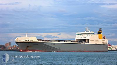
PEREGRINE
Ro-Ro Cargo
Current Trip
| Time Travelled | 14 h, 25 mins |
|---|---|
| Remaining Time | 1 h, 48 mins |
| Distance Travelled | 221.71 nm |
| Remaining Distance | 37.18 nm |
| AVG Speed | 16.6 Knots |
| MAX Speed | 18.3 Knots |
| AVG Wind | 10.1 knots |
| MAX Wind | 17.6 knots |
| MIN Temp | 5.6°C / 42.08°F |
| MAX Temp | 8°C / 46.4°F |
| Draught | 6.4 m |
| Position Received | 1 m ago |
Current Position
| Longitude | -0.39061° |
|---|---|
| Latitude | 54.46023° |
| Status | Under way using engine |
| Speed | 13.9 Knots |
| Course | 323.5° |
| Area | North Sea |
| Station | T-AIS |
| Position Received | 1 m ago |
Info
Information
The current position of PEREGRINE is in North Sea with coordinates 54.46023° / -0.39061° as reported on 2024-04-18 10:01 by AIS to our vessel tracker app. The vessel's current speed is 13.9 Knots and is heading at the port of TEES. The estimated time of arrival as calculated by MyShipTracking vessel tracking app is 2024-04-18 11:50 LT
The vessel PEREGRINE (IMO: 9376725, MMSI: 215740000) is a Ro-Ro Cargo that was built in 2010 ( 14 years old ). It's sailing under the flag of [MT] Malta.
In this page you can find informations about the vessels current position, last detected port calls, and current voyage information. If the vessels is not in coverage by AIS you will find the latest position.
The current position of PEREGRINE is detected by our AIS receivers and we are not responsible for the reliability of the data. The last position was recorded while the vessel was in Coverage by the Ais receivers of our vessel tracking app.
The current draught of PEREGRINE as reported by AIS is 6.4 meters
Weather
| Temperature | 8°C / 46.4°F |
|---|---|
| Wind Speed | 9 knots |
| Direction | 237° WSW |
| Pressure | 1020.5 hPa |
| Humidity | 61 % |
| Cloud Coverage | 100 % |
Featured Company
Last Port Calls
| Port | Arrival | Departure | Time In Port |
|---|---|---|---|
| 2024-04-17 12:16 | 2024-04-17 19:37 | 7 h | |
| 2024-04-16 13:32 | 2024-04-16 19:29 | 5 h | |
| 2024-04-14 12:16 | 2024-04-15 19:19 | 1 d | |
| 2024-04-13 11:58 | 2024-04-13 20:22 | 8 h | |
| 2024-04-12 12:15 | 2024-04-12 19:39 | 7 h | |
| 2024-04-11 12:20 | 2024-04-11 19:29 | 7 h | |
| 2024-04-10 12:08 | 2024-04-10 20:07 | 7 h | |
| 2024-04-09 11:24 | 2024-04-09 19:29 | 8 h | |
| 2024-04-07 00:13 | 2024-04-08 18:58 | 1 d | |
| 2024-04-06 07:54 | 2024-04-06 16:23 | 8 h |
Last Trips
| Origin | Departure | Destination | Arrival | Distance | |
|---|---|---|---|---|---|
| 2024-04-16 20:29 | 2024-04-17 14:16 | 266.19 nm | |||
| 2024-04-15 21:19 | 2024-04-16 14:32 | 268.31 nm | |||
| 2024-04-13 21:22 | 2024-04-14 14:16 | 265.85 nm | |||
| 2024-04-12 21:39 | 2024-04-13 12:58 | 269.37 nm | |||
| 2024-04-11 20:29 | 2024-04-12 14:15 | 266.06 nm | |||
| 2024-04-10 22:07 | 2024-04-11 13:20 | 269.26 nm | |||
| 2024-04-09 20:29 | 2024-04-10 14:08 | 267.13 nm | |||
| 2024-04-08 20:58 | 2024-04-09 12:24 | 269.93 nm | |||
| 2024-04-06 17:23 | 2024-04-07 02:13 | 115.92 nm | |||
| 2024-04-06 00:51 | 2024-04-06 08:54 | 118.14 nm |
Events
| Time | Event | Details | Position / Dest | Info |
|---|---|---|---|---|
| 2024-04-18 10:00 | Status Changed | Under way using engine Default |
54.45778 / -.38750
GBTEE
|
Speed: 15.8 kn Course: 322° |
| 2024-04-18 09:07 | Status Changed | Default Under way using engine |
54.27417 / -.15837
GBTEE
|
Speed: 15.7 kn Course: 324.9° |
| 2024-04-18 08:56 | OUT of Coverage |
54.23613 / -.11305
North Sea
GBTEE
|
Speed: 15.7 kn Course: 324.9° |
|
| 2024-04-18 06:41 | IN Coverage |
53.76921 / .52633
North Sea
GBTEE
|
Speed: 16 kn Course: 311.3° |
|
| 2024-04-18 04:35 | OUT of Coverage |
53.34827 / 1.15640
North Sea
GBTEE
|
Speed: 16 kn Course: 325.9° |
|
| 2024-04-17 22:11 | Change Sea Area | United Kingdom part of the North Sea Dutch part of the North Sea |
51.89704 / 2.54282
North Sea
GBTEE
|
Speed: 18.2 kn Course: 344° |
| 2024-04-17 22:05 | Change Sea Area | Dutch part of the North Sea Belgian part of the North Sea |
51.86790 / 2.55620
North Sea
GBTEE
|
Speed: 18.1 kn Course: 344° |
| 2024-04-17 19:37 | PORT DEPARTURE |
|
51.36600 / 3.18745
GBTEE
|
Speed: 15.7 kn Course: 320° |
| 2024-04-17 19:25 | START Moving |
51.34334 / 3.21882
[BE] ZEEBRUGGE
|
Speed: 3.6 kn Course: 258° |
|
| 2024-04-17 19:01 | Draught Changed | 6.4 6.2 |
51.34363 / 3.22201
[BE] ZEEBRUGGE
|
Speed: 0.1 kn Course: 257° |