
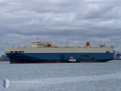
PEGASUS ACE
Vehicles Carrier
Current Trip
| Time Travelled | 2 days |
|---|---|
| Remaining Time | 3 days |
| Distance Travelled | 1206.81 nm |
| Remaining Distance | 1242.08 nm |
| AVG Speed | 16.8 Knots |
| MAX Speed | 21.1 Knots |
| AVG Wind | 15.5 knots |
| MAX Wind | 27 knots |
| MIN Temp | 17.1°C / 62.78°F |
| MAX Temp | 22°C / 71.6°F |
| Draught | 7.4 m |
| Position Received | 23 h, 27 m ago |
Current Position
| Longitude | --- |
|---|---|
| Latitude | --- |
| Status | Under way using engine |
| Speed | 16.7 Knots |
| Course | 329.7° |
| Area | South Atlantic Ocean |
| Station | T-AIS |
| Position Received | 23 h, 27 m ago |
Info
Information
The current position of PEGASUS ACE is in South Atlantic Ocean with coordinates -34.39942° / 17.83939° as reported on 2025-12-06 00:49 by AIS to our vessel tracker app. The vessel's current speed is 16.7 Knots and is heading at the port of LUANDA. The estimated time of arrival as calculated by MyShipTracking vessel tracking app is 2025-12-10 04:22 LT
The vessel PEGASUS ACE (IMO: 9150341, MMSI: 431339000) is a Vehicles Carrier that was built in 1998 ( 27 years old ). It's sailing under the flag of [JP] Japan.
In this page you can find informations about the vessels current position, last detected port calls, and current voyage information. If the vessels is not in coverage by AIS you will find the latest position.
The current position of PEGASUS ACE is detected by our AIS receivers and we are not responsible for the reliability of the data. The last position was recorded while the vessel was in Coverage by the Ais receivers of our vessel tracking app.
The current draught of PEGASUS ACE as reported by AIS is 7.4 meters
Weather
| Temperature | 17.7°C / 63.86°F |
|---|---|
| Wind Speed | 22 knots |
| Direction | 153° SSE |
| Pressure | 1014.2 hPa |
| Humidity | 87.3 % |
| Cloud Coverage | 3 % |
Featured Company
Last Port Calls
| Port | Arrival | Departure | Time In Port |
|---|---|---|---|
| 2025-12-02 10:13 | 2025-12-04 03:30 | 1 d | |
| 2025-11-19 04:14 | 2025-11-20 23:38 | 1 d | |
| 2025-11-11 04:50 | 2025-11-12 03:02 | 22 h | |
| 2025-11-09 23:38 | 2025-11-10 10:53 | 11 h | |
| 2025-11-08 23:32 | 2025-11-09 19:06 | 19 h | |
| 2025-10-30 09:52 | 2025-10-30 17:41 | 7 h | |
| 2025-10-23 07:04 | 2025-10-23 17:56 | 10 h | |
| 2025-10-22 05:52 | 2025-10-22 23:28 | 17 h | |
| 2025-10-07 06:08 | 2025-10-07 20:23 | 14 h | |
| 2025-10-05 04:52 | 2025-10-05 18:30 | 13 h |
Most Visited Ports (Last year)
| Port | Arrivals | |
|---|---|---|
| 4 | ||
| 4 | ||
| 4 | ||
| 4 | ||
| 3 | ||
| 3 |
Last Trips
| Origin | Departure | Destination | Arrival | Distance | |
|---|---|---|---|---|---|
| 2025-11-20 23:38 | 2025-12-02 10:13 | 3986.12 nm | |||
| 2025-11-12 03:02 | 2025-11-19 04:14 | 2493.98 nm | |||
| 2025-11-10 10:53 | 2025-11-11 04:50 | 315.41 nm | |||
| 2025-11-09 19:06 | 2025-11-09 23:38 | 47.13 nm | |||
| 2025-10-30 17:41 | 2025-11-08 23:32 | 3605.76 nm | |||
| 2025-10-23 17:56 | 2025-10-30 09:52 | 2653.71 nm | |||
| 2025-10-22 23:28 | 2025-10-23 07:04 | 96.32 nm | |||
| 2025-10-07 20:23 | 2025-10-22 05:52 | 4129.18 nm | |||
| 2025-10-05 18:30 | 2025-10-07 06:08 | 569.88 nm | |||
| 2025-10-03 14:45 | 2025-10-05 04:52 | 579.63 nm |
Events
| Time | Event | Details | Position / Dest | Info |
|---|---|---|---|---|
| 2025-12-06 00:55 | Status Changed | Default Under way using engine |
-34.37716 / 17.82355
AO LAD
|
Speed: 16.7 kn Course: 329.7° |
| 2025-12-06 00:49 | Change Sea Area | South African part of the South Atlantic Ocean South African part of the Indian Ocean |
-34.39942 / 17.83939
South Atlantic Ocean
AO LAD
|
Speed: 16.7 kn Course: 329.7° |
| 2025-12-06 00:49 | Status Changed | Under way using engine Default |
-34.39942 / 17.83939
AO LAD
|
Speed: 16.7 kn Course: 332° |
| 2025-12-06 00:49 | OUT of Coverage |
-34.39942 / 17.83939
South Atlantic Ocean
AO LAD
|
Speed: 16.7 kn Course: 329.7° |
|
| 2025-12-06 00:34 | IN Coverage |
-34.39942 / 17.83939
South Atlantic Ocean
AO LAD
|
Speed: 16.7 kn Course: 329.7° |
|
| 2025-12-05 08:50 | Status Changed | Default Under way using engine |
-34.62499 / 22.96816
AO LAD
|
Speed: 16.9 kn Course: 252.2° |
| 2025-12-05 08:48 | OUT of Coverage |
-34.62236 / 22.97798
Indian Ocean
AO LAD
|
Speed: 16.9 kn Course: 252.2° |
|
| 2025-12-05 08:10 | Status Changed | Under way using engine Default |
-34.56819 / 23.18629
AO LAD
|
Speed: 17.1 kn Course: 252° |
| 2025-12-05 08:02 | Status Changed | Default Under way using engine |
-34.55600 / 23.23241
AO LAD
|
Speed: 17.1 kn Course: 250.9° |
| 2025-12-05 07:45 | Status Changed | Under way using engine Default |
-34.53182 / 23.32374
AO LAD
|
Speed: 17.1 kn Course: 252° |