
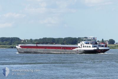
PANTA RHEI
Cargo
Current Trip
PANTA RHEI is out of coverage. Learn how you can join the community and extend the coverage to your area by clicking here!
| Time Travelled | 9 h, 47 mins |
|---|---|
| Remaining Time | --- |
| Distance Travelled | 25.56 nm |
| Remaining Distance | --- |
| AVG Speed | 4.1 Knots |
| MAX Speed | 5 Knots |
| AVG Wind | 16.1 knots |
| MAX Wind | 16.9 knots |
| MIN Temp | 5.4°C / 41.72°F |
| MAX Temp | 6.9°C / 44.42°F |
| Draught | 0 m |
| Position Received | 3 h, 22 m ago |
Current Position
| Longitude | 3.20635° |
|---|---|
| Latitude | 50.92471° |
| Status | Under way using engine |
| Speed | 4.8 Knots |
| Course | 285.1° |
| Area | North Sea |
| Station | T-AIS |
| Position Received | 3 h, 22 m ago |
Info
info
Information
The current position of PANTA RHEI is in North Sea with coordinates 50.92471° / 3.20635° as reported on 2024-04-20 00:20 by AIS to our vessel tracker app. The vessel's current speed is 4.8 Knots
The vessel PANTA RHEI (MMSI: 244750541) is a Cargo It's sailing under the flag of [NL] Netherlands.
In this page you can find informations about the vessels current position, last detected port calls, and current voyage information. If the vessels is not in coverage by AIS you will find the latest position.
The current position of PANTA RHEI is detected by our AIS receivers and we are not responsible for the reliability of the data. The last position was recorded while the vessel was in Coverage by the Ais receivers of our vessel tracking app.
Weather
| Temperature | 5.4°C / 41.72°F |
|---|---|
| Wind Speed | 14 knots |
| Direction | 344° NNW |
| Pressure | 1020.8 hPa |
| Humidity | 68.3 % |
| Cloud Coverage | 100 % |
Featured Company
Limited time offer - Install a base station receiver to your area and list your company on MyShipTracking Free forever!
Last Port Calls
| Port | Arrival | Departure | Time In Port |
|---|---|---|---|
| 2024-04-19 15:29 | 2024-04-19 17:55 | 2 h | |
| 2024-04-19 12:38 | 2024-04-19 12:55 | 16 m | |
| 2024-04-19 06:00 | 2024-04-19 06:11 | 10 m | |
| 2024-04-17 11:44 | 2024-04-18 12:00 | 1 d | |
| 2024-04-15 03:45 | 2024-04-16 14:08 | 1 d | |
| 2024-04-15 00:35 | 2024-04-15 01:00 | 25 m | |
| 2024-04-12 19:54 | 2024-04-15 00:31 | 2 d | |
| 2024-04-12 17:15 | 2024-04-12 17:33 | 17 m | |
| 2024-04-12 07:59 | 2024-04-12 08:06 | 7 m | |
| 2024-04-12 01:33 | 2024-04-12 02:54 | 1 h |
Last Trips
| Origin | Departure | Destination | Arrival | Distance | |
|---|---|---|---|---|---|
| 2024-04-19 14:55 | 2024-04-19 17:29 | 21.04 nm | |||
| 2024-04-19 08:11 | 2024-04-19 14:38 | 48.58 nm | |||
| 2024-04-18 14:00 | 2024-04-19 08:00 | 180.18 nm | |||
| 2024-04-16 16:08 | 2024-04-17 13:44 | 58.74 nm | |||
| 2024-04-15 03:00 | 2024-04-15 05:45 | 14.36 nm | |||
| 2024-04-15 02:31 | 2024-04-15 02:35 | 0.33 nm | |||
| 2024-04-12 19:33 | 2024-04-12 21:54 | 11.65 nm | |||
| 2024-04-12 10:06 | 2024-04-12 19:15 | 49.80 nm | |||
| 2024-04-12 04:54 | 2024-04-12 09:59 | 27.12 nm | |||
| 2024-04-11 23:19 | 2024-04-12 03:33 | 18.65 nm |
Events
| Time | Event | Details | Position / Dest | Info |
|---|---|---|---|---|
| 2024-04-20 01:00 | STOP Moving | 0.53 nm, East of ROESELARE |
50.94333 / 3.15667
ROESELARE
|
Speed: Course: -1° |
| 2024-04-20 00:25 | Status Changed | Default Under way using engine |
50.92670 / 3.19672
ROESELARE
|
Speed: 4.8 kn Course: 285.1° |
| 2024-04-20 00:20 | OUT of Coverage |
50.92471 / 3.20635
North Sea
ROESELARE
|
Speed: 4.8 kn Course: 285.1° |
|
| 2024-04-20 00:12 | Status Changed | Under way using engine Default |
50.92167 / 3.22230
ROESELARE
|
Speed: 5 kn Course: 281° |
| 2024-04-20 00:03 | Status Changed | Default Under way using engine |
50.91833 / 3.24167
ROESELARE
|
Speed: 4.3 kn Course: 286° |
| 2024-04-19 23:07 | START Moving | 5.04 nm, North East of KORTRIJK |
50.90086 / 3.33902
ROESELARE
|
Speed: 4.5 kn Course: 319.9° |
| 2024-04-19 22:58 | STOP Moving | 4.96 nm, North East of KORTRIJK |
50.89722 / 3.34403
ROESELARE
|
Speed: Course: 511° |
| 2024-04-19 22:02 | START Moving | 6.22 nm, South West of DEINZE |
50.91212 / 3.41006
ROESELARE
|
Speed: 3.2 kn Course: 232.8° |
| 2024-04-19 21:51 | STOP Moving | 6.08 nm, South West of DEINZE |
50.91346 / 3.41316
ROESELARE
|
Speed: 0.1 kn Course: 511° |
| 2024-04-19 17:55 | PORT DEPARTURE |
|
51.09206 / 3.63467
ROESELARE
|
Speed: 3.4 kn Course: 268.2° |