
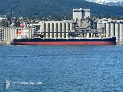
PAN CONCORD
Cargo
Current Trip
| Time Travelled | --- |
|---|---|
| Remaining Time | 4 days |
| Distance Travelled | 9573.97 nm |
| Remaining Distance | 1372.91 nm |
| AVG Speed | 10.2 Knots |
| MAX Speed | 15.2 Knots |
| AVG Wind | 14.9 knots |
| MAX Wind | 41 knots |
| MIN Temp | 10.2°C / 50.36°F |
| MAX Temp | 26°C / 78.8°F |
| Draught | 14.1 m |
| Position Received | 7 d ago |
Current Position
| Longitude | --- |
|---|---|
| Latitude | --- |
| Status | Under way using engine |
| Speed | 11.7 Knots |
| Course | 331.6° |
| Area | South Atlantic Ocean |
| Station | T-AIS |
| Position Received | 7 d ago |
Info
Information
The current position of PAN CONCORD is in South Atlantic Ocean with coordinates -33.77150° / 17.85363° as reported on 2025-12-01 20:35 by AIS to our vessel tracker app. The vessel's current speed is 11.7 Knots and is heading at the port of WALVIS BAY. The estimated time of arrival as calculated by MyShipTracking vessel tracking app is 2025-12-14 12:48 LT
The vessel PAN CONCORD (IMO: 9966855, MMSI: 352003818) is a Cargo It's sailing under the flag of [PA] Panama.
In this page you can find informations about the vessels current position, last detected port calls, and current voyage information. If the vessels is not in coverage by AIS you will find the latest position.
The current position of PAN CONCORD is detected by our AIS receivers and we are not responsible for the reliability of the data. The last position was recorded while the vessel was in Coverage by the Ais receivers of our vessel tracking app.
The current draught of PAN CONCORD as reported by AIS is 14.1 meters
Weather
| Temperature | 22.9°C / 73.22°F |
|---|---|
| Wind Speed | 10 knots |
| Direction | 158° SSE |
| Pressure | 1013.2 hPa |
| Humidity | 78.6 % |
| Cloud Coverage | 100 % |
Featured Company
Last Trips
| Origin | Departure | Destination | Arrival | Distance | |
|---|---|---|---|---|---|
| 2025-09-27 07:56 | 2025-10-02 23:20 | 1065.54 nm |
Events
| Time | Event | Details | Position / Dest | Info |
|---|---|---|---|---|
| 2025-12-04 16:32 | START Moving |
-23.05520 / 13.77813
NA WVB
|
Speed: 4.9 kn Course: 316° |
|
| 2025-12-04 08:03 | STOP Moving |
-22.87167 / 13.99500
NA WVB
|
Speed: Course: -1° |
|
| 2025-12-01 20:43 | Status Changed | Default Under way using engine |
-33.74773 / 17.83739
NA WVB
|
Speed: 11.7 kn Course: 331.6° |
| 2025-12-01 20:35 | Status Changed | Under way using engine Default |
-33.77150 / 17.85363
NA WVB
|
Speed: 11.7 kn Course: 330° |
| 2025-12-01 20:35 | OUT of Coverage |
-33.77150 / 17.85363
South Atlantic Ocean
NA WVB
|
Speed: 11.7 kn Course: 331.6° |
|
| 2025-12-01 19:51 | Status Changed | Default Under way using engine |
-33.89625 / 17.93720
NA WVB
|
Speed: 11.8 kn Course: 328.7° |
| 2025-12-01 19:38 | Status Changed | Under way using engine Default |
-33.93368 / 17.96304
NA WVB
|
Speed: 11.8 kn Course: 330° |
| 2025-12-01 19:31 | Status Changed | Default Under way using engine |
-33.95300 / 17.97657
NA WVB
|
Speed: 11.9 kn Course: 331.9° |
| 2025-12-01 19:30 | Status Changed | Under way using engine Default |
-33.95691 / 17.97917
NA WVB
|
Speed: 11 kn Course: 327° |
| 2025-12-01 19:22 | Status Changed | Default Under way using engine |
-33.97831 / 17.99416
NA WVB
|
Speed: 11.8 kn Course: 329.6° |