
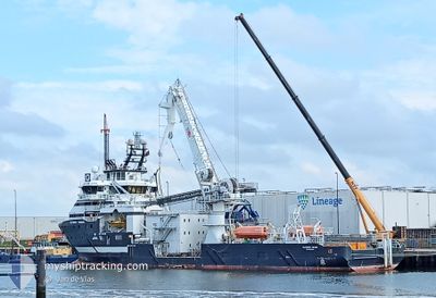
OLYMPIC ORION
Multi Purpose Offshore Vessel
Current Trip
| Trip Time | 7 days |
|---|---|
| Trip Distance | 52.26 nm |
| AVG Speed | 9.4 Knots |
| MAX Speed | 10.3 Knots |
| Draught | 6.2 m |
| AVG Wind | 13.7 knots |
| MAX Wind | 21 knots |
| MIN Temp | 7.3°C / 45.14°F |
| MAX Temp | 10.8°C / 51.44°F |
| Position Received | 3 m ago |
Current Position
| Longitude | -4.02805° |
|---|---|
| Latitude | 57.69603° |
| Status | Moored |
| Speed | |
| Course | 358° |
| Area | North Sea |
| Station | T-AIS |
| Position Received | 3 m ago |
Info
Information
The current position of OLYMPIC ORION is in North Sea with coordinates 57.69603° / -4.02805° as reported on 2024-04-19 03:17 by AIS to our vessel tracker app. The vessel's current speed is 0 Knots and is currently inside the port of NIGG.
The vessel OLYMPIC ORION (IMO: 9617313, MMSI: 257786000) is a Multi Purpose Offshore Vessel that was built in 2012 ( 12 years old ). It's sailing under the flag of [NO] Norway.
In this page you can find informations about the vessels current position, last detected port calls, and current voyage information. If the vessels is not in coverage by AIS you will find the latest position.
The current position of OLYMPIC ORION is detected by our AIS receivers and we are not responsible for the reliability of the data. The last position was recorded while the vessel was in Coverage by the Ais receivers of our vessel tracking app.
The current draught of OLYMPIC ORION as reported by AIS is 6.2 meters
Weather
| Temperature | 5.8°C / 42.44°F |
|---|---|
| Wind Speed | 10 knots |
| Direction | 346° NNW |
| Pressure | 1012.4 hPa |
| Humidity | 86.5 % |
| Cloud Coverage | 94 % |
Featured Company
Last Port Calls
| Port | Arrival | Departure | Time In Port |
|---|---|---|---|
| 2024-04-18 16:30 | |||
| 2024-04-10 04:02 | 2024-04-10 20:18 | 16 h | |
| 2024-04-02 05:24 | 2024-04-04 17:19 | 2 d | |
| 2024-03-27 18:17 | 2024-03-28 23:47 | 1 d | |
| 2024-03-21 22:21 | 2024-03-22 22:21 | 23 h | |
| 2024-03-15 18:13 | 2024-03-15 19:56 | 1 h | |
| 2024-03-13 05:07 | 2024-03-13 18:34 | 13 h | |
| 2024-03-07 13:11 | 2024-03-10 11:28 | 2 d | |
| 2024-02-28 02:21 | 2024-03-06 12:36 | 7 d | |
| 2024-02-16 06:07 | 2024-02-26 21:33 | 10 d |
Most Visited Ports (Last year)
| Port | Arrivals | |
|---|---|---|
| 14 | ||
| 9 | ||
| 7 | ||
| 7 | ||
| 6 | ||
| 4 |
Last Trips
| Origin | Departure | Destination | Arrival | Distance | |
|---|---|---|---|---|---|
| 2024-04-10 21:18 | 2024-04-18 17:30 | 52.26 nm | |||
| 2024-04-04 18:19 | 2024-04-10 05:02 | 52.84 nm | |||
| 2024-03-28 23:47 | 2024-04-02 06:24 | 99.16 nm | |||
| 2024-03-22 22:21 | 2024-03-27 18:17 | 42.27 nm | |||
| 2024-03-15 19:56 | 2024-03-21 22:21 | 52.44 nm | |||
| 2024-03-13 18:34 | 2024-03-15 18:13 | 45.94 nm | |||
| 2024-03-10 12:28 | 2024-03-13 05:07 | 472.08 nm | |||
| 2024-03-06 13:36 | 2024-03-07 14:11 | 194.70 nm | |||
| 2024-02-26 22:33 | 2024-02-28 03:21 | 76.11 nm | |||
| 2024-02-13 02:41 | 2024-02-16 07:07 | 536.13 nm |
Events
| Time | Event | Details | Position / Dest | Info |
|---|---|---|---|---|
| 2024-04-18 20:23 | IN Coverage |
57.69600 / -4.02806
North Sea
[GB] NIGG
|
Speed: Course: 252.7° |
|
| 2024-04-18 16:30 | PORT ARRIVAL |
|
57.69600 / -4.02806
[GB] NIGG
|
Speed: 8.4 kn Course: 279.6° |
| 2024-04-18 16:23 | OUT of Coverage |
57.68599 / -4.00362
North Sea
INVERGORDON
|
Speed: 8.4 kn Course: 279.6° |
|
| 2024-04-18 14:21 | Draught Changed | 6.2 6 |
57.81440 / -3.45558
INVERGORDON
|
Speed: 9.9 kn Course: 236.7° |
| 2024-04-18 14:21 | Destination Changed | INVERGORDON MORAY WEST |
57.81440 / -3.45558
INVERGORDON
|
Speed: 9.9 kn Course: 236.7° |
| 2024-04-18 14:21 | ETA Changed | 2024/04/18 18:00 2024/04/11 04:00 |
57.81440 / -3.45558
INVERGORDON
|
Speed: 9.9 kn Course: 236.7° |
| 2024-04-18 13:47 | IN Coverage |
57.87797 / -3.34912
North Sea
|
Speed: 4.7 kn Course: 214.6° |
|
| 2024-04-10 22:24 | OUT of Coverage |
57.80673 / -3.47597
North Sea
MORAY WEST
|
Speed: 9.3 kn Course: 59.6° |
|
| 2024-04-10 20:24 | Draught Changed | 6 6.2 |
57.68656 / -3.99795
MORAY WEST
|
Speed: 9 kn Course: 106.3° |
| 2024-04-10 20:24 | Destination Changed | MORAY WEST NIGG BASE |
57.68656 / -3.99795
MORAY WEST
|
Speed: 9 kn Course: 106.3° |