
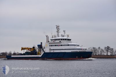
NOORDHOEK PATHFINDER
Diving Support Vessel
Current Trip
Current Position
| Longitude | 4.58607° |
|---|---|
| Latitude | 52.46365° |
| Status | Moored |
| Speed | |
| Course | 266° |
| Area | North Sea |
| Station | T-AIS |
| Position Received | 2 m ago |
Info
Information
The current position of NOORDHOEK PATHFINDER is in North Sea with coordinates 52.46365° / 4.58607° as reported on 2024-04-19 20:53 by AIS to our vessel tracker app. The vessel's current speed is 0 Knots and is currently inside the port of IJMUIDEN.
The vessel NOORDHOEK PATHFINDER (IMO: 9545663, MMSI: 245457000) is a Diving Support Vessel that was built in 2010 ( 14 years old ). It's sailing under the flag of [NL] Netherlands.
In this page you can find informations about the vessels current position, last detected port calls, and current voyage information. If the vessels is not in coverage by AIS you will find the latest position.
The current position of NOORDHOEK PATHFINDER is detected by our AIS receivers and we are not responsible for the reliability of the data. The last position was recorded while the vessel was in Coverage by the Ais receivers of our vessel tracking app.
The current draught of NOORDHOEK PATHFINDER as reported by AIS is 3.5 meters
Weather
| Temperature | 7.8°C / 46.04°F |
|---|---|
| Wind Speed | 30 knots |
| Direction | 341° NNW |
| Pressure | 1015 hPa |
| Humidity | 74.9 % |
| Cloud Coverage | 100 % |
Featured Company
Last Port Calls
| Port | Arrival | Departure | Time In Port |
|---|---|---|---|
| 2024-04-18 19:36 | |||
| 2024-04-15 06:39 | 2024-04-17 16:12 | 2 d | |
| 2024-04-09 06:06 | 2024-04-11 15:35 | 2 d | |
| 2024-03-28 06:38 | 2024-03-29 11:14 | 1 d | |
| 2024-03-28 05:17 | 2024-03-28 06:28 | 1 h | |
| 2024-03-23 09:00 | 2024-03-24 23:19 | 1 d | |
| 2024-03-18 16:46 | 2024-03-18 17:31 | 44 m | |
| 2024-03-13 14:58 | 2024-03-14 16:01 | 1 d | |
| 2024-03-07 23:23 | 2024-03-13 14:10 | 5 d | |
| 2024-03-06 13:41 | 2024-03-06 14:07 | 25 m |
Last Trips
| Origin | Departure | Destination | Arrival | Distance | |
|---|---|---|---|---|---|
| 2024-04-17 18:12 | 2024-04-18 21:36 | 190.16 nm | |||
| 2024-04-11 17:35 | 2024-04-15 08:39 | 515.68 nm | |||
| 2024-03-29 12:14 | 2024-04-09 08:06 | 1051.48 nm | |||
| 2024-03-28 07:28 | 2024-03-28 07:38 | 0.91 nm | |||
| 2024-03-25 00:19 | 2024-03-28 06:17 | 432.32 nm | |||
| 2024-03-18 18:31 | 2024-03-23 10:00 | 537.81 nm | |||
| 2024-03-14 17:01 | 2024-03-18 17:46 | 493.89 nm | |||
| 2024-03-13 15:10 | 2024-03-13 15:58 | 5.62 nm | |||
| 2024-03-06 14:07 | 2024-03-08 00:23 | 208.56 nm | |||
| 2024-02-29 16:08 | 2024-03-06 13:41 | 680.43 nm |
Events
| Time | Event | Details | Position / Dest | Info |
|---|---|---|---|---|
| 2024-04-18 20:08 | Status Changed | Moored Under way using engine |
52.46361 / 4.58603
[NL] IJMUIDEN
|
Speed: Course: 267° |
| 2024-04-18 19:46 | STOP Moving |
52.46433 / 4.58420
[NL] IJMUIDEN
|
Speed: 0.3 kn Course: 148° |
|
| 2024-04-18 19:36 | PORT ARRIVAL |
|
52.46319 / 4.56850
[NL] IJMUIDEN
|
Speed: 5.3 kn Course: 95.3° |
| 2024-04-18 18:10 | Destination Changed | IJMUIDEN SURVEY OPS.CPA>0.5 |
52.49986 / 4.14695
IJMUIDEN
|
Speed: 12 kn Course: 159.1° |
| 2024-04-18 18:10 | ETA Changed | 2024/04/18 20:30 2024/04/18 00:00 |
52.49986 / 4.14695
IJMUIDEN
|
Speed: 12 kn Course: 159.1° |
| 2024-04-18 17:28 | Change Sea Area | Dutch part of the North Sea United Kingdom part of the North Sea |
52.60667 / 4.01973
North Sea
|
Speed: 11.4 kn Course: 113.2° |
| 2024-04-18 17:28 | IN Coverage |
52.60667 / 4.01973
North Sea
|
Speed: 11.4 kn Course: 113.2° |
|
| 2024-04-18 12:24 | OUT of Coverage |
52.81677 / 2.51155
North Sea
|
Speed: 5.3 kn Course: 197.3° |
|
| 2024-04-18 12:18 | IN Coverage |
52.81905 / 2.52463
North Sea
|
Speed: 2.3 kn Course: 215.7° |
|
| 2024-04-18 11:16 | OUT of Coverage |
52.83743 / 2.51001
North Sea
|
Speed: 4.4 kn Course: 207.3° |