
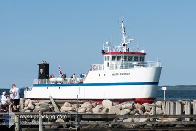
NEKSELOEFAERGEN
Passenger
Current Trip
HAVNSOE>SEJEROE
| Time Travelled | --- |
|---|---|
| Remaining Time | --- |
| Distance Travelled | 950.37 nm |
| Remaining Distance | --- |
| AVG Speed | 7.7 Knots |
| MAX Speed | 11.4 Knots |
| AVG Wind | 13.8 knots |
| MAX Wind | 28.8 knots |
| MIN Temp | -5.8°C / 21.56°F |
| MAX Temp | 7.7°C / 45.86°F |
| Draught | 2 m |
| Position Received | 3 m ago |
Current Position
| Longitude | 11.13724° |
|---|---|
| Latitude | 55.88005° |
| Status | Moored |
| Speed | |
| Course | 234° |
| Area | Kattegat |
| Station | T-AIS |
| Position Received | 3 m ago |
Info
Information
The current position of NEKSELOEFAERGEN is in Kattegat with coordinates 55.88005° / 11.13724° as reported on 2024-04-20 12:44 by AIS to our vessel tracker app. The vessel's current speed is 0 Knots
The vessel NEKSELOEFAERGEN (IMO: 9074377, MMSI: 219000899) is a Passenger It's sailing under the flag of [DK] Denmark.
In this page you can find informations about the vessels current position, last detected port calls, and current voyage information. If the vessels is not in coverage by AIS you will find the latest position.
The current position of NEKSELOEFAERGEN is detected by our AIS receivers and we are not responsible for the reliability of the data. The last position was recorded while the vessel was in Coverage by the Ais receivers of our vessel tracking app.
The current draught of NEKSELOEFAERGEN as reported by AIS is 2 meters
Weather
| Temperature | 5.7°C / 42.26°F |
|---|---|
| Wind Speed | 5 knots |
| Direction | 271° W |
| Pressure | 1017.2 hPa |
| Humidity | 57.7 % |
| Cloud Coverage | 20 % |
Featured Company
Last Port Calls
Most Visited Ports (Last year)
| Port | Arrivals | |
|---|---|---|
| 2 |
Last Trips
| Origin | Departure | Destination | Arrival | Distance |
|---|
Events
| Time | Event | Details | Position / Dest | Info |
|---|---|---|---|---|
| 2024-04-20 09:55 | Status Changed | Moored Under way using engine |
55.88005 / 11.13724
HAVNSOE>SEJEROE
|
Speed: Course: 235° |
| 2024-04-20 09:51 | STOP Moving | 7.86 nm, South West of SJAELLANDS ODDE |
55.87971 / 11.13612
HAVNSOE>SEJEROE
|
Speed: 0.3 kn Course: 265° |
| 2024-04-20 09:35 | Destination Changed | HAVNSOE>SEJEROE HAVNSOE>NEKSELOE |
55.85303 / 11.16125
HAVNSOE>SEJEROE
|
Speed: 9.4 kn Course: 301.7° |
| 2024-04-20 08:43 | START Moving | 9.57 nm, North East of KALUNDBORG |
55.75666 / 11.32576
HAVNSOE>NEKSELOE
|
Speed: 8.5 kn Course: 349.3° |
| 2024-04-20 08:12 | STOP Moving | 9.51 nm, North East of KALUNDBORG |
55.75457 / 11.32580
HAVNSOE>NEKSELOE
|
Speed: 0.2 kn Course: 330° |
| 2024-04-20 07:09 | START Moving | 7.9 nm, South West of SJAELLANDS ODDE |
55.87814 / 11.13725
HAVNSOE>NEKSELOE
|
Speed: 5.3 kn Course: 183.2° |
| 2024-04-20 06:53 | STOP Moving | 7.82 nm, South West of SJAELLANDS ODDE |
55.88002 / 11.13719
HAVNSOE>NEKSELOE
|
Speed: 0.3 kn Course: 235° |
| 2024-04-20 05:43 | START Moving | 9.58 nm, North East of KALUNDBORG |
55.75645 / 11.32630
HAVNSOE>NEKSELOE
|
Speed: 8.1 kn Course: 355° |
| 2024-04-20 05:15 | STOP Moving | 9.51 nm, North East of KALUNDBORG |
55.75458 / 11.32581
HAVNSOE>NEKSELOE
|
Speed: 0.1 kn Course: 344° |
| 2024-04-20 04:11 | START Moving | 7.9 nm, South West of SJAELLANDS ODDE |
55.87804 / 11.13722
HAVNSOE>NEKSELOE
|
Speed: 4.9 kn Course: 196° |