
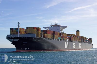
MSC VEGA
Container Ship
Current Trip
| Time Travelled | 22 days |
|---|---|
| Remaining Time | --- |
| Distance Travelled | 8091.97 nm |
| Remaining Distance | --- |
| AVG Speed | 15.2 Knots |
| MAX Speed | 17.9 Knots |
| AVG Wind | 14.4 knots |
| MAX Wind | 38.8 knots |
| MIN Temp | 12.6°C / 54.68°F |
| MAX Temp | 28.9°C / 84.02°F |
| Draught | 16.3 m |
| Position Received | 8 d ago |
Current Position
| Longitude | --- |
|---|---|
| Latitude | --- |
| Status | Under way using engine |
| Speed | 15.1 Knots |
| Course | 324° |
| Area | South Atlantic Ocean |
| Station | T-AIS |
| Position Received | 8 d ago |
Info
Information
The current position of MSC VEGA is in South Atlantic Ocean with coordinates -34.19737° / 17.80264° as reported on 2024-09-21 19:27 by AIS to our vessel tracker app. The vessel's current speed is 15.1 Knots and is heading at the port of SINES. The estimated time of arrival as calculated by MyShipTracking vessel tracking app is 2024-10-05 18:00 LT
The vessel MSC VEGA (IMO: 9465265, MMSI: 636015506) is a Container Ship that was built in 2012 ( 12 years old ). It's sailing under the flag of [LR] Liberia.
In this page you can find informations about the vessels current position, last detected port calls, and current voyage information. If the vessels is not in coverage by AIS you will find the latest position.
The current position of MSC VEGA is detected by our AIS receivers and we are not responsible for the reliability of the data. The last position was recorded while the vessel was in Coverage by the Ais receivers of our vessel tracking app.
The current draught of MSC VEGA as reported by AIS is 16.3 meters
Weather
| Temperature | 26.6°C / 79.88°F |
|---|---|
| Wind Speed | 7 knots |
| Direction | 169° S |
| Pressure | 1013.7 hPa |
| Humidity | 78 % |
| Cloud Coverage | 99 % |
Featured Company
Last Port Calls
| Port | Arrival | Departure | Time In Port |
|---|---|---|---|
| 2024-09-06 03:57 | 2024-09-08 03:36 | 1 d | |
| 2024-09-01 01:24 | 2024-09-02 06:13 | 1 d | |
| 2024-08-27 00:10 | 2024-08-28 15:46 | 1 d | |
| 2024-08-21 08:20 | 2024-08-22 16:00 | 1 d | |
| 2024-07-22 01:26 | 2024-07-23 03:50 | 1 d | |
| 2024-07-17 10:46 | 2024-07-18 17:28 | 1 d | |
| 2024-07-13 11:20 | 2024-07-15 12:41 | 2 d | |
| 2024-07-12 06:09 | 2024-07-13 01:49 | 19 h | |
| 2024-07-08 23:12 | 2024-07-09 22:08 | 22 h | |
| 2024-07-07 00:38 | 2024-07-08 14:53 | 1 d |
Last Trips
| Origin | Departure | Destination | Arrival | Distance | |
|---|---|---|---|---|---|
| 2024-09-02 06:13 | 2024-09-06 03:57 | 1034.64 nm | |||
| 2024-08-28 15:46 | 2024-09-01 01:24 | 342.65 nm | |||
| 2024-08-22 16:00 | 2024-08-27 00:10 | 536.91 nm | |||
| 2024-07-23 03:50 | 2024-08-21 08:20 | 11501.77 nm | |||
| 2024-07-18 17:28 | 2024-07-22 01:26 | 764.93 nm | |||
| 2024-07-15 12:41 | 2024-07-17 10:46 | 778.10 nm | |||
| 2024-07-13 01:49 | 2024-07-13 11:20 | 108.93 nm | |||
| 2024-07-09 22:08 | 2024-07-12 06:09 | 844.30 nm | |||
| 2024-07-08 14:53 | 2024-07-08 23:12 | 108.98 nm | |||
| 2024-07-05 09:59 | 2024-07-07 00:38 | 706.49 nm |
Events
| Time | Event | Details | Position / Dest | Info |
|---|---|---|---|---|
| 2024-09-21 19:34 | Status Changed | Default Under way using engine |
-34.17266 / 17.77964
PTSIE
|
Speed: 15.1 kn Course: 324° |
| 2024-09-21 19:27 | OUT of Coverage |
-34.19737 / 17.80264
South Atlantic Ocean
PTSIE
|
Speed: 15.1 kn Course: 324° |
|
| 2024-09-21 18:47 | Status Changed | Under way using engine Default |
-34.33170 / 17.92622
PTSIE
|
Speed: 15.2 kn Course: 322° |
| 2024-09-21 18:41 | Status Changed | Default Under way using engine |
-34.35045 / 17.94387
PTSIE
|
Speed: 15.1 kn Course: 322.1° |
| 2024-09-21 18:37 | Status Changed | Under way using engine Default |
-34.36648 / 17.95880
PTSIE
|
Speed: 15.1 kn Course: 321° |
| 2024-09-21 18:26 | Status Changed | Default Under way using engine |
-34.40343 / 17.99431
PTSIE
|
Speed: 15.3 kn Course: 321.1° |
| 2024-09-21 18:00 | Status Changed | Under way using engine Default |
-34.48033 / 18.08806
PTSIE
|
Speed: 15.6 kn Course: 298° |
| 2024-09-21 17:51 | Status Changed | Default Under way using engine |
-34.50002 / 18.13048
PTSIE
|
Speed: 15.7 kn Course: 299.2° |
| 2024-09-21 16:13 | Status Changed | Under way using engine Default |
-34.70180 / 18.58969
PTSIE
|
Speed: 15.5 kn Course: 286° |
| 2024-09-21 16:06 | IN Coverage |
-34.70180 / 18.58969
South Atlantic Ocean
PTSIE
|
Speed: 15.6 kn Course: 293.4° |