
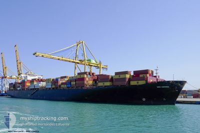
MSC ANTONIA
Container Ship
Current Trip
| Time Travelled | 9 days |
|---|---|
| Remaining Time | 5 h, 9 mins |
| Distance Travelled | 3905.19 nm |
| Remaining Distance | 226.00 nm |
| AVG Speed | 17.7 Knots |
| MAX Speed | 20.1 Knots |
| AVG Wind | 10.3 knots |
| MAX Wind | 21.8 knots |
| MIN Temp | 19°C / 66.2°F |
| MAX Temp | 30°C / 86°F |
| Draught | 13.6 m |
| Position Received | 10 h, 51 m ago |
Current Position
| Longitude | 56.70838° |
|---|---|
| Latitude | 25.92289° |
| Status | Under way using engine |
| Speed | 14 Knots |
| Course | 355.2° |
| Area | Gulf of Oman |
| Station | T-AIS |
| Position Received | 10 h, 51 m ago |
Info
Information
The current position of MSC ANTONIA is in Gulf of Oman with coordinates 25.92289° / 56.70838° as reported on 2024-04-16 01:56 by AIS to our vessel tracker app. The vessel's current speed is 14 Knots and is heading at the port of ABU DHABI. The estimated time of arrival as calculated by MyShipTracking vessel tracking app is 2024-04-16 17:56 LT
The vessel MSC ANTONIA (IMO: 9398216, MMSI: 636018660) is a Container Ship that was built in 2009 ( 15 years old ). It's sailing under the flag of [LR] Liberia.
In this page you can find informations about the vessels current position, last detected port calls, and current voyage information. If the vessels is not in coverage by AIS you will find the latest position.
The current position of MSC ANTONIA is detected by our AIS receivers and we are not responsible for the reliability of the data. The last position was recorded while the vessel was in Coverage by the Ais receivers of our vessel tracking app.
The current draught of MSC ANTONIA as reported by AIS is 13.6 meters
Weather
| Temperature | 22.7°C / 72.86°F |
|---|---|
| Wind Speed | 23 knots |
| Direction | 157° SSE |
| Pressure | 1011.8 hPa |
| Humidity | 86.1 % |
| Cloud Coverage | 100 % |
Featured Company
Last Port Calls
| Port | Arrival | Departure | Time In Port |
|---|---|---|---|
| 2024-04-02 19:46 | 2024-04-07 03:44 | 4 d | |
| 2024-03-24 17:22 | 2024-03-25 22:52 | 1 d | |
| 2024-03-16 19:12 | 2024-03-22 18:01 | 5 d | |
| 2024-03-02 06:21 | 2024-03-03 02:33 | 20 h | |
| 2024-02-22 05:43 | 2024-02-23 15:23 | 1 d | |
| 2024-02-14 02:33 | 2024-02-15 12:48 | 1 d | |
| 2024-02-02 09:29 | 2024-02-02 22:06 | 12 h |
Most Visited Ports (Last year)
| Port | Arrivals | |
|---|---|---|
| 4 | ||
| 4 | ||
| 4 | ||
| 4 | ||
| 4 | ||
| 4 |
Last Trips
| Origin | Departure | Destination | Arrival | Distance | |
|---|---|---|---|---|---|
| 2024-03-26 00:52 | 2024-04-02 21:46 | 1019.59 nm | |||
| 2024-03-22 20:01 | 2024-03-24 19:22 | 180.85 nm | |||
| 2024-03-03 06:33 | 2024-03-16 21:12 | 2064.07 nm | |||
| 2024-02-23 20:53 | 2024-03-02 10:21 | 2146.47 nm | |||
| 2024-02-15 20:48 | 2024-02-22 11:13 | 1630.73 nm | |||
| 2024-02-03 06:06 | 2024-02-14 10:33 | 2610.31 nm | |||
| 2024-01-05 11:13 | 2024-02-02 17:29 | 10107.04 nm |
Events
| Time | Event | Details | Position / Dest | Info |
|---|---|---|---|---|
| 2024-04-16 01:58 | Status Changed | Default Under way using engine |
25.93253 / 56.70748
ABU DHABI
|
Speed: 14 kn Course: 355.2° |
| 2024-04-16 01:56 | OUT of Coverage |
25.92289 / 56.70838
Gulf of Oman
ABU DHABI
|
Speed: 14 kn Course: 355.2° |
|
| 2024-04-16 00:53 | Change Sea Area | Omani part of the Gulf of Oman United Arab Emirates part of the Gulf of Oman |
25.67704 / 56.73183
Gulf of Oman
ABU DHABI
|
Speed: 14.1 kn Course: 0.5° |
| 2024-04-15 22:13 | Change Sea Area | United Arab Emirates part of the Gulf of Oman Omani part of the Gulf of Oman |
25.06153 / 56.86363
Gulf of Oman
ABU DHABI
|
Speed: 14.1 kn Course: 342.6° |
| 2024-04-15 21:29 | Draught Changed | 13.6 13.5 |
24.89758 / 56.91989
ABU DHABI
|
Speed: 14 kn Course: 346.7° |
| 2024-04-15 21:29 | ETA Changed | 2024/04/16 21:00 2024/04/17 08:00 |
24.89758 / 56.91989
ABU DHABI
|
Speed: 14 kn Course: 346.7° |
| 2024-04-15 20:43 | Change Sea Area | Omani part of the Gulf of Oman South African part of the Indian Ocean |
24.70394 / 56.97225
Gulf of Oman
ABU DHABI
|
Speed: 16.1 kn Course: 345.8° |
| 2024-04-15 20:42 | Status Changed | Under way using engine Default |
24.69692 / 56.97422
ABU DHABI
|
Speed: 16 kn Course: 346° |
| 2024-04-15 20:26 | IN Coverage |
24.70394 / 56.97225
Gulf of Oman
ABU DHABI
|
Speed: 16.1 kn Course: 345.8° |
|
| 2024-04-10 05:48 | START Moving | 1.7 nm, North West of MORONI |
-11.68421 / 43.22554
ABU DHABI
|
Speed: 5.6 kn Course: 339° |