
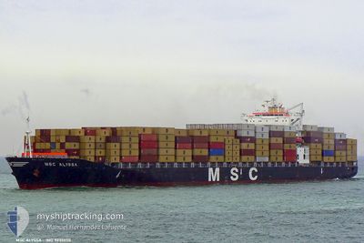
MSC ALYSSA
Container Ship
Current Trip
| Time Travelled | 8 days |
|---|---|
| Remaining Time | 2 h, 29 mins |
| Distance Travelled | 2748.08 nm |
| Remaining Distance | 35.97 nm |
| AVG Speed | 13.9 Knots |
| MAX Speed | 20 Knots |
| AVG Wind | 13.6 knots |
| MAX Wind | 23.8 knots |
| MIN Temp | 2.2°C / 35.96°F |
| MAX Temp | 19°C / 66.2°F |
| Draught | 10.6 m |
| Position Received | 1 m ago |
Current Position
| Longitude | -4.83240° |
|---|---|
| Latitude | 36.28542° |
| Status | Under way using engine |
| Speed | 13.8 Knots |
| Course | 60.5° |
| Area | Alboran Sea |
| Station | T-AIS |
| Position Received | 1 m ago |
Info
Information
The current position of MSC ALYSSA is in Alboran Sea with coordinates 36.28542° / -4.83240° as reported on 2024-04-25 12:56 by AIS to our vessel tracker app. The vessel's current speed is 13.8 Knots and is heading at the port of MALAGA. The estimated time of arrival as calculated by MyShipTracking vessel tracking app is 2024-04-25 15:27 LT
The vessel MSC ALYSSA (IMO: 9235050, MMSI: 351473000) is a Container Ship that was built in 2001 ( 23 years old ). It's sailing under the flag of [PA] Panama.
In this page you can find informations about the vessels current position, last detected port calls, and current voyage information. If the vessels is not in coverage by AIS you will find the latest position.
The current position of MSC ALYSSA is detected by our AIS receivers and we are not responsible for the reliability of the data. The last position was recorded while the vessel was in Coverage by the Ais receivers of our vessel tracking app.
The current draught of MSC ALYSSA as reported by AIS is 10.6 meters
Weather
| Temperature | 17.5°C / 63.5°F |
|---|---|
| Wind Speed | 14 knots |
| Direction | 222° SW |
| Pressure | 1010 hPa |
| Humidity | 76.9 % |
| Cloud Coverage | 50 % |
Featured Company
Last Port Calls
| Port | Arrival | Departure | Time In Port |
|---|---|---|---|
| 2024-04-16 12:09 | 2024-04-17 02:29 | 14 h | |
| 2024-04-11 11:08 | 2024-04-13 19:12 | 2 d | |
| 2024-04-07 19:31 | 2024-04-08 03:53 | 8 h | |
| 2024-03-29 17:33 | 2024-03-30 20:34 | 1 d | |
| 2024-03-26 11:21 | 2024-03-27 05:24 | 18 h | |
| 2024-03-23 05:34 | 2024-03-23 16:40 | 11 h | |
| 2024-03-20 14:40 | 2024-03-21 20:07 | 1 d | |
| 2024-03-19 17:32 | 2024-03-20 08:11 | 14 h | |
| 2024-03-16 17:42 | 2024-03-17 15:28 | 21 h | |
| 2024-03-07 10:27 | 2024-03-07 23:06 | 12 h |
Last Trips
| Origin | Departure | Destination | Arrival | Distance | |
|---|---|---|---|---|---|
| 2024-04-13 15:12 | 2024-04-16 09:09 | 973.11 nm | |||
| 2024-04-08 00:53 | 2024-04-11 07:08 | 986.14 nm | |||
| 2024-03-30 20:34 | 2024-04-07 16:31 | 2755.56 nm | |||
| 2024-03-27 06:24 | 2024-03-29 17:33 | 674.78 nm | |||
| 2024-03-23 17:40 | 2024-03-26 12:21 | 739.26 nm | |||
| 2024-03-21 21:07 | 2024-03-23 06:34 | 363.05 nm | |||
| 2024-03-20 09:11 | 2024-03-20 15:40 | 84.13 nm | |||
| 2024-03-17 16:28 | 2024-03-19 18:32 | 839.73 nm | |||
| 2024-03-07 19:06 | 2024-03-16 18:42 | 2842.19 nm | |||
| 2024-03-04 06:49 | 2024-03-07 06:27 | 544.83 nm |
Events
| Time | Event | Details | Position / Dest | Info |
|---|---|---|---|---|
| 2024-04-25 11:44 | Change Sea Area | Spanish part of the Alboran Sea Gibraltarian part of the Alboran Sea |
36.13711 / -5.10605
Alboran Sea
ESAGP
|
Speed: 13.2 kn Course: 32.5° |
| 2024-04-25 11:04 | Change Sea Area | Gibraltarian part of the Alboran Sea Spanish part of the Alboran Sea |
36.02137 / -5.24433
Alboran Sea
ESAGP
|
Speed: 15.3 kn Course: 63° |
| 2024-04-25 10:50 | Change Sea Area | Spanish part of the Alboran Sea Spanish part of the Strait of Gibraltar |
35.99863 / -5.30967
Alboran Sea
ESAGP
|
Speed: 15 kn Course: 69.4° |
| 2024-04-25 10:38 | Change Sea Area | Spanish part of the Strait of Gibraltar Moroccan part of the Strait of Gibraltar |
35.98142 / -5.36915
Strait of Gibraltar
ESAGP
|
Speed: 15.4 kn Course: 71.1° |
| 2024-04-25 08:37 | Change Sea Area | Moroccan part of the Strait of Gibraltar Moroccan part of the North Atlantic Ocean |
35.90433 / -5.93512
Strait of Gibraltar
ESAGP
|
Speed: 14 kn Course: 87.8° |
| 2024-04-25 07:48 | Status Changed | Under way using engine Default |
35.89862 / -6.17519
ESAGP
|
Speed: 14.3 kn Course: 93° |
| 2024-04-25 07:47 | Status Changed | Default Under way using engine |
35.89894 / -6.18353
ESAGP
|
Speed: 14.3 kn Course: 92.4° |
| 2024-04-25 07:46 | Status Changed | Under way using engine Default |
35.89900 / -6.18500
ESAGP
|
Speed: 14.3 kn Course: 92° |
| 2024-04-25 07:46 | Change Sea Area | Moroccan part of the North Atlantic Ocean Spanish part of the North Atlantic Ocean |
35.89900 / -6.18500
North Atlantic Ocean
ESAGP
|
Speed: 14.3 kn Course: 92.4° |
| 2024-04-25 06:57 | Status Changed | Default Under way using engine |
35.92269 / -6.42376
ESAGP
|
Speed: 14.6 kn Course: 98.3° |