
MARYLAKI
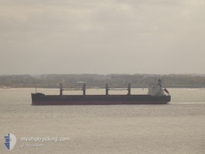
Bulk Carrier
Current Trip
| Trip Time | 22 days |
|---|---|
| Trip Distance | 4610.18 nm |
| AVG Speed | 10.5 Knots |
| MAX Speed | 13 Knots |
| Draught | 11.4 m |
| AVG Wind | 11 knots |
| MAX Wind | 19.3 knots |
| MIN Temp | 14.3°C / 57.74°F |
| MAX Temp | 29.9°C / 85.82°F |
| Position Received | 24 d ago |
Current Position
| Longitude | 153.94342° |
|---|---|
| Latitude | -27.57689° |
| Status | Under way using engine |
| Speed | 9.1 Knots |
| Course | 359.1° |
| Area | Coral Sea |
| Station | T-AIS |
| Position Received | 24 d ago |
Info
Information
The current position of MARYLAKI is in Coral Sea with coordinates -27.57689° / 153.94342° as reported on 2024-03-30 17:13 by AIS to our vessel tracker app. The vessel's current speed is 9.1 Knots and is currently inside the port of KANDA.
The vessel MARYLAKI (IMO: 9494010, MMSI: 538007931) is a Bulk Carrier that was built in 2010 ( 14 years old ). It's sailing under the flag of [MH] Marshall Is.
In this page you can find informations about the vessels current position, last detected port calls, and current voyage information. If the vessels is not in coverage by AIS you will find the latest position.
The current position of MARYLAKI is detected by our AIS receivers and we are not responsible for the reliability of the data. The last position was recorded while the vessel was in Coverage by the Ais receivers of our vessel tracking app.
The current draught of MARYLAKI as reported by AIS is 11.4 meters
Weather
| Temperature | 18.2°C / 64.76°F |
|---|---|
| Wind Speed | 10 knots |
| Direction | 290° WNW |
| Pressure | 1007.7 hPa |
| Humidity | 71 % |
| Cloud Coverage | 93 % |
Featured Company
Last Port Calls
| Port | Arrival | Departure | Time In Port |
|---|---|---|---|
| 2024-04-20 23:52 | |||
| 2024-03-26 05:32 | 2024-03-29 03:54 | 2 d | |
| 2024-03-09 09:11 | |||
| 2024-03-03 21:54 | 2024-03-07 10:31 | 3 d | |
| 2024-02-09 01:35 | 2024-02-11 07:32 | 2 d | |
| 2024-02-02 12:31 |
Most Visited Ports (Last year)
| Port | Arrivals | |
|---|---|---|
| 2 | ||
| 1 | ||
| 1 | ||
| 1 | ||
| 1 | ||
| 1 |
Last Trips
| Origin | Departure | Destination | Arrival | Distance | |
|---|---|---|---|---|---|
| 2024-03-29 14:54 | 2024-04-21 08:52 | 4610.18 nm | |||
| 2024-03-09 18:11 | 2024-03-26 16:32 | 4596.20 nm | |||
| 2024-02-11 15:32 | 2024-03-04 06:54 | 3085.90 nm | |||
| 2024-02-02 20:31 | 2024-02-09 09:35 | 1003.36 nm |
Events
| Time | Event | Details | Position / Dest | Info |
|---|---|---|---|---|
| 2024-04-21 00:35 | STOP Moving |
33.79767 / 130.99344
[JP] KANDA
|
Speed: 0.1 kn Course: 40° |
|
| 2024-04-20 23:52 | PORT ARRIVAL |
|
33.80146 / 131.02190
[JP] KANDA
|
Speed: 7.1 kn Course: 248° |
| 2024-04-20 22:28 | START Moving | 9.06 nm, North of NAKATSU |
33.76086 / 131.22288
JP KND
|
Speed: 3.3 kn Course: 1° |
| 2024-04-20 06:28 | STOP Moving | 8.74 nm, North East of UNOSHIMA |
33.75621 / 131.21945
JP KND
|
Speed: 0.3 kn Course: 53° |
| 2024-04-18 03:12 | STOP Moving | 21.05 nm, East of MIYAZAKI |
31.98667 / 131.86333
JP KND
|
Speed: Course: -1° |
| 2024-04-18 02:04 | START Moving | 16.29 nm, East of MIYAZAKI |
31.98658 / 131.76703
JP KND
|
Speed: 5.7 kn Course: 97° |
| 2024-04-17 20:15 | STOP Moving |
32.03167 / 131.86500
JP KND
|
Speed: Course: -1° |
|
| 2024-04-17 18:36 | START Moving | 18 nm, East of MIYAZAKI |
31.92333 / 131.81334
JP KND
|
Speed: 7 kn Course: 25° |
| 2024-04-17 06:12 | STOP Moving |
31.98167 / 131.90834
JP KND
|
Speed: Course: -1° |
|
| 2024-04-17 04:54 | START Moving | 17.45 nm, East of MIYAZAKI |
31.99333 / 131.78833
JP KND
|
Speed: 7 kn Course: 94° |