

CC-SUMMER
Pleasure Craft

Current Trip
STANIEL CAY
| Time Travelled | 2 days |
|---|---|
| Remaining Time | --- |
| Distance Travelled | 257.67 nm |
| Remaining Distance | --- |
| AVG Speed | 8.3 Knots |
| MAX Speed | 14.7 Knots |
| AVG Wind | 11.6 knots |
| MAX Wind | 17.8 knots |
| MIN Temp | 22.7°C / 72.86°F |
| MAX Temp | 24.5°C / 76.1°F |
| Draught | 3.9 m |
| Position Received | 1 m ago |
Current Position
| Longitude | --- |
|---|---|
| Latitude | --- |
| Status | At anchor |
| Speed | |
| Course | 202° |
| Area | North Atlantic Ocean |
| Station | T-AIS |
| Position Received | 1 m ago |
Information
The current position of CC-SUMMER is in North Atlantic Ocean with coordinates 24.19200° / -76.49837° as reported on 2025-02-27 16:55 by AIS to our vessel tracker app. The vessel's current speed is 0 Knots
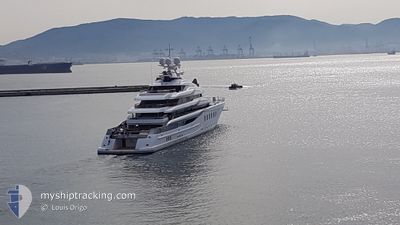
The vessel CC-SUMMER (IMO: 9807956, MMSI: 538071410) is a Pleasure Craft It's sailing under the flag of [MH] Marshall Is.
In this page you can find informations about the vessels current position, last detected port calls, and current voyage information. If the vessels is not in coverage by AIS you will find the latest position.
The current position of CC-SUMMER is detected by our AIS receivers and we are not responsible for the reliability of the data. The last position was recorded while the vessel was in Coverage by the Ais receivers of our vessel tracking app.
The current draught of CC-SUMMER as reported by AIS is 3.9 meters
Weather
| Temperature | 23.9°C / 75.02°F |
|---|---|
| Wind Speed | 10 knots |
| Direction | 136° SE |
| Pressure | 1018.4 hPa |
| Humidity | 71.9 % |
| Cloud Coverage | 2 % |


Featured Company
Last Port Calls
| Port | Arrival | Departure | Time In Port |
|---|---|---|---|
| 2025-02-18 23:41 | 2025-02-24 19:41 | 5 d | |
| 2024-12-11 15:54 | 2024-12-14 21:32 | 3 d | |
| 2024-12-02 21:25 | 2024-12-10 15:32 | 7 d | |
| 2024-12-02 21:02 | 2024-12-02 21:17 | 14 m |
Most Visited Ports (Last year)
| Port | Arrivals | |
|---|---|---|
| 4 | ||
| 2 | ||
| 2 | ||
| 2 | ||
| 2 | ||
| 2 |
Last Trips
| Origin | Departure | Destination | Arrival | Distance | |
|---|---|---|---|---|---|
| 2024-12-14 17:32 | 2025-02-18 18:41 | 1622.11 nm | |||
| 2024-12-10 11:32 | 2024-12-11 11:54 | 300.18 nm | |||
| 2024-12-02 17:17 | 2024-12-02 17:25 | 0.55 nm | |||
| 2024-11-18 08:31 | 2024-12-02 17:02 | 212.60 nm |
Events
| Time | Event | Details | Position / Dest | Info |
|---|---|---|---|---|
| 2025-02-27 15:50 | ETA Changed | 2025/02/25 23:00 |
24.19198 / -76.49835
STANIEL CAY
|
Speed: Course: 205° |
| 2025-02-27 14:01 | ETA Changed | 2025/02/25 23:00 |
24.19203 / -76.49835
STANIEL CAY
|
Speed: Course: 187° |
| 2025-02-27 12:49 | ETA Changed | 2025/02/25 23:00 |
24.19203 / -76.49838
STANIEL CAY
|
Speed: Course: 180° |
| 2025-02-27 11:49 | ETA Changed | 2025/02/25 23:00 |
24.19181 / -76.49864
STANIEL CAY
|
Speed: Course: 136° |
| 2025-02-27 11:13 | ETA Changed | 2025/02/25 23:00 |
24.19180 / -76.49867
STANIEL CAY
|
Speed: Course: 123° |
| 2025-02-27 04:25 | ETA Changed | 2025/02/25 23:00 |
24.19147 / -76.49852
STANIEL CAY
|
Speed: 0.1 kn Course: 85° |
| 2025-02-26 20:43 | ETA Changed | 2025/02/25 23:00 |
24.19145 / -76.49851
STANIEL CAY
|
Speed: Course: 80° |
| 2025-02-26 19:13 | ETA Changed | 2025/02/25 23:00 |
24.19142 / -76.49856
STANIEL CAY
|
Speed: Course: 54° |
| 2025-02-26 15:55 | ETA Changed | 2025/02/25 23:00 |
24.19153 / -76.49855
STANIEL CAY
|
Speed: Course: 34° |
| 2025-02-26 15:43 | ETA Changed | 2025/02/25 23:00 |
24.19151 / -76.49860
STANIEL CAY
|
Speed: Course: 44° |