
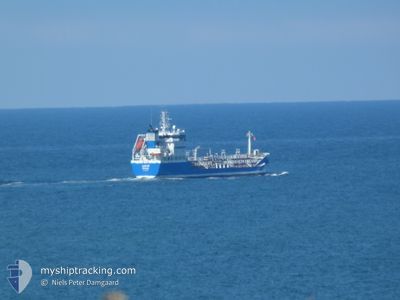
LEXUS
Oil/Chemical Tanker
Current Trip
| Time Travelled | 4 h, 10 mins |
|---|---|
| Remaining Time | 13 h, 32 mins |
| Distance Travelled | 47.77 nm |
| Remaining Distance | 170.84 nm |
| AVG Speed | 11.2 Knots |
| MAX Speed | 13 Knots |
| AVG Wind | 16.1 knots |
| MAX Wind | 17.1 knots |
| MIN Temp | 3.7°C / 38.66°F |
| MAX Temp | 4.7°C / 40.46°F |
| Draught | 5.8 m |
| Position Received | Now |
Current Position
| Longitude | 11.00366° |
|---|---|
| Latitude | 54.66407° |
| Status | Under way using engine |
| Speed | 12 Knots |
| Course | 304.5° |
| Area | Baltic Sea |
| Station | T-AIS |
| Position Received | Now |
Info
Information
The current position of LEXUS is in Baltic Sea with coordinates 54.66407° / 11.00366° as reported on 2024-04-20 07:06 by AIS to our vessel tracker app. The vessel's current speed is 12 Knots and is heading at the port of AALBORG. The estimated time of arrival as calculated by MyShipTracking vessel tracking app is 2024-04-20 20:38 LT
The vessel LEXUS (IMO: 9310317, MMSI: 266472000) is a Oil/Chemical Tanker that was built in 2005 ( 19 years old ). It's sailing under the flag of [SE] Sweden.
In this page you can find informations about the vessels current position, last detected port calls, and current voyage information. If the vessels is not in coverage by AIS you will find the latest position.
The current position of LEXUS is detected by our AIS receivers and we are not responsible for the reliability of the data. The last position was recorded while the vessel was in Coverage by the Ais receivers of our vessel tracking app.
The current draught of LEXUS as reported by AIS is 5.8 meters
Weather
| Temperature | 4.4°C / 39.92°F |
|---|---|
| Wind Speed | 9 knots |
| Direction | 34° NE |
| Pressure | 1015.6 hPa |
| Humidity | 69.4 % |
| Cloud Coverage | 100 % |
Featured Company
Last Port Calls
| Port | Arrival | Departure | Time In Port |
|---|---|---|---|
| 2024-04-19 14:04 | 2024-04-20 02:56 | 12 h | |
| 2024-04-17 06:58 | 2024-04-17 18:21 | 11 h | |
| 2024-04-14 13:31 | 2024-04-14 13:35 | 4 m | |
| 2024-04-12 20:55 | 2024-04-13 22:42 | 1 d | |
| 2024-04-05 13:06 | 2024-04-06 01:28 | 12 h | |
| 2024-04-04 21:19 | 2024-04-05 02:39 | 5 h | |
| 2024-04-04 09:14 | 2024-04-04 16:07 | 6 h | |
| 2024-04-03 05:10 | 2024-04-04 04:34 | 23 h | |
| 2024-03-29 22:33 | 2024-03-30 05:18 | 6 h | |
| 2024-03-29 13:56 | 2024-03-29 19:41 | 5 h |
Most Visited Ports (Last year)
| Port | Arrivals | |
|---|---|---|
| 66 | ||
| 22 | ||
| 11 | ||
| 9 | ||
| 8 | ||
| 8 |
Last Trips
| Origin | Departure | Destination | Arrival | Distance | |
|---|---|---|---|---|---|
| 2024-04-17 21:21 | 2024-04-19 16:04 | 536.89 nm | |||
| 2024-04-14 15:35 | 2024-04-17 09:58 | 590.91 nm | |||
| 2024-04-14 00:42 | 2024-04-14 15:31 | 90.72 nm | |||
| 2024-04-06 03:28 | 2024-04-12 22:55 | 427.56 nm | |||
| 2024-04-05 04:39 | 2024-04-05 15:06 | 68.62 nm | |||
| 2024-04-04 18:07 | 2024-04-04 23:19 | 60.65 nm | |||
| 2024-04-04 06:34 | 2024-04-04 11:14 | 45.40 nm | |||
| 2024-03-30 06:18 | 2024-04-03 07:10 | 123.24 nm | |||
| 2024-03-29 20:41 | 2024-03-29 23:33 | 32.66 nm | |||
| 2024-03-28 22:18 | 2024-03-29 14:56 | 155.56 nm |
Events
| Time | Event | Details | Position / Dest | Info |
|---|---|---|---|---|
| 2024-04-20 06:53 | Change Sea Area | Danish part of the Baltic Sea German part of the Baltic Sea |
54.63998 / 11.06687
Baltic Sea
DKAAL PEC-518
|
Speed: 12.1 kn Course: 302.1° |
| 2024-04-20 06:15 | Destination Changed | DKAAL PEC-518 DKAAL PEC-75 |
54.58318 / 11.26346
DKAAL PEC-518
|
Speed: 12.8 kn Course: 294.3° |
| 2024-04-20 06:15 | ETA Changed | 2024/04/20 21:00 2024/04/20 23:00 |
54.58318 / 11.26346
DKAAL PEC-518
|
Speed: 12.8 kn Course: 294.3° |
| 2024-04-20 06:05 | Change Sea Area | German part of the Baltic Sea Danish part of the Baltic Sea |
54.56793 / 11.32253
Baltic Sea
DKAAL PEC-75
|
Speed: 13 kn Course: 294.3° |
| 2024-04-20 04:11 | Detected in Sea | Danish part of the Baltic Sea |
54.37251 / 11.90386
Baltic Sea
DKAAL PEC-75
|
Speed: 11.6 kn Course: 319.7° |
| 2024-04-20 04:09 | Destination Changed | DKAAL PEC-75 DKAAL |
54.36922 / 11.90858
DKAAL PEC-75
|
Speed: 11.6 kn Course: 319.8° |
| 2024-04-20 03:20 | ETA Changed | 2024/04/20 23:00 2024/04/21 19:00 |
54.24914 / 12.06332
DKAAL
|
Speed: 10.8 kn Course: 348.5° |
| 2024-04-20 02:56 | PORT DEPARTURE |
|
54.19021 / 12.08784
DKAAL
|
Speed: 7.1 kn Course: 341° |
| 2024-04-20 02:30 | START Moving |
54.15839 / 12.13032
[DE] ROSTOCK
|
Speed: 3.3 kn Course: 312° |
|
| 2024-04-20 02:27 | Status Changed | Under way using engine Moored |
54.15729 / 12.13226
[DE] ROSTOCK
|
Speed: Course: 322° |