
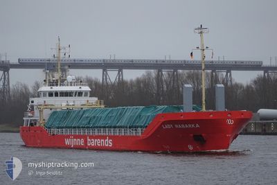
LADY HABARKA
Cargo
Current Trip
| Time Travelled | 3 h, 45 mins |
|---|---|
| Remaining Time | --- |
| Distance Travelled | 36.63 nm |
| Remaining Distance | --- |
| AVG Speed | 10.4 Knots |
| MAX Speed | 11.6 Knots |
| AVG Wind | 2.1 knots |
| MAX Wind | 4 knots |
| MIN Temp | 6.6°C / 43.88°F |
| MAX Temp | 7.6°C / 45.68°F |
| Draught | 5.5 m |
| Position Received | 1 m ago |
Current Position
| Longitude | -5.45224° |
|---|---|
| Latitude | 54.28597° |
| Status | Under way using engine |
| Speed | 11.7 Knots |
| Course | 36.1° |
| Area | Irish Sea and St. George's Channel |
| Station | T-AIS |
| Position Received | 1 m ago |
Info
Information
The current position of LADY HABARKA is in Irish Sea and St. George's Channel with coordinates 54.28597° / -5.45224° as reported on 2024-04-24 13:27 by AIS to our vessel tracker app. The vessel's current speed is 11.7 Knots and is heading at the port of OSLO. The estimated time of arrival as calculated by MyShipTracking vessel tracking app is 2024-04-27 16:00 LT
The vessel LADY HABARKA (IMO: 9835006, MMSI: 245302000) is a Cargo It's sailing under the flag of [NL] Netherlands.
In this page you can find informations about the vessels current position, last detected port calls, and current voyage information. If the vessels is not in coverage by AIS you will find the latest position.
The current position of LADY HABARKA is detected by our AIS receivers and we are not responsible for the reliability of the data. The last position was recorded while the vessel was in Coverage by the Ais receivers of our vessel tracking app.
The current draught of LADY HABARKA as reported by AIS is 5.5 meters
Weather
| Temperature | 7.2°C / 44.96°F |
|---|---|
| Wind Speed | 3 knots |
| Direction | 174° S |
| Pressure | 1019 hPa |
| Humidity | 65.3 % |
| Cloud Coverage | 100 % |
Featured Company
Last Port Calls
| Port | Arrival | Departure | Time In Port |
|---|---|---|---|
| 2024-04-23 11:22 | 2024-04-24 09:43 | 22 h | |
| 2024-04-21 19:04 | 2024-04-22 16:10 | 21 h | |
| 2024-04-21 18:26 | 2024-04-21 18:34 | 7 m | |
| 2024-04-18 06:50 | 2024-04-18 22:57 | 16 h | |
| 2024-04-16 12:26 | 2024-04-17 21:56 | 1 d | |
| 2024-04-10 20:58 | 2024-04-10 21:42 | 43 m | |
| 2024-04-09 11:25 | 2024-04-10 16:34 | 1 d | |
| 2024-04-09 06:17 | 2024-04-09 06:51 | 33 m | |
| 2024-03-31 01:53 | 2024-04-03 18:22 | 3 d | |
| 2024-03-27 12:17 | 2024-03-28 22:07 | 1 d |
Last Trips
| Origin | Departure | Destination | Arrival | Distance | |
|---|---|---|---|---|---|
| 2024-04-22 17:10 | 2024-04-23 12:22 | 214.92 nm | |||
| 2024-04-21 19:34 | 2024-04-21 20:04 | 3.46 nm | |||
| 2024-04-19 00:57 | 2024-04-21 19:26 | 585.65 nm | |||
| 2024-04-17 23:56 | 2024-04-18 08:50 | 87.18 nm | |||
| 2024-04-10 23:42 | 2024-04-16 14:26 | 1112.69 nm | |||
| 2024-04-10 18:34 | 2024-04-10 22:58 | 48.59 nm | |||
| 2024-04-09 08:51 | 2024-04-09 13:25 | 48.97 nm | |||
| 2024-04-03 19:22 | 2024-04-09 08:17 | 1398.93 nm | |||
| 2024-03-28 22:07 | 2024-03-31 02:53 | 30.38 nm | |||
| 2024-03-22 09:33 | 2024-03-27 12:17 | 1322.17 nm |
Events
| Time | Event | Details | Position / Dest | Info |
|---|---|---|---|---|
| 2024-04-24 12:02 | Status Changed | Under way using engine Default |
54.08029 / -5.74722
NOOSL
|
Speed: 11.2 kn Course: 42° |
| 2024-04-24 11:58 | Status Changed | Default Under way using engine |
54.07262 / -5.75914
NOOSL
|
Speed: 11.2 kn Course: 42.7° |
| 2024-04-24 11:50 | Status Changed | Under way using engine Default |
54.05385 / -5.78824
NOOSL
|
Speed: 11.3 kn Course: 41° |
| 2024-04-24 11:14 | Status Changed | Default Under way using engine |
53.97199 / -5.91743
NOOSL
|
Speed: 10.7 kn Course: 64.2° |
| 2024-04-24 10:23 | Change Sea Area | United Kingdom part of the Irish Sea and St. George's Channel Irish part of the Irish Sea and St. George's Channel |
54.02988 / -6.11185
Irish Sea and St. George's Channel
NOOSL
|
Speed: 10.3 kn Course: 105.7° |
| 2024-04-24 10:21 | Draught Changed | 5.5 3.6 |
54.03125 / -6.11864
NOOSL
|
Speed: 9.9 kn Course: 114.9° |
| 2024-04-24 10:21 | Destination Changed | NOOSL GBWPT |
54.03125 / -6.11864
NOOSL
|
Speed: 9.9 kn Course: 114.9° |
| 2024-04-24 10:21 | ETA Changed | 2024/04/27 16:00 2024/04/23 10:00 |
54.03125 / -6.11864
NOOSL
|
Speed: 9.9 kn Course: 114.9° |
| 2024-04-24 10:17 | Change Sea Area | Irish part of the Irish Sea and St. George's Channel United Kingdom part of the Irish Sea and St. George's Channel |
54.03908 / -6.13414
Irish Sea and St. George's Channel
|
Speed: 10 kn Course: 151.3° |
| 2024-04-24 10:15 | Status Changed | Under way using engine Default |
54.04355 / -6.13803
GBWPT
|
Speed: 10.4 kn Course: 137° |