
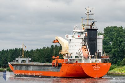
LADY CLAUDIA
General Cargo
Current Trip
| Time Travelled | 7 h, 13 mins |
|---|---|
| Remaining Time | 18 h, 27 mins |
| Distance Travelled | 30.30 nm |
| Remaining Distance | 158.54 nm |
| AVG Speed | 7.6 Knots |
| MAX Speed | 10.5 Knots |
| AVG Wind | 21.9 knots |
| MAX Wind | 23.8 knots |
| MIN Temp | 8.1°C / 46.58°F |
| MAX Temp | 8.8°C / 47.84°F |
| Draught | 4.3 m |
| Position Received | 2 h, 38 m ago |
Current Position
| Longitude | 3.89741° |
|---|---|
| Latitude | 52.60871° |
| Status | Under way using engine |
| Speed | 8.4 Knots |
| Course | 310.5° |
| Area | North Sea |
| Station | T-AIS |
| Position Received | 2 h, 38 m ago |
Info
Information
The current position of LADY CLAUDIA is in North Sea with coordinates 52.60871° / 3.89741° as reported on 2024-04-24 15:14 by AIS to our vessel tracker app. The vessel's current speed is 8.4 Knots and is heading at the port of TILBURY. The estimated time of arrival as calculated by MyShipTracking vessel tracking app is 2024-04-25 12:19 LT
The vessel LADY CLAUDIA (IMO: 9201798, MMSI: 245772000) is a General Cargo that was built in 1999 ( 25 years old ). It's sailing under the flag of [NL] Netherlands.
In this page you can find informations about the vessels current position, last detected port calls, and current voyage information. If the vessels is not in coverage by AIS you will find the latest position.
The current position of LADY CLAUDIA is detected by our AIS receivers and we are not responsible for the reliability of the data. The last position was recorded while the vessel was in Coverage by the Ais receivers of our vessel tracking app.
The current draught of LADY CLAUDIA as reported by AIS is 4.3 meters
Weather
| Temperature | 7.7°C / 45.86°F |
|---|---|
| Wind Speed | 20 knots |
| Direction | 344° NNW |
| Pressure | 1010.5 hPa |
| Humidity | 69.4 % |
| Cloud Coverage | 48 % |
Featured Company
Last Port Calls
| Port | Arrival | Departure | Time In Port |
|---|---|---|---|
| 2024-04-22 13:18 | 2024-04-24 10:39 | 1 d | |
| 2024-04-21 06:55 | 2024-04-21 07:55 | 59 m | |
| 2024-04-17 16:46 | |||
| 2024-04-13 12:39 | 2024-04-16 14:39 | 3 d | |
| 2024-04-11 23:01 | 2024-04-11 23:05 | 3 m | |
| 2024-04-07 08:34 | 2024-04-10 07:30 | 2 d | |
| 2024-04-05 08:36 | 2024-04-06 08:58 | 1 d | |
| 2024-04-05 00:54 | 2024-04-05 08:07 | 7 h | |
| 2024-03-31 08:43 | 2024-04-01 18:38 | 1 d | |
| 2024-03-28 11:45 | 2024-03-30 07:17 | 1 d |
Last Trips
| Origin | Departure | Destination | Arrival | Distance | |
|---|---|---|---|---|---|
| 2024-04-21 09:55 | 2024-04-22 15:18 | 301.23 nm | |||
| 2024-04-16 16:39 | 2024-04-17 19:46 | 318.45 nm | |||
| 2024-04-12 01:05 | 2024-04-13 14:39 | 462.58 nm | |||
| 2024-04-10 08:30 | 2024-04-12 01:01 | 438.64 nm | |||
| 2024-04-06 10:58 | 2024-04-07 09:34 | 189.54 nm | |||
| 2024-04-05 10:07 | 2024-04-05 10:36 | 1.37 nm | |||
| 2024-04-01 21:38 | 2024-04-05 02:54 | 863.48 nm | |||
| 2024-03-30 08:17 | 2024-03-31 11:43 | 271.95 nm | |||
| 2024-03-22 14:50 | 2024-03-28 12:45 | 1046.53 nm | |||
| 2024-03-19 21:33 | 2024-03-20 15:22 | 194.48 nm |
Events
| Time | Event | Details | Position / Dest | Info |
|---|---|---|---|---|
| 2024-04-24 15:24 | Status Changed | Default Under way using engine |
52.62091 / 3.87092
GBTIL
|
Speed: 8.4 kn Course: 310.5° |
| 2024-04-24 15:14 | OUT of Coverage |
52.60871 / 3.89741
North Sea
GBTIL
|
Speed: 8.4 kn Course: 310.5° |
|
| 2024-04-24 12:55 | START Moving | 8.91 nm, West of IJMUIDEN |
52.49539 / 4.34925
GBTIL
|
Speed: 8.7 kn Course: 283° |
| 2024-04-24 12:54 | STOP Moving | 8.79 nm, West of IJMUIDEN |
52.49489 / 4.35256
GBTIL
|
Speed: Course: 0° |
| 2024-04-24 12:43 | START Moving | 7.29 nm, West of IJMUIDEN |
52.48971 / 4.39261
GBTIL
|
Speed: 8.4 kn Course: 285.1° |
| 2024-04-24 12:42 | STOP Moving | 7.17 nm, West of IJMUIDEN |
52.48925 / 4.39583
GBTIL
|
Speed: Course: 0° |
| 2024-04-24 12:37 | START Moving | 6.4 nm, West of IJMUIDEN |
52.48627 / 4.41610
GBTIL
|
Speed: 8.5 kn Course: 282.6° |
| 2024-04-24 12:36 | STOP Moving | 6.28 nm, West of IJMUIDEN |
52.48578 / 4.41927
GBTIL
|
Speed: Course: 0° |
| 2024-04-24 12:31 | START Moving | 5.61 nm, West of IJMUIDEN |
52.48337 / 4.43709
GBTIL
|
Speed: 8.2 kn Course: 285.1° |
| 2024-04-24 12:30 | STOP Moving | 5.5 nm, West of IJMUIDEN |
52.48289 / 4.44011
GBTIL
|
Speed: Course: 0° |