
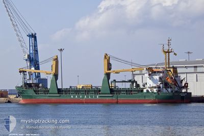
JASPERLAND
General Cargo
Current Trip
| Time Travelled | 20 h, 40 mins |
|---|---|
| Remaining Time | 11 h, 47 mins |
| Distance Travelled | 195.80 nm |
| Remaining Distance | 90.24 nm |
| AVG Speed | 10.1 Knots |
| MAX Speed | 12.9 Knots |
| AVG Wind | 23.8 knots |
| MAX Wind | 27.3 knots |
| MIN Temp | 5.2°C / 41.36°F |
| MAX Temp | 8.4°C / 47.12°F |
| Draught | 3.8 m |
| Position Received | 1 m ago |
Current Position
| Longitude | 1.77059° |
|---|---|
| Latitude | 51.25711° |
| Status | Under way using engine |
| Speed | 7.7 Knots |
| Course | 205.4° |
| Area | North Sea |
| Station | T-AIS |
| Position Received | 1 m ago |
Info
Information
The current position of JASPERLAND is in North Sea with coordinates 51.25711° / 1.77059° as reported on 2024-04-20 15:31 by AIS to our vessel tracker app. The vessel's current speed is 7.7 Knots and is heading at the port of SHOREHAM. The estimated time of arrival as calculated by MyShipTracking vessel tracking app is 2024-04-21 03:19 LT
The vessel JASPERLAND (IMO: 9519042, MMSI: 255806470) is a General Cargo that was built in 2012 ( 12 years old ). It's sailing under the flag of [PT] Portugal.
In this page you can find informations about the vessels current position, last detected port calls, and current voyage information. If the vessels is not in coverage by AIS you will find the latest position.
The current position of JASPERLAND is detected by our AIS receivers and we are not responsible for the reliability of the data. The last position was recorded while the vessel was in Coverage by the Ais receivers of our vessel tracking app.
The current draught of JASPERLAND as reported by AIS is 3.8 meters
Weather
| Temperature | 8.4°C / 47.12°F |
|---|---|
| Wind Speed | 18 knots |
| Direction | 2° N |
| Pressure | 1027.4 hPa |
| Humidity | 61.8 % |
| Cloud Coverage | 69 % |
Featured Company
Last Port Calls
| Port | Arrival | Departure | Time In Port |
|---|---|---|---|
| 2024-04-18 11:01 | 2024-04-19 18:52 | 1 d | |
| 2024-04-10 12:25 | 2024-04-12 20:26 | 2 d | |
| 2024-04-07 13:59 | 2024-04-09 00:17 | 1 d | |
| 2024-04-05 15:37 | 2024-04-06 10:13 | 18 h | |
| 2024-04-02 15:17 | 2024-04-03 20:29 | 1 d | |
| 2024-03-28 17:58 | 2024-03-29 16:55 | 22 h | |
| 2024-03-24 06:21 | 2024-03-25 02:47 | 20 h | |
| 2024-03-19 20:17 | 2024-03-20 19:16 | 22 h | |
| 2024-03-17 18:16 | 2024-03-18 18:48 | 1 d | |
| 2024-03-14 12:50 | 2024-03-15 11:51 | 23 h |
Last Trips
| Origin | Departure | Destination | Arrival | Distance | |
|---|---|---|---|---|---|
| 2024-04-12 23:26 | 2024-04-18 12:01 | 1113.80 nm | |||
| 2024-04-09 02:17 | 2024-04-10 15:25 | 376.28 nm | |||
| 2024-04-06 13:13 | 2024-04-07 15:59 | 285.19 nm | |||
| 2024-04-03 23:29 | 2024-04-05 18:37 | 373.33 nm | |||
| 2024-03-29 18:55 | 2024-04-02 18:17 | 360.72 nm | |||
| 2024-03-25 04:47 | 2024-03-28 19:58 | 550.96 nm | |||
| 2024-03-20 21:16 | 2024-03-24 08:21 | 449.90 nm | |||
| 2024-03-18 19:48 | 2024-03-19 22:17 | 289.71 nm | |||
| 2024-03-15 13:51 | 2024-03-17 19:16 | 273.81 nm | |||
| 2024-03-12 16:39 | 2024-03-14 14:50 | 274.38 nm |
Events
| Time | Event | Details | Position / Dest | Info |
|---|---|---|---|---|
| 2024-04-20 11:57 | ETA Changed | 2024/04/21 06:00 2024/04/21 03:00 |
51.61527 / 2.14389
GBSHO
|
Speed: 6.3 kn Course: 222.8° |
| 2024-04-20 08:52 | Status Changed | Under way using engine Default |
51.95235 / 2.44174
GBSHO
|
Speed: 11.9 kn Course: 168° |
| 2024-04-20 08:43 | Status Changed | Default Under way using engine |
51.98073 / 2.43153
GBSHO
|
Speed: 11.9 kn Course: 171.6° |
| 2024-04-20 08:41 | Status Changed | Under way using engine Default |
51.98567 / 2.43015
GBSHO
|
Speed: 11.2 kn Course: 175° |
| 2024-04-20 08:02 | Status Changed | Default Under way using engine |
52.10333 / 2.38333
GBSHO
|
Speed: 11.1 kn Course: 141.7° |
| 2024-04-20 07:57 | Status Changed | Under way using engine Default |
52.11660 / 2.36783
GBSHO
|
Speed: 11 kn Course: 141° |
| 2024-04-20 07:53 | Status Changed | Default Under way using engine |
52.12500 / 2.35500
GBSHO
|
Speed: 11 kn Course: 144.5° |
| 2024-04-20 00:22 | Status Changed | Under way using engine Default |
53.24124 / 1.12988
GBSHO
|
Speed: 9 kn Course: 142° |
| 2024-04-20 00:20 | IN Coverage |
53.24124 / 1.12988
North Sea
GBSHO
|
Speed: 8.7 kn Course: 143.7° |
|
| 2024-04-19 20:14 | OUT of Coverage |
53.54281 / .22225
North Sea
GBSHO
|
Speed: 10.3 kn Course: 85.3° |