
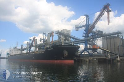
IPPOKRATIS
Bulk Carrier
Current Trip
| Time Travelled | 18 days |
|---|---|
| Remaining Time | --- |
| Distance Travelled | 4908.27 nm |
| Remaining Distance | --- |
| AVG Speed | 11.2 Knots |
| MAX Speed | 14.3 Knots |
| AVG Wind | 15.8 knots |
| MAX Wind | 31 knots |
| MIN Temp | 16.3°C / 61.34°F |
| MAX Temp | 29.8°C / 85.64°F |
| Draught | 11.3 m |
| Position Received | 2 h, 54 m ago |
Current Position
| Longitude | -17.80513° |
|---|---|
| Latitude | 16.54704° |
| Status | Under way using engine |
| Speed | 10.4 Knots |
| Course | 3.8° |
| Area | North Atlantic Ocean |
| Station | T-AIS |
| Position Received | 2 h, 54 m ago |
Info
Information
The current position of IPPOKRATIS is in North Atlantic Ocean with coordinates 16.54704° / -17.80513° as reported on 2024-04-18 22:25 by AIS to our vessel tracker app. The vessel's current speed is 10.4 Knots and is heading at the port of VLISSINGEN. The estimated time of arrival as calculated by MyShipTracking vessel tracking app is 2024-04-25 16:00 LT
The vessel IPPOKRATIS (IMO: 9585663, MMSI: 538009398) is a Bulk Carrier that was built in 2011 ( 13 years old ). It's sailing under the flag of [MH] Marshall Is.
In this page you can find informations about the vessels current position, last detected port calls, and current voyage information. If the vessels is not in coverage by AIS you will find the latest position.
The current position of IPPOKRATIS is detected by our AIS receivers and we are not responsible for the reliability of the data. The last position was recorded while the vessel was in Coverage by the Ais receivers of our vessel tracking app.
The current draught of IPPOKRATIS as reported by AIS is 11.3 meters
Weather
| Temperature | 23°C / 73.4°F |
|---|---|
| Wind Speed | 18 knots |
| Direction | 8° N |
| Pressure | 1012.2 hPa |
| Humidity | 74.2 % |
| Cloud Coverage | 66 % |
Featured Company
Last Port Calls
| Port | Arrival | Departure | Time In Port |
|---|---|---|---|
| 2024-03-30 15:35 | 2024-03-31 17:32 | 1 d | |
| 2024-03-22 18:54 | 2024-03-27 18:32 | 4 d | |
| 2024-02-29 11:04 | |||
| 2024-02-05 10:13 | 2024-02-08 00:57 | 2 d |
Last Trips
| Origin | Departure | Destination | Arrival | Distance | |
|---|---|---|---|---|---|
| 2024-03-27 20:32 | 2024-03-30 17:35 | 33.48 nm | |||
| 2024-02-07 21:57 | 2024-02-29 14:04 | 5887.26 nm | |||
| 2024-01-17 12:00 | 2024-02-05 07:13 | 3224.32 nm |
Events
| Time | Event | Details | Position / Dest | Info |
|---|---|---|---|---|
| 2024-04-18 22:40 | Status Changed | Default Under way using engine |
16.58794 / -17.80227
FLUSHING
|
Speed: 10.4 kn Course: 3.8° |
| 2024-04-18 22:25 | OUT of Coverage |
16.54704 / -17.80514
North Atlantic Ocean
FLUSHING
|
Speed: 10.4 kn Course: 3.8° |
|
| 2024-04-18 19:38 | Detected in Sea | Mauritanian part of the North Atlantic Ocean |
16.06977 / -17.83455
North Atlantic Ocean
FLUSHING
|
Speed: 10.7 kn Course: 2° |
| 2024-04-18 19:31 | Status Changed | Under way using engine Default |
16.04902 / -17.83517
FLUSHING
|
Speed: 10.9 kn Course: 4° |
| 2024-04-18 19:15 | Status Changed | Default Under way using engine |
15.99975 / -17.83732
FLUSHING
|
Speed: 10.9 kn Course: 2.6° |
| 2024-04-18 18:47 | Status Changed | Under way using engine Default |
15.91444 / -17.84357
FLUSHING
|
Speed: 11 kn Course: 5° |
| 2024-04-18 18:47 | IN Coverage |
15.91444 / -17.84357
North Atlantic Ocean
FLUSHING
|
Speed: 10.9 kn Course: 4° |
|
| 2024-04-18 17:56 | Status Changed | Default Under way using engine |
15.76250 / -17.84392
FLUSHING
|
Speed: 10.8 kn Course: 12.2° |
| 2024-04-18 17:34 | OUT of Coverage |
15.69415 / -17.85201
North Atlantic Ocean
FLUSHING
|
Speed: 10.8 kn Course: 12.2° |
|
| 2024-04-18 16:59 | Status Changed | Under way using engine Default |
15.58917 / -17.85366
FLUSHING
|
Speed: 10.9 kn Course: 3° |