
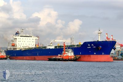
HONG YUN
Tanker A
Current Trip
TW KHH
| Time Travelled | 10 h, 24 mins |
|---|---|
| Remaining Time | --- |
| Distance Travelled | 4.84 nm |
| Remaining Distance | --- |
| AVG Speed | 4.5 Knots |
| MAX Speed | 8 Knots |
| AVG Wind | 7.5 knots |
| MAX Wind | 13.6 knots |
| MIN Temp | 26.4°C / 79.52°F |
| MAX Temp | 27.5°C / 81.5°F |
| Draught | 7.5 m |
| Position Received | 2 m ago |
Current Position
| Longitude | 120.23809° |
|---|---|
| Latitude | 22.58654° |
| Status | At anchor |
| Speed | 0.2 Knots |
| Course | --- |
| Area | South China Sea |
| Station | T-AIS |
| Position Received | 2 m ago |
Info
Information
The current position of HONG YUN is in South China Sea with coordinates 22.58654° / 120.23809° as reported on 2024-04-19 14:40 by AIS to our vessel tracker app. The vessel's current speed is 0.2 Knots
The vessel HONG YUN (IMO: 9737010, MMSI: 416018000) is a Tanker A It's sailing under the flag of [TW] Taiwan.
In this page you can find informations about the vessels current position, last detected port calls, and current voyage information. If the vessels is not in coverage by AIS you will find the latest position.
The current position of HONG YUN is detected by our AIS receivers and we are not responsible for the reliability of the data. The last position was recorded while the vessel was in Coverage by the Ais receivers of our vessel tracking app.
The current draught of HONG YUN as reported by AIS is 7.5 meters
Weather
| Temperature | 27.1°C / 80.78°F |
|---|---|
| Wind Speed | 9 knots |
| Direction | 169° S |
| Pressure | 1011.2 hPa |
| Humidity | 76.2 % |
| Cloud Coverage | 59 % |
Featured Company
Last Port Calls
| Port | Arrival | Departure | Time In Port |
|---|---|---|---|
| 2024-04-08 07:26 | 2024-04-19 04:19 | 10 d | |
| 2024-04-02 00:56 | 2024-04-04 06:28 | 2 d | |
| 2024-03-31 01:20 | 2024-04-01 04:00 | 1 d | |
| 2024-03-27 05:39 | 2024-03-30 00:35 | 2 d | |
| 2024-03-25 00:36 | 2024-03-27 00:48 | 2 d | |
| 2024-03-22 01:12 | 2024-03-24 03:05 | 2 d | |
| 2024-03-18 03:11 | 2024-03-20 06:53 | 2 d | |
| 2024-03-16 00:31 | 2024-03-17 06:20 | 1 d | |
| 2024-03-12 01:43 | 2024-03-14 23:06 | 2 d | |
| 2024-03-09 06:29 | 2024-03-11 07:11 | 2 d |
Last Trips
| Origin | Departure | Destination | Arrival | Distance | |
|---|---|---|---|---|---|
| 2024-04-04 14:28 | 2024-04-08 15:26 | 257.51 nm | |||
| 2024-04-01 12:00 | 2024-04-02 08:56 | 239.23 nm | |||
| 2024-03-30 08:35 | 2024-03-31 09:20 | 249.25 nm | |||
| 2024-03-27 08:48 | 2024-03-27 13:39 | 44.60 nm | |||
| 2024-03-24 11:05 | 2024-03-25 08:36 | 213.28 nm | |||
| 2024-03-20 14:53 | 2024-03-22 09:12 | 250.26 nm | |||
| 2024-03-17 14:20 | 2024-03-18 11:11 | 223.36 nm | |||
| 2024-03-15 07:06 | 2024-03-16 08:31 | 269.90 nm | |||
| 2024-03-11 15:11 | 2024-03-12 09:43 | 234.56 nm | |||
| 2024-03-07 14:28 | 2024-03-09 14:29 | 263.32 nm |
Events
| Time | Event | Details | Position / Dest | Info |
|---|---|---|---|---|
| 2024-04-19 05:40 | STOP Moving | 3.35 nm, North West of KAOHSIUNG |
22.58773 / 120.23992
TW KHH
|
Speed: Course: 286° |
| 2024-04-19 05:25 | Status Changed | At anchor Under way using engine |
22.58728 / 120.23721
TW KHH
|
Speed: 0.7 kn Course: 338° |
| 2024-04-19 05:02 | START Moving | 3.38 nm, North West of KAOHSIUNG |
22.58723 / 120.23907
TW KHH
|
Speed: 3.5 kn Course: 341° |
| 2024-04-19 04:59 | STOP Moving | 3.48 nm, North West of KAOHSIUNG |
22.58873 / 120.23783
TW KHH
|
Speed: 0.2 kn Course: 302° |
| 2024-04-19 04:19 | PORT DEPARTURE |
|
22.54797 / 120.27959
TW KHH
|
Speed: 8.9 kn Course: 265° |
| 2024-04-19 03:53 | START Moving |
22.54805 / 120.33371
[TW] KAOHSIUNG
|
Speed: 3.1 kn Course: 272° |
|
| 2024-04-19 03:15 | ETA Changed | 2024/04/19 04:00 2024/04/05 04:00 |
22.54968 / 120.33651
[TW] KAOHSIUNG
|
Speed: 0.1 kn Course: 53° |
| 2024-04-19 03:15 | Status Changed | Under way using engine Moored |
22.54968 / 120.33651
[TW] KAOHSIUNG
|
Speed: 0.1 kn Course: 53° |
| 2024-04-19 02:26 | IN Coverage |
22.54961 / 120.33660
South China Sea
[TW] KAOHSIUNG
|
Speed: 0.1 kn Course: 190.4° |
|
| 2024-04-18 22:41 | OUT of Coverage |
22.54965 / 120.33655
South China Sea
[TW] KAOHSIUNG
|
Speed: Course: 196.5° |