
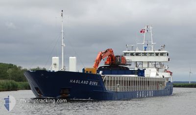
HAGLAND BORG
General Cargo
Current Trip
| Time Travelled | 1 day |
|---|---|
| Remaining Time | --- |
| Distance Travelled | 385.75 nm |
| Remaining Distance | --- |
| AVG Speed | 9.3 Knots |
| MAX Speed | 10.7 Knots |
| AVG Wind | 14.6 knots |
| MAX Wind | 29.5 knots |
| MIN Temp | 3.2°C / 37.76°F |
| MAX Temp | 8.5°C / 47.3°F |
| Draught | 5.4 m |
| Position Received | Now |
Current Position
| Longitude | 10.19116° |
|---|---|
| Latitude | 57.90105° |
| Status | Under way using engine |
| Speed | 9.5 Knots |
| Course | 91.7° |
| Area | Skaggerak |
| Station | T-AIS |
| Position Received | Now |
Info
Information
The current position of HAGLAND BORG is in Skaggerak with coordinates 57.90105° / 10.19116° as reported on 2024-04-24 02:12 by AIS to our vessel tracker app. The vessel's current speed is 9.5 Knots and is heading at the port of KARLSTAD. The estimated time of arrival as calculated by MyShipTracking vessel tracking app is 2024-04-24 10:00 LT
The vessel HAGLAND BORG (IMO: 9173563, MMSI: 258709000) is a General Cargo that was built in 1997 ( 27 years old ). It's sailing under the flag of [NO] Norway.
In this page you can find informations about the vessels current position, last detected port calls, and current voyage information. If the vessels is not in coverage by AIS you will find the latest position.
The current position of HAGLAND BORG is detected by our AIS receivers and we are not responsible for the reliability of the data. The last position was recorded while the vessel was in Coverage by the Ais receivers of our vessel tracking app.
The current draught of HAGLAND BORG as reported by AIS is 5.4 meters
Weather
| Temperature | 5.4°C / 41.72°F |
|---|---|
| Wind Speed | 9 knots |
| Direction | 84° E |
| Pressure | 1010.2 hPa |
| Humidity | 76.3 % |
| Cloud Coverage | 67 % |
Featured Company
Last Port Calls
| Port | Arrival | Departure | Time In Port |
|---|---|---|---|
| 2024-04-22 07:26 | 2024-04-22 08:29 | 1 h | |
| 2024-04-16 21:11 | 2024-04-17 09:53 | 12 h | |
| 2024-04-16 05:03 | 2024-04-16 18:20 | 13 h | |
| 2024-04-14 20:38 | 2024-04-15 15:03 | 18 h | |
| 2024-04-13 02:06 | 2024-04-13 20:12 | 18 h | |
| 2024-04-11 14:42 | 2024-04-11 22:34 | 7 h | |
| 2024-04-09 10:45 | 2024-04-09 11:56 | 1 h | |
| 2024-04-01 03:45 | 2024-04-01 18:40 | 14 h | |
| 2024-03-27 07:32 | 2024-03-27 17:29 | 9 h | |
| 2024-03-23 01:20 | 2024-03-23 02:48 | 1 h |
Last Trips
| Origin | Departure | Destination | Arrival | Distance | |
|---|---|---|---|---|---|
| 2024-04-17 11:53 | 2024-04-22 09:26 | 727.33 nm | |||
| 2024-04-16 20:20 | 2024-04-16 23:11 | 24.15 nm | |||
| 2024-04-15 17:03 | 2024-04-16 07:03 | 144.18 nm | |||
| 2024-04-13 22:12 | 2024-04-14 22:38 | 181.36 nm | |||
| 2024-04-12 00:34 | 2024-04-13 04:06 | 279.39 nm | |||
| 2024-04-09 13:56 | 2024-04-11 16:42 | 344.39 nm | |||
| 2024-04-01 20:40 | 2024-04-09 12:45 | 637.86 nm | |||
| 2024-03-27 17:29 | 2024-04-01 05:45 | 940.27 nm | |||
| 2024-03-23 03:48 | 2024-03-27 07:32 | 601.81 nm | |||
| 2024-03-21 21:25 | 2024-03-23 02:20 | 276.91 nm |
Events
| Time | Event | Details | Position / Dest | Info |
|---|---|---|---|---|
| 2024-04-23 23:10 | Detected in Sea | Danish part of the Skaggerak |
57.91542 / 9.28172
Skaggerak
SE KSD
|
Speed: 9 kn Course: 90.7° |
| 2024-04-23 14:48 | Change Sea Area | Norwegian part of the Skaggerak Norwegian part of the North Sea |
57.94526 / 7.09260
Skaggerak
SE KSD
|
Speed: 8.7 kn Course: 107.6° |
| 2024-04-22 15:44 | Change Sea Area | Norwegian part of the North Sea Norwegian part of the Norwegian Sea |
60.99430 / 4.75455
North Sea
SE KSD
|
Speed: 9.8 kn Course: 180.6° |
| 2024-04-22 10:48 | ETA Changed | 2024/04/24 10:00 2025/03/24 12:34 |
61.69123 / 4.96056
SE KSD
|
Speed: 9 kn Course: 179.1° |
| 2024-04-22 08:29 | PORT DEPARTURE |
|
61.92565 / 5.12008
SE KSD
|
Speed: 6.7 kn Course: 186° |
| 2024-04-22 08:21 | START Moving |
61.93941 / 5.12594
[NO] MALOY
|
Speed: 3.9 kn Course: 195° |
|
| 2024-04-22 07:33 | STOP Moving |
61.94169 / 5.12689
[NO] MALOY
|
Speed: 0.1 kn Course: 225° |
|
| 2024-04-22 07:26 | PORT ARRIVAL |
|
61.94241 / 5.12849
[NO] MALOY
|
Speed: 1.7 kn Course: 243° |
| 2024-04-21 17:30 | ETA Changed | 2025/03/24 12:34 2025/03/21 12:34 |
62.95712 / 7.43190
SE KSD
|
Speed: 6.8 kn Course: 122.9° |
| 2024-04-21 17:21 | Status Changed | Under way using engine Moored |
62.95891 / 7.40827
SE KSD
|
Speed: 2.1 kn Course: 52° |