
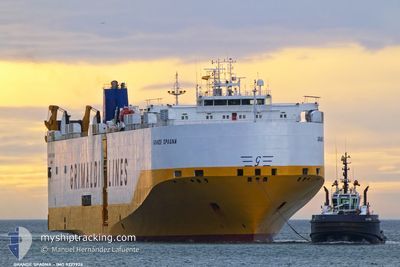
GRANDE SPAGNA
Vehicles Carrier
Current Trip
| Time Travelled | 1 day |
|---|---|
| Remaining Time | 1 day |
| Distance Travelled | 513.67 nm |
| Remaining Distance | 422.11 nm |
| AVG Speed | 16.4 Knots |
| MAX Speed | 18.1 Knots |
| AVG Wind | 11.6 knots |
| MAX Wind | 27.8 knots |
| MIN Temp | 15.8°C / 60.44°F |
| MAX Temp | 18.1°C / 64.58°F |
| Draught | 8.3 m |
| Position Received | Now |
Current Position
| Longitude | -7.70564° |
|---|---|
| Latitude | 36.36166° |
| Status | Under way using engine |
| Speed | 16.9 Knots |
| Course | 289.1° |
| Area | North Atlantic Ocean |
| Station | T-AIS |
| Position Received | Now |
Info
Information
The current position of GRANDE SPAGNA is in North Atlantic Ocean with coordinates 36.36166° / -7.70564° as reported on 2024-04-18 01:32 by AIS to our vessel tracker app. The vessel's current speed is 16.9 Knots and is heading at the port of VIGO. The estimated time of arrival as calculated by MyShipTracking vessel tracking app is 2024-04-19 02:17 LT
The vessel GRANDE SPAGNA (IMO: 9227924, MMSI: 247056200) is a Vehicles Carrier that was built in 2002 ( 22 years old ). It's sailing under the flag of [IT] Italy.
In this page you can find informations about the vessels current position, last detected port calls, and current voyage information. If the vessels is not in coverage by AIS you will find the latest position.
The current position of GRANDE SPAGNA is detected by our AIS receivers and we are not responsible for the reliability of the data. The last position was recorded while the vessel was in Coverage by the Ais receivers of our vessel tracking app.
The current draught of GRANDE SPAGNA as reported by AIS is 8.3 meters
Weather
| Temperature | 17°C / 62.6°F |
|---|---|
| Wind Speed | 7 knots |
| Direction | 267° W |
| Pressure | 1013 hPa |
| Humidity | 87 % |
| Cloud Coverage | 100 % |
Featured Company
Last Port Calls
| Port | Arrival | Departure | Time In Port |
|---|---|---|---|
| 2024-04-16 01:30 | 2024-04-16 18:39 | 17 h | |
| 2024-04-14 02:37 | 2024-04-14 10:39 | 8 h | |
| 2024-04-12 23:11 | 2024-04-13 13:10 | 13 h | |
| 2024-04-05 04:00 | 2024-04-12 13:31 | 7 d | |
| 2024-04-02 00:42 | 2024-04-02 18:01 | 17 h | |
| 2024-03-31 21:23 | 2024-04-01 10:40 | 13 h | |
| 2024-03-30 05:39 | 2024-03-30 22:04 | 16 h | |
| 2024-03-27 15:29 | 2024-03-28 08:58 | 17 h | |
| 2024-03-25 15:32 | 2024-03-26 18:41 | 1 d | |
| 2024-03-23 13:55 | 2024-03-24 05:15 | 15 h |
Last Trips
| Origin | Departure | Destination | Arrival | Distance | |
|---|---|---|---|---|---|
| 2024-04-14 12:39 | 2024-04-16 03:30 | 576.04 nm | |||
| 2024-04-13 15:10 | 2024-04-14 04:37 | 179.60 nm | |||
| 2024-04-12 15:31 | 2024-04-13 01:11 | 147.31 nm | |||
| 2024-04-02 21:01 | 2024-04-05 06:00 | 869.07 nm | |||
| 2024-04-01 13:40 | 2024-04-02 03:42 | 84.65 nm | |||
| 2024-03-31 00:04 | 2024-04-01 00:23 | 374.74 nm | |||
| 2024-03-28 09:58 | 2024-03-30 07:39 | 663.39 nm | |||
| 2024-03-26 19:41 | 2024-03-27 16:29 | 319.27 nm | |||
| 2024-03-24 06:15 | 2024-03-25 16:32 | 549.55 nm | |||
| 2024-03-19 03:51 | 2024-03-23 14:55 | 1628.53 nm |
Events
| Time | Event | Details | Position / Dest | Info |
|---|---|---|---|---|
| 2024-04-18 00:47 | Change Sea Area | Portuguese part of the North Atlantic Ocean Spanish part of the North Atlantic Ocean |
36.29228 / -7.45494
North Atlantic Ocean
ESVLC>ESVGO
|
Speed: 17 kn Course: 287° |
| 2024-04-17 23:48 | Status Changed | Under way using engine Default |
36.20697 / -7.12619
ESVLC>ESVGO
|
Speed: 17.1 kn Course: 289° |
| 2024-04-17 23:47 | Status Changed | Default Under way using engine |
36.20449 / -7.11737
ESVLC>ESVGO
|
Speed: 17.1 kn Course: 288.5° |
| 2024-04-17 23:41 | Status Changed | Under way using engine Default |
36.19556 / -7.08484
ESVLC>ESVGO
|
Speed: 17.1 kn Course: 288° |
| 2024-04-17 23:39 | Status Changed | Default Under way using engine |
36.19275 / -7.07430
ESVLC>ESVGO
|
Speed: 17.1 kn Course: 288.4° |
| 2024-04-17 23:24 | Status Changed | Under way using engine Default |
36.16985 / -6.99032
ESVLC>ESVGO
|
Speed: 16.9 kn Course: 288° |
| 2024-04-17 23:18 | Status Changed | Default Under way using engine |
36.16192 / -6.96131
ESVLC>ESVGO
|
Speed: 16.7 kn Course: 288.4° |
| 2024-04-17 23:01 | Status Changed | Under way using engine Default |
36.13563 / -6.86400
ESVLC>ESVGO
|
Speed: 16.6 kn Course: 288° |
| 2024-04-17 22:59 | Status Changed | Default Under way using engine |
36.13349 / -6.85577
ESVLC>ESVGO
|
Speed: 16.6 kn Course: 287.7° |
| 2024-04-17 20:20 | Change Sea Area | Spanish part of the North Atlantic Ocean Spanish part of the Strait of Gibraltar |
35.96407 / -5.98581
North Atlantic Ocean
ESVLC>ESVGO
|
Speed: 16.5 kn Course: 271.6° |