
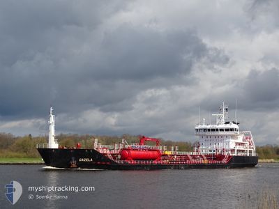
GAZELA
Oil/Chemical Tanker
Current Trip
| Trip Time | 3 days |
|---|---|
| Trip Distance | 707.78 nm |
| AVG Speed | 9 Knots |
| MAX Speed | 14.3 Knots |
| Draught | 4.6 m |
| AVG Wind | 19.2 knots |
| MAX Wind | 43.8 knots |
| MIN Temp | 5.7°C / 42.26°F |
| MAX Temp | 10.7°C / 51.26°F |
| Position Received | 6 m ago |
Current Position
| Longitude | --- |
|---|---|
| Latitude | --- |
| Status | Moored |
| Speed | |
| Course | 262° |
| Area | North Sea |
| Station | T-AIS |
| Position Received | 6 m ago |
Info
Information
The current position of GAZELA is in North Sea with coordinates 52.39846° / 4.83288° as reported on 2025-02-27 03:44 by AIS to our vessel tracker app. The vessel's current speed is 0 Knots and is currently inside the port of AMSTERDAM.
The vessel GAZELA (IMO: 9525572, MMSI: 212878000) is a Oil/Chemical Tanker that was built in 2010 ( 15 years old ). It's sailing under the flag of [CY] Cyprus.
In this page you can find informations about the vessels current position, last detected port calls, and current voyage information. If the vessels is not in coverage by AIS you will find the latest position.
The current position of GAZELA is detected by our AIS receivers and we are not responsible for the reliability of the data. The last position was recorded while the vessel was in Coverage by the Ais receivers of our vessel tracking app.
The current draught of GAZELA as reported by AIS is 4.6 meters
Weather
| Temperature | 5°C / 41°F |
|---|---|
| Wind Speed | 7 knots |
| Direction | 230° SW |
| Pressure | 1010.2 hPa |
| Humidity | 91.4 % |
| Cloud Coverage | 100 % |
Featured Company
Last Port Calls
| Port | Arrival | Departure | Time In Port |
|---|---|---|---|
| 2025-02-26 12:18 | |||
| 2025-02-22 06:38 | 2025-02-23 01:08 | 18 h | |
| 2025-02-17 04:24 | 2025-02-18 10:42 | 1 d | |
| 2025-02-11 18:03 | 2025-02-15 13:37 | 3 d | |
| 2025-02-04 11:13 | 2025-02-06 00:31 | 1 d | |
| 2025-02-01 09:46 | 2025-02-02 08:29 | 22 h | |
| 2025-01-29 00:31 | 2025-01-29 22:26 | 21 h | |
| 2025-01-25 16:49 | 2025-01-26 21:41 | 1 d | |
| 2025-01-14 18:05 | 2025-01-16 05:44 | 1 d | |
| 2025-01-10 15:16 | 2025-01-11 18:37 | 1 d |
Last Trips
| Origin | Departure | Destination | Arrival | Distance | |
|---|---|---|---|---|---|
| 2025-02-23 01:08 | 2025-02-26 13:18 | 707.78 nm | |||
| 2025-02-18 10:42 | 2025-02-22 06:38 | 986.31 nm | |||
| 2025-02-15 14:37 | 2025-02-17 04:24 | 338.73 nm | |||
| 2025-02-06 01:31 | 2025-02-11 19:03 | 1020.13 nm | |||
| 2025-02-02 09:29 | 2025-02-04 12:13 | 554.83 nm | |||
| 2025-01-29 23:26 | 2025-02-01 10:46 | 546.65 nm | |||
| 2025-01-26 22:41 | 2025-01-29 01:31 | 579.13 nm | |||
| 2025-01-16 06:44 | 2025-01-25 17:49 | 379.92 nm | |||
| 2025-01-11 19:37 | 2025-01-14 19:05 | 563.04 nm | |||
| 2025-01-09 03:33 | 2025-01-10 16:16 | 387.42 nm |
Events
| Time | Event | Details | Position / Dest | Info |
|---|---|---|---|---|
| 2025-02-26 17:44 | Destination Changed | DK AAR NL AMS |
52.39829 / 4.83288
[NL] AMSTERDAM
|
Speed: Course: 262° |
| 2025-02-26 17:44 | ETA Changed | 2025/03/01 12:00 2025/02/26 08:00 |
52.39829 / 4.83288
[NL] AMSTERDAM
|
Speed: Course: 262° |
| 2025-02-26 13:02 | Status Changed | Moored Under way using engine |
52.39829 / 4.83287
[NL] AMSTERDAM
|
Speed: 0.1 kn Course: 261° |
| 2025-02-26 12:47 | STOP Moving |
52.39845 / 4.83252
[NL] AMSTERDAM
|
Speed: 0.2 kn Course: 282° |
|
| 2025-02-26 12:18 | PORT ARRIVAL |
|
52.42120 / 4.80810
[NL] AMSTERDAM
|
Speed: 7.6 kn Course: 119.9° |
| 2025-02-26 11:15 | START Moving | 0.53 nm, East of IJMUIDEN |
52.46606 / 4.60201
NL AMS
|
Speed: 3.6 kn Course: 96° |
| 2025-02-26 10:59 | STOP Moving | 0.42 nm, East of IJMUIDEN |
52.46605 / 4.59898
NL AMS
|
Speed: 0.1 kn Course: 88° |
| 2025-02-26 08:26 | Status Changed | Under way using engine At anchor |
52.43682 / 3.97275
NL AMS
|
Speed: 0.7 kn Course: 354° |
| 2025-02-26 08:26 | START Moving | 21.41 nm, North West of KATWIJK |
52.43682 / 3.97275
NL AMS
|
Speed: 4.2 kn Course: 352° |
| 2025-02-26 08:23 | Status Changed | At anchor Default |
52.43531 / 3.97410
NL AMS
|
Speed: 0.2 kn Course: 12° |