
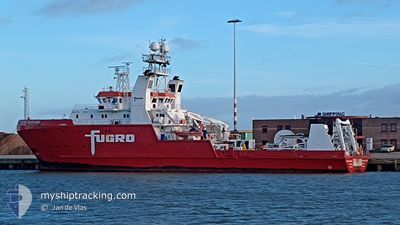
FUGRO SEARCHER
Research/Survey Vessel
Current Trip
SURVEY AREA
| Time Travelled | 15 days |
|---|---|
| Remaining Time | --- |
| Distance Travelled | 1501.27 nm |
| Remaining Distance | --- |
| AVG Speed | 5.2 Knots |
| MAX Speed | 15.5 Knots |
| AVG Wind | 17.4 knots |
| MAX Wind | 35 knots |
| MIN Temp | 2.5°C / 36.5°F |
| MAX Temp | 11.6°C / 52.88°F |
| Draught | 5.4 m |
| Position Received | 1 d ago |
Current Position
| Longitude | -2.00771° |
|---|---|
| Latitude | 56.95169° |
| Status | Under way using engine |
| Speed | 8.6 Knots |
| Course | 258.6° |
| Area | North Sea |
| Station | T-AIS |
| Position Received | 1 d ago |
Info
Information
The current position of FUGRO SEARCHER is in North Sea with coordinates 56.95169° / -2.00771° as reported on 2024-04-19 05:53 by AIS to our vessel tracker app. The vessel's current speed is 8.6 Knots
The vessel FUGRO SEARCHER (IMO: 9504011, MMSI: 311000904) is a Research/Survey Vessel that was built in 2010 ( 14 years old ). It's sailing under the flag of [BS] Bahamas.
In this page you can find informations about the vessels current position, last detected port calls, and current voyage information. If the vessels is not in coverage by AIS you will find the latest position.
The current position of FUGRO SEARCHER is detected by our AIS receivers and we are not responsible for the reliability of the data. The last position was recorded while the vessel was in Coverage by the Ais receivers of our vessel tracking app.
The current draught of FUGRO SEARCHER as reported by AIS is 5.4 meters
Weather
| Temperature | 4.7°C / 40.46°F |
|---|---|
| Wind Speed | 10 knots |
| Direction | 350° N |
| Pressure | 1028.4 hPa |
| Humidity | 82.7 % |
| Cloud Coverage | 97 % |
Featured Company
Last Port Calls
| Port | Arrival | Departure | Time In Port |
|---|---|---|---|
| 2024-04-01 11:16 | 2024-04-04 12:19 | 3 d | |
| 2024-03-27 11:17 | 2024-03-29 22:30 | 2 d | |
| 2024-03-21 17:23 | 2024-03-25 00:07 | 3 d | |
| 2024-03-09 07:31 | 2024-03-11 15:09 | 2 d | |
| 2024-02-29 14:21 | 2024-03-02 12:22 | 1 d | |
| 2024-02-25 12:52 | 2024-02-25 13:45 | 52 m | |
| 2024-02-09 11:53 | 2024-02-23 16:00 | 14 d | |
| 2024-02-02 08:07 | 2024-02-07 15:28 | 5 d |
Most Visited Ports (Last year)
| Port | Arrivals | |
|---|---|---|
| 5 | ||
| 3 | ||
| 3 | ||
| 2 | ||
| 2 | ||
| 2 |
Last Trips
| Origin | Departure | Destination | Arrival | Distance | |
|---|---|---|---|---|---|
| 2024-03-29 22:30 | 2024-04-01 12:16 | 286.97 nm | |||
| 2024-03-25 00:07 | 2024-03-27 11:17 | 336.82 nm | |||
| 2024-03-11 16:09 | 2024-03-21 17:23 | 818.97 nm | |||
| 2024-03-02 13:22 | 2024-03-09 08:31 | 510.04 nm | |||
| 2024-02-25 14:45 | 2024-02-29 15:21 | 437.55 nm | |||
| 2024-02-23 17:00 | 2024-02-25 13:52 | 327.79 nm | |||
| 2024-02-07 16:28 | 2024-02-09 12:53 | 150.50 nm | |||
| 2024-01-29 19:53 | 2024-02-02 09:07 | 249.51 nm |
Events
| Time | Event | Details | Position / Dest | Info |
|---|---|---|---|---|
| 2024-04-19 06:05 | Status Changed | Default Under way using engine |
56.93167 / -2.04333
SURVEY AREA
|
Speed: 8.6 kn Course: 258.6° |
| 2024-04-19 05:53 | OUT of Coverage |
56.95169 / -2.00771
North Sea
|
Speed: 8.6 kn Course: 258.6° |
|
| 2024-04-19 04:18 | Status Changed | Under way using engine Default |
56.94342 / -1.60687
SURVEY AREA
|
Speed: 8 kn Course: 272° |
| 2024-04-19 04:08 | IN Coverage |
56.94342 / -1.60687
North Sea
|
Speed: 8.1 kn Course: 272.2° |
|
| 2024-04-18 07:30 | START Moving |
57.03199 / 1.95139
SURVEY AREA
|
Speed: 3.9 kn Course: 185° |
|
| 2024-04-17 08:52 | START Moving |
57.04678 / 1.95052
SURVEY AREA
|
Speed: 4.4 kn Course: 173° |
|
| 2024-04-17 07:47 | STOP Moving |
57.03667 / 1.98667
SURVEY AREA
|
Speed: Course: -1° |
|
| 2024-04-16 22:14 | START Moving |
57.06368 / 1.90209
SURVEY AREA
|
Speed: 4.4 kn Course: 135° |
|
| 2024-04-16 21:14 | STOP Moving |
57.06964 / 1.94632
SURVEY AREA
|
Speed: 0.3 kn Course: 265° |
|
| 2024-04-16 15:05 | START Moving |
57.11833 / 2.07167
SURVEY AREA
|
Speed: 4 kn Course: -1° |