
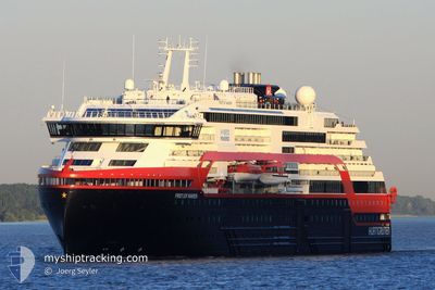
FRIDTJOF NANSEN
Passenger
Current Trip
DAMOY
| Time Travelled | 6 days |
|---|---|
| Remaining Time | --- |
| Distance Travelled | 1040.43 nm |
| Remaining Distance | --- |
| AVG Speed | 8.8 Knots |
| MAX Speed | 15 Knots |
| AVG Wind | 8.8 knots |
| MAX Wind | 26.8 knots |
| MIN Temp | -5.5°C / 22.1°F |
| MAX Temp | 11.2°C / 52.16°F |
| Draught | 5.5 m |
| Position Received | 13 h, 59 m ago |
Current Position
| Longitude | --- |
|---|---|
| Latitude | --- |
| Status | Under way using engine |
| Speed | |
| Course | 183° |
| Area | Southern Ocean |
| Station | T-AIS |
| Position Received | 13 h, 59 m ago |
Info
Information
The current position of FRIDTJOF NANSEN is in Southern Ocean with coordinates -64.81046° / -63.49846° as reported on 2025-12-06 21:28 by AIS to our vessel tracker app. The vessel's current speed is 0 Knots
The vessel FRIDTJOF NANSEN (IMO: 9813084, MMSI: 257088070) is a Passenger It's sailing under the flag of [NO] Norway.
In this page you can find informations about the vessels current position, last detected port calls, and current voyage information. If the vessels is not in coverage by AIS you will find the latest position.
The current position of FRIDTJOF NANSEN is detected by our AIS receivers and we are not responsible for the reliability of the data. The last position was recorded while the vessel was in Coverage by the Ais receivers of our vessel tracking app.
The current draught of FRIDTJOF NANSEN as reported by AIS is 5.5 meters
Weather
| Temperature | -0.8°C / 30.56°F |
|---|---|
| Wind Speed | 4 knots |
| Direction | 62° ENE |
| Pressure | 1008.5 hPa |
| Humidity | 84.2 % |
| Cloud Coverage | 1 % |
Featured Company
Last Port Calls
| Port | Arrival | Departure | Time In Port |
|---|---|---|---|
| 2025-11-30 05:59 | 2025-11-30 18:28 | 12 h | |
| 2025-11-19 12:45 | 2025-11-20 19:03 | 1 d | |
| 2025-11-09 19:43 | 2025-11-10 21:07 | 1 d | |
| 2025-10-30 19:49 | 2025-10-31 19:23 | 23 h | |
| 2025-10-30 08:45 | 2025-10-30 17:33 | 8 h | |
| 2025-10-17 12:03 | 2025-10-17 21:25 | 9 h | |
| 2025-10-01 19:03 | 2025-10-02 08:10 | 13 h |
Last Trips
| Origin | Departure | Destination | Arrival | Distance | |
|---|---|---|---|---|---|
| 2025-11-20 19:03 | 2025-11-30 05:59 | 1587.00 nm | |||
| 2025-11-10 21:07 | 2025-11-19 12:45 | 1663.62 nm | |||
| 2025-10-31 19:23 | 2025-11-09 19:43 | 1600.44 nm | |||
| 2025-10-30 17:33 | 2025-10-30 19:49 | 27.19 nm | |||
| 2025-10-17 21:25 | 2025-10-30 08:45 | 2479.51 nm | |||
| 2025-10-02 08:10 | 2025-10-17 12:03 | 5117.49 nm | |||
| 2025-09-28 09:23 | 2025-10-01 19:03 | 1135.60 nm |
Events
| Time | Event | Details | Position / Dest | Info |
|---|---|---|---|---|
| 2025-12-07 10:35 | STOP Moving |
-64.82732 / -63.50652
DAMOY
|
Speed: 0.2 kn Course: 29° |
|
| 2025-12-07 10:00 | START Moving |
-64.80565 / -63.50225
DAMOY
|
Speed: 5.5 kn Course: 320° |
|
| 2025-12-06 21:32 | Status Changed | Default Under way using engine |
-64.81046 / -63.49847
DAMOY
|
Speed: Course: 183° |
| 2025-12-06 21:28 | OUT of Coverage |
-64.81046 / -63.49846
Southern Ocean
DAMOY
|
Speed: Course: 2.9° |
|
| 2025-12-06 21:25 | STOP Moving |
-64.81046 / -63.49827
DAMOY
|
Speed: 0.2 kn Course: 173° |
|
| 2025-12-06 21:17 | Status Changed | Under way using engine Default |
-64.80845 / -63.49769
DAMOY
|
Speed: 3 kn Course: -1° |
| 2025-12-06 20:57 | IN Coverage |
-64.80845 / -63.49769
Southern Ocean
DAMOY
|
Speed: 1.6 kn Course: 211° |
|
| 2025-12-06 20:16 | Status Changed | Default Under way using engine |
-64.73004 / -63.25806
DAMOY
|
Speed: 9 kn Course: 238.6° |
| 2025-12-06 20:11 | OUT of Coverage |
-64.72244 / -63.24156
Southern Ocean
DAMOY
|
Speed: 9 kn Course: 238.6° |
|
| 2025-12-06 18:06 | START Moving |
-64.65985 / -62.63842
DAMOY
|
Speed: 3.1 kn Course: 82° |