
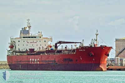
FPMC 30
Oil/Chemical Tanker
Current Trip
| Time Travelled | 1 day |
|---|---|
| Remaining Time | --- |
| Distance Travelled | 455.20 nm |
| Remaining Distance | --- |
| AVG Speed | 12.8 Knots |
| MAX Speed | 14.6 Knots |
| AVG Wind | 16.4 knots |
| MAX Wind | 26 knots |
| MIN Temp | 6.9°C / 44.42°F |
| MAX Temp | 10.9°C / 51.62°F |
| Draught | 7.9 m |
| Position Received | 1 d ago |
Current Position
| Longitude | --- |
|---|---|
| Latitude | --- |
| Status | Under way using engine |
| Speed | 12.3 Knots |
| Course | 218.2° |
| Area | Japan Sea |
| Station | T-AIS |
| Position Received | 1 d ago |
Info
Information
The current position of FPMC 30 is in Japan Sea with coordinates 34.76552° / 129.19839° as reported on 2025-02-25 12:36 by AIS to our vessel tracker app. The vessel's current speed is 12.3 Knots and is heading at the port of NANTONG. The estimated time of arrival as calculated by MyShipTracking vessel tracking app is 2025-02-26 22:00 LT
The vessel FPMC 30 (IMO: 9581679, MMSI: 636015251) is a Oil/Chemical Tanker that was built in 2012 ( 13 years old ). It's sailing under the flag of [LR] Liberia.
In this page you can find informations about the vessels current position, last detected port calls, and current voyage information. If the vessels is not in coverage by AIS you will find the latest position.
The current position of FPMC 30 is detected by our AIS receivers and we are not responsible for the reliability of the data. The last position was recorded while the vessel was in Coverage by the Ais receivers of our vessel tracking app.
The current draught of FPMC 30 as reported by AIS is 7.9 meters
Weather
| Temperature | 11.6°C / 52.88°F |
|---|---|
| Wind Speed | 11 knots |
| Direction | 169° S |
| Pressure | 1017.3 hPa |
| Humidity | 97.3 % |
| Cloud Coverage | 100 % |
Featured Company
Last Port Calls
| Port | Arrival | Departure | Time In Port |
|---|---|---|---|
| 2025-02-23 05:33 | 2025-02-25 09:03 | 2 d | |
| 2025-02-09 06:33 | 2025-02-13 15:35 | 4 d | |
| 2025-02-05 15:53 | 2025-02-08 03:09 | 2 d | |
| 2025-01-23 23:00 | 2025-01-25 21:54 | 1 d | |
| 2024-12-17 15:02 | 2024-12-18 09:58 | 18 h | |
| 2024-12-16 22:12 | 2024-12-17 13:44 | 15 h | |
| 2024-12-13 04:28 | 2024-12-13 23:53 | 19 h | |
| 2024-12-08 14:56 | 2024-12-09 18:38 | 1 d | |
| 2024-12-01 21:20 | 2024-12-02 20:13 | 22 h |
Last Trips
| Origin | Departure | Destination | Arrival | Distance | |
|---|---|---|---|---|---|
| 2025-02-13 23:35 | 2025-02-23 14:33 | 2514.08 nm | |||
| 2025-02-08 11:09 | 2025-02-09 14:33 | 85.76 nm | |||
| 2025-01-26 06:54 | 2025-02-05 23:53 | 2557.38 nm | |||
| 2024-12-18 18:58 | 2025-01-24 08:00 | 2675.48 nm | |||
| 2024-12-17 22:44 | 2024-12-18 00:02 | 9.99 nm | |||
| 2024-12-14 08:53 | 2024-12-17 07:12 | 578.70 nm | |||
| 2024-12-10 02:38 | 2024-12-13 13:28 | 913.58 nm | |||
| 2024-12-03 04:13 | 2024-12-08 22:56 | 1606.77 nm | |||
| 2024-12-01 05:45 | 2024-12-02 05:20 | 246.01 nm |
Events
| Time | Event | Details | Position / Dest | Info |
|---|---|---|---|---|
| 2025-02-27 05:41 | START Moving |
31.15726 / 123.10798
CN NTG
|
Speed: 5.3 kn Course: 228° |
|
| 2025-02-26 21:02 | STOP Moving |
31.15814 / 123.10513
CN NTG
|
Speed: 0.3 kn Course: 50° |
|
| 2025-02-25 12:42 | Status Changed | Default Under way using engine |
34.75005 / 129.18420
CN NTG
|
Speed: 12.3 kn Course: 218.2° |
| 2025-02-25 12:36 | OUT of Coverage |
34.76552 / 129.19839
Japan Sea
CN NTG
|
Speed: 12.3 kn Course: 218.2° |
|
| 2025-02-25 12:31 | Change Sea Area | Japanese part of the Japan Sea South Korean part of the Japan Sea |
34.77931 / 129.21008
Japan Sea
CN NTG
|
Speed: 12.7 kn Course: 211.6° |
| 2025-02-25 12:30 | Status Changed | Under way using engine Default |
34.78337 / 129.21307
CN NTG
|
Speed: 12.7 kn Course: 209° |
| 2025-02-25 12:22 | IN Coverage |
34.77931 / 129.21008
Japan Sea
CN NTG
|
Speed: 12.7 kn Course: 211.6° |
|
| 2025-02-25 11:26 | Status Changed | Default Under way using engine |
34.97666 / 129.33972
CN NTG
|
Speed: 12.6 kn Course: 187.9° |
| 2025-02-25 11:20 | Status Changed | Under way using engine Default |
34.99781 / 129.34341
CN NTG
|
Speed: 12.6 kn Course: 191° |
| 2025-02-25 11:20 | OUT of Coverage |
34.99781 / 129.34341
Japan Sea
CN NTG
|
Speed: 12.6 kn Course: 187.9° |