
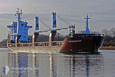
FORTUNAGRACHT
General Cargo
Current Trip
| Time Travelled | 5 days |
|---|---|
| Remaining Time | --- |
| Distance Travelled | 478.88 nm |
| Remaining Distance | 2.14 nm |
| AVG Speed | 12.2 Knots |
| MAX Speed | 19 Knots |
| AVG Wind | 8.1 knots |
| MAX Wind | 19 knots |
| MIN Temp | -11.2°C / 11.84°F |
| MAX Temp | 12.3°C / 54.14°F |
| Draught | 6 m |
| Position Received | 4 d ago |
Current Position
| Longitude | -68.48867° |
|---|---|
| Latitude | 48.66696° |
| Status | Under way using engine |
| Speed | 10.3 Knots |
| Course | 60.1° |
| Area | Gulf of St-Lawrence |
| Station | T-AIS |
| Position Received | 4 d ago |
Info
Information
The current position of FORTUNAGRACHT is in Gulf of St-Lawrence with coordinates 48.66696° / -68.48867° as reported on 2024-04-19 22:03 by AIS to our vessel tracker app. The vessel's current speed is 10.3 Knots and is heading at the port of SEPT-ILES. The estimated time of arrival as calculated by MyShipTracking vessel tracking app is 2024-04-20 14:00 LT
The vessel FORTUNAGRACHT (IMO: 9507609, MMSI: 246621000) is a General Cargo that was built in 2012 ( 12 years old ). It's sailing under the flag of [NL] Netherlands.
In this page you can find informations about the vessels current position, last detected port calls, and current voyage information. If the vessels is not in coverage by AIS you will find the latest position.
The current position of FORTUNAGRACHT is detected by our AIS receivers and we are not responsible for the reliability of the data. The last position was recorded while the vessel was in Coverage by the Ais receivers of our vessel tracking app.
The current draught of FORTUNAGRACHT as reported by AIS is 6 meters
Weather
| Temperature | 0.3°C / 32.54°F |
|---|---|
| Wind Speed | 5 knots |
| Direction | 31° NNE |
| Pressure | 1006.5 hPa |
| Humidity | 98.9 % |
| Cloud Coverage | 100 % |
Featured Company
Last Port Calls
| Port | Arrival | Departure | Time In Port |
|---|---|---|---|
| 2024-04-14 12:46 | 2024-04-19 00:21 | 4 d | |
| 2024-03-23 17:28 | 2024-03-28 20:35 | 5 d | |
| 2024-03-20 05:12 | |||
| 2024-02-22 19:05 | 2024-02-25 15:16 | 2 d | |
| 2024-02-15 14:25 | 2024-02-17 16:41 | 2 d | |
| 2024-02-08 12:47 | 2024-02-09 12:48 | 1 d |
Last Trips
| Origin | Departure | Destination | Arrival | Distance | |
|---|---|---|---|---|---|
| 2024-03-28 21:35 | 2024-04-14 08:46 | 4457.41 nm | |||
| 2024-03-20 06:12 | 2024-03-23 18:28 | 1083.20 nm | |||
| 2024-02-17 10:41 | 2024-02-22 14:05 | 1574.12 nm | |||
| 2024-02-09 08:48 | 2024-02-15 08:25 | 1848.86 nm | |||
| 2023-12-25 23:07 | 2024-02-08 08:47 | 11663.53 nm |
Events
| Time | Event | Details | Position / Dest | Info |
|---|---|---|---|---|
| 2024-04-20 12:24 | STOP Moving | 2.77 nm, West of SEPT-ILES |
50.19667 / -66.46333
CASEI
|
Speed: Course: -1° |
| 2024-04-19 22:10 | Status Changed | Default Under way using engine |
48.67799 / -68.45940
CASEI
|
Speed: 10.3 kn Course: 60.1° |
| 2024-04-19 22:03 | OUT of Coverage |
48.66696 / -68.48867
Gulf of St-Lawrence
CASEI
|
Speed: 10.3 kn Course: 60.1° |
|
| 2024-04-19 22:00 | Status Changed | Under way using engine Default |
48.66389 / -68.49679
CASEI
|
Speed: 9.2 kn Course: 60° |
| 2024-04-19 21:54 | Status Changed | Default Under way using engine |
48.65567 / -68.51768
CASEI
|
Speed: 8.5 kn Course: 58.6° |
| 2024-04-19 21:46 | Status Changed | Under way using engine Default |
48.64541 / -68.54365
CASEI
|
Speed: 8 kn Course: 59° |
| 2024-04-19 21:14 | Status Changed | Default Under way using engine |
48.62080 / -68.60532
CASEI
|
Speed: 1.7 kn Course: 61° |
| 2024-04-19 21:09 | Status Changed | Under way using engine Default |
48.61890 / -68.60703
CASEI
|
Speed: 2.4 kn Course: 61° |
| 2024-04-19 21:06 | Status Changed | Default Under way using engine |
48.61806 / -68.60861
CASEI
|
Speed: 6.6 kn Course: 57.2° |
| 2024-04-19 20:51 | Status Changed | Under way using engine Default |
48.59614 / -68.66267
CASEI
|
Speed: 14 kn Course: 57° |