
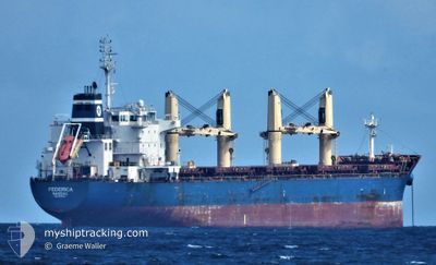
FEDERICA
Bulk Carrier
Current Trip
| Time Travelled | 15 days |
|---|---|
| Remaining Time | --- |
| Distance Travelled | 3088.69 nm |
| Remaining Distance | --- |
| AVG Speed | 11.4 Knots |
| MAX Speed | 13.9 Knots |
| AVG Wind | 15.7 knots |
| MAX Wind | 36.9 knots |
| MIN Temp | 2.1°C / 35.78°F |
| MAX Temp | 14.3°C / 57.74°F |
| Draught | 10.6 m |
| Position Received | 6 d ago |
Current Position
| Longitude | -4.43337° |
|---|---|
| Latitude | 58.73721° |
| Status | Under way using engine |
| Speed | 11.7 Knots |
| Course | 272.4° |
| Area | North Atlantic Ocean |
| Station | T-AIS |
| Position Received | 6 d ago |
Info
Information
The current position of FEDERICA is in North Atlantic Ocean with coordinates 58.73721° / -4.43337° as reported on 2024-04-18 12:16 by AIS to our vessel tracker app. The vessel's current speed is 11.7 Knots and is heading at the port of NEW ORLEANS. The estimated time of arrival as calculated by MyShipTracking vessel tracking app is 2024-05-04 11:00 LT
The vessel FEDERICA (IMO: 9612313, MMSI: 311000886) is a Bulk Carrier that was built in 2012 ( 12 years old ). It's sailing under the flag of [BS] Bahamas.
In this page you can find informations about the vessels current position, last detected port calls, and current voyage information. If the vessels is not in coverage by AIS you will find the latest position.
The current position of FEDERICA is detected by our AIS receivers and we are not responsible for the reliability of the data. The last position was recorded while the vessel was in Coverage by the Ais receivers of our vessel tracking app.
The current draught of FEDERICA as reported by AIS is 10.6 meters
Weather
| Temperature | 14.3°C / 57.74°F |
|---|---|
| Wind Speed | 15 knots |
| Direction | 151° SSE |
| Pressure | 1030.7 hPa |
| Humidity | 96.2 % |
| Cloud Coverage | 100 % |
Featured Company
Last Port Calls
| Port | Arrival | Departure | Time In Port |
|---|---|---|---|
| 2024-04-06 16:08 | 2024-04-09 21:24 | 3 d | |
| 2024-03-25 07:04 | 2024-03-27 18:27 | 2 d | |
| 2024-03-21 20:41 | 2024-03-24 18:47 | 2 d | |
| 2024-02-19 09:38 | 2024-02-24 18:37 | 5 d | |
| 2024-02-11 08:46 |
Most Visited Ports (Last year)
| Port | Arrivals | |
|---|---|---|
| 2 | ||
| 2 | ||
| 2 | ||
| 1 | ||
| 1 | ||
| 1 |
Last Trips
| Origin | Departure | Destination | Arrival | Distance | |
|---|---|---|---|---|---|
| 2024-03-27 18:27 | 2024-04-06 19:08 | 1684.86 nm | |||
| 2024-03-24 18:47 | 2024-03-25 07:04 | 110.89 nm | |||
| 2024-02-24 20:37 | 2024-03-21 20:41 | 3418.15 nm | |||
| 2024-02-11 11:46 | 2024-02-19 11:38 | 754.64 nm |
Events
| Time | Event | Details | Position / Dest | Info |
|---|---|---|---|---|
| 2024-04-22 04:29 | START Moving |
53.21500 / -28.63167
NEW ORLEANS
|
Speed: 5 kn Course: 232° |
|
| 2024-04-22 03:53 | STOP Moving |
53.22167 / -28.61500
NEW ORLEANS
|
Speed: Course: -1° |
|
| 2024-04-22 03:41 | START Moving |
53.23000 / -28.60500
NEW ORLEANS
|
Speed: 4 kn Course: -1° |
|
| 2024-04-21 15:47 | STOP Moving |
53.20833 / -28.34667
NEW ORLEANS
|
Speed: Course: -1° |
|
| 2024-04-18 12:25 | Status Changed | Default Under way using engine |
58.73868 / -4.48667
NEW ORLEANS
|
Speed: 11.7 kn Course: 272.4° |
| 2024-04-18 12:16 | OUT of Coverage |
58.73721 / -4.43337
North Atlantic Ocean
NEW ORLEANS
|
Speed: 11.7 kn Course: 272.4° |
|
| 2024-04-18 09:41 | Change Sea Area | United Kingdom part of the North Atlantic Ocean United Kingdom part of the North Sea |
58.72176 / -3.43092
North Atlantic Ocean
NEW ORLEANS
|
Speed: 12.8 kn Course: 271° |
| 2024-04-18 07:32 | Change Sea Area | United Kingdom part of the North Sea Norwegian part of the North Sea |
58.69824 / -2.58162
North Sea
NEW ORLEANS
|
Speed: 11.7 kn Course: 272.6° |
| 2024-04-18 07:30 | Status Changed | Under way using engine Default |
58.69791 / -2.56815
NEW ORLEANS
|
Speed: 11.7 kn Course: 274° |
| 2024-04-18 07:30 | IN Coverage |
58.69824 / -2.58162
North Sea
NEW ORLEANS
|
Speed: 11.7 kn Course: 272.6° |