
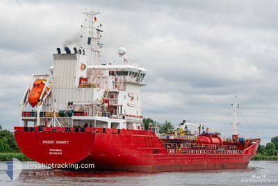
DUZGIT DIGNITY
Oil/Chemical Tanker
Current Trip
| Trip Time | 5 days |
|---|---|
| Trip Distance | 1245.42 nm |
| AVG Speed | 10 Knots |
| MAX Speed | 12.6 Knots |
| Draught | 5.7 m |
| AVG Wind | 10.5 knots |
| MAX Wind | 21.3 knots |
| MIN Temp | 11.7°C / 53.06°F |
| MAX Temp | 23.2°C / 73.76°F |
| Position Received | 22 h, 4 m ago |
Current Position
| Longitude | 29.47338° |
|---|---|
| Latitude | 40.71602° |
| Status | Moored |
| Speed | |
| Course | 127° |
| Area | Sea of Marmara |
| Station | T-AIS |
| Position Received | 22 h, 4 m ago |
Info
Information
The current position of DUZGIT DIGNITY is in Sea of Marmara with coordinates 40.71602° / 29.47338° as reported on 2024-04-24 19:03 by AIS to our vessel tracker app. The vessel's current speed is 0 Knots and is currently inside the port of YALOVA.
The vessel DUZGIT DIGNITY (IMO: 9581019, MMSI: 271043776) is a Oil/Chemical Tanker that was built in 2014 ( 10 years old ). It's sailing under the flag of [TR] Turkey.
In this page you can find informations about the vessels current position, last detected port calls, and current voyage information. If the vessels is not in coverage by AIS you will find the latest position.
The current position of DUZGIT DIGNITY is detected by our AIS receivers and we are not responsible for the reliability of the data. The last position was recorded while the vessel was in Coverage by the Ais receivers of our vessel tracking app.
The current draught of DUZGIT DIGNITY as reported by AIS is 5.7 meters
Weather
| Temperature | 18.4°C / 65.12°F |
|---|---|
| Wind Speed | 3 knots |
| Direction | 79° E |
| Pressure | 1005.4 hPa |
| Humidity | 67.5 % |
| Cloud Coverage | 100 % |
Featured Company
Last Port Calls
| Port | Arrival | Departure | Time In Port |
|---|---|---|---|
| 2024-04-19 22:47 | |||
| 2024-04-13 10:43 | 2024-04-14 10:44 | 1 d | |
| 2024-04-08 06:54 | 2024-04-09 07:06 | 1 d | |
| 2024-04-04 08:40 | 2024-04-05 15:06 | 1 d | |
| 2024-03-29 14:15 | 2024-03-30 18:13 | 1 d | |
| 2024-03-23 19:30 | 2024-03-25 05:37 | 1 d | |
| 2024-03-19 19:58 | 2024-03-20 00:06 | 4 h | |
| 2024-03-18 09:23 | 2024-03-19 07:46 | 22 h | |
| 2024-03-13 07:45 | 2024-03-14 17:50 | 1 d | |
| 2024-03-01 22:04 | 2024-03-02 22:52 | 1 d |
Most Visited Ports (Last year)
| Port | Arrivals | |
|---|---|---|
| 5 | ||
| 4 | ||
| 3 | ||
| 3 | ||
| 3 | ||
| 2 |
Last Trips
| Origin | Departure | Destination | Arrival | Distance | |
|---|---|---|---|---|---|
| 2024-04-14 12:44 | 2024-04-20 01:47 | 1245.42 nm | |||
| 2024-04-09 09:06 | 2024-04-13 12:43 | 1124.91 nm | |||
| 2024-04-05 17:06 | 2024-04-08 08:54 | 264.77 nm | |||
| 2024-03-30 19:13 | 2024-04-04 10:40 | 316.48 nm | |||
| 2024-03-25 06:37 | 2024-03-29 15:15 | 663.60 nm | |||
| 2024-03-20 01:06 | 2024-03-23 20:30 | 265.46 nm | |||
| 2024-03-19 08:46 | 2024-03-19 20:58 | 131.29 nm | |||
| 2024-03-14 18:50 | 2024-03-18 10:23 | 1009.03 nm | |||
| 2024-03-02 23:52 | 2024-03-13 08:45 | 1105.55 nm | |||
| 2024-02-28 22:59 | 2024-03-01 23:04 | 523.05 nm |
Events
| Time | Event | Details | Position / Dest | Info |
|---|---|---|---|---|
| 2024-04-24 19:03 | OUT of Coverage |
40.71602 / 29.47338
Sea of Marmara
[TR] YALOVA
|
Speed: Course: 85.2° |
|
| 2024-04-24 18:42 | IN Coverage |
40.71607 / 29.47339
Sea of Marmara
[TR] YALOVA
|
Speed: Course: 85.2° |
|
| 2024-04-20 06:28 | Status Changed | Default Moored |
40.71601 / 29.47336
[TR] YALOVA
|
Speed: Course: 127° |
| 2024-04-20 06:28 | OUT of Coverage |
40.71602 / 29.47336
Sea of Marmara
[TR] YALOVA
|
Speed: Course: 85.2° |
|
| 2024-04-19 23:16 | Status Changed | Moored Under way using engine |
40.71608 / 29.47337
[TR] YALOVA
|
Speed: Course: 127° |
| 2024-04-19 23:03 | STOP Moving |
40.71600 / 29.47237
[TR] YALOVA
|
Speed: 0.3 kn Course: 103° |
|
| 2024-04-19 22:47 | PORT ARRIVAL |
|
40.71641 / 29.46276
[TR] YALOVA
|
Speed: 2.6 kn Course: 80° |
| 2024-04-19 22:04 | START Moving | 2.8 nm, South West of GEBZE |
40.71207 / 29.35096
TR YAL
|
Speed: 3.2 kn Course: 96° |
| 2024-04-19 21:48 | Status Changed | Under way using engine At anchor |
40.70532 / 29.35611
TR YAL
|
Speed: 1.4 kn Course: 9° |
| 2024-04-19 19:09 | Status Changed | At anchor Under way using engine |
40.70543 / 29.36037
TR YAL
|
Speed: 0.4 kn Course: 83° |