
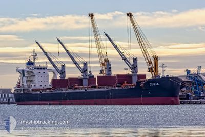
CURIA
Cargo
Current Trip
| Time Travelled | 8 days |
|---|---|
| Remaining Time | --- |
| Distance Travelled | 2165.16 nm |
| Remaining Distance | --- |
| AVG Speed | 10.8 Knots |
| MAX Speed | 14.7 Knots |
| AVG Wind | 8.7 knots |
| MAX Wind | 25 knots |
| MIN Temp | 12.8°C / 55.04°F |
| MAX Temp | 21°C / 69.8°F |
| Draught | 10.3 m |
| Position Received | 13 h, 11 m ago |
Current Position
| Longitude | -13.37929° |
|---|---|
| Latitude | 37.11939° |
| Status | Under way using engine |
| Speed | 11.9 Knots |
| Course | 312.2° |
| Area | North Atlantic Ocean |
| Station | T-AIS |
| Position Received | 13 h, 11 m ago |
Info
Information
The current position of CURIA is in North Atlantic Ocean with coordinates 37.11939° / -13.37929° as reported on 2024-04-24 23:16 by AIS to our vessel tracker app. The vessel's current speed is 11.9 Knots and is heading at the port of NORFOLK. The estimated time of arrival as calculated by MyShipTracking vessel tracking app is 2024-05-04 10:00 LT
The vessel CURIA (IMO: 9710048, MMSI: 269056000) is a Cargo It's sailing under the flag of [CH] Switzerland.
In this page you can find informations about the vessels current position, last detected port calls, and current voyage information. If the vessels is not in coverage by AIS you will find the latest position.
The current position of CURIA is detected by our AIS receivers and we are not responsible for the reliability of the data. The last position was recorded while the vessel was in Coverage by the Ais receivers of our vessel tracking app.
The current draught of CURIA as reported by AIS is 10.3 meters
Weather
| Temperature | 15.7°C / 60.26°F |
|---|---|
| Wind Speed | 14 knots |
| Direction | 351° N |
| Pressure | 1022 hPa |
| Humidity | 76.4 % |
| Cloud Coverage | 62 % |
Featured Company
Last Port Calls
| Port | Arrival | Departure | Time In Port |
|---|---|---|---|
| 2024-04-09 06:18 | 2024-04-16 14:15 | 7 d | |
| 2024-03-24 06:49 | 2024-04-06 02:03 | 12 d | |
| 2024-03-21 00:26 | 2024-03-21 02:14 | 1 h | |
| 2024-02-23 08:21 | 2024-02-24 12:57 | 1 d |
Most Visited Ports (Last year)
| Port | Arrivals | |
|---|---|---|
| 2 | ||
| 2 | ||
| 2 | ||
| 1 | ||
| 1 | ||
| 1 |
Last Trips
| Origin | Departure | Destination | Arrival | Distance | |
|---|---|---|---|---|---|
| 2024-04-06 04:03 | 2024-04-09 09:18 | 582.69 nm | |||
| 2024-03-21 04:14 | 2024-03-24 08:49 | 22.35 nm | |||
| 2024-02-24 06:57 | 2024-03-21 02:26 | 6731.98 nm | |||
| 2024-01-05 17:14 | 2024-02-23 02:21 | 10402.82 nm |
Events
| Time | Event | Details | Position / Dest | Info |
|---|---|---|---|---|
| 2024-04-24 23:22 | Status Changed | Default Under way using engine |
37.13167 / -13.39500
US ORF
|
Speed: 11.9 kn Course: 312.2° |
| 2024-04-24 23:16 | OUT of Coverage |
37.11939 / -13.37929
North Atlantic Ocean
US ORF
|
Speed: 11.9 kn Course: 312.2° |
|
| 2024-04-24 23:09 | Status Changed | Under way using engine Default |
37.10287 / -13.35673
US ORF
|
Speed: 11.8 kn Course: 314° |
| 2024-04-24 22:58 | Status Changed | Default Under way using engine |
37.07667 / -13.32167
US ORF
|
Speed: 11.9 kn Course: 313.7° |
| 2024-04-24 22:52 | Status Changed | Under way using engine Default |
37.06466 / -13.30508
US ORF
|
Speed: 11 kn Course: 310° |
| 2024-04-24 22:40 | Status Changed | Default Under way using engine |
37.03667 / -13.26667
US ORF
|
Speed: 12 kn Course: 313.3° |
| 2024-04-24 22:05 | Detected in Sea | High seas of the North Atlantic Ocean |
36.95806 / -13.16246
North Atlantic Ocean
US ORF
|
Speed: 12 kn Course: 313.6° |
| 2024-04-24 19:40 | Status Changed | Under way using engine Default |
36.62420 / -12.72409
US ORF
|
Speed: 12.4 kn Course: 311° |
| 2024-04-24 19:38 | Status Changed | Default Under way using engine |
36.61952 / -12.71790
US ORF
|
Speed: 12.4 kn Course: 312.1° |
| 2024-04-24 18:54 | Status Changed | Under way using engine Default |
36.51719 / -12.58127
US ORF
|
Speed: 12.2 kn Course: 313° |