
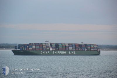
CSCL STAR
Container Ship
Current Trip
| Time Travelled | 17 h, 21 mins |
|---|---|
| Remaining Time | --- |
| Distance Travelled | 28.05 nm |
| Remaining Distance | --- |
| AVG Speed | 10.2 Knots |
| MAX Speed | 13 Knots |
| AVG Wind | 8.9 knots |
| MAX Wind | 13.7 knots |
| MIN Temp | 22°C / 71.6°F |
| MAX Temp | 26.1°C / 78.98°F |
| Draught | 13.1 m |
| Position Received | 2 m ago |
Current Position
| Longitude | --- |
|---|---|
| Latitude | --- |
| Status | At anchor |
| Speed | 0.1 Knots |
| Course | 53° |
| Area | Persian Gulf |
| Station | T-AIS |
| Position Received | 2 m ago |
Info
Information
The current position of CSCL STAR is in Persian Gulf with coordinates 25.19581° / 54.76750° as reported on 2025-12-07 19:38 by AIS to our vessel tracker app. The vessel's current speed is 0.1 Knots
The vessel CSCL STAR (IMO: 9466867, MMSI: 477963800) is a Container Ship that was built in 2011 ( 14 years old ). It's sailing under the flag of [HK] Hong Kong.
In this page you can find informations about the vessels current position, last detected port calls, and current voyage information. If the vessels is not in coverage by AIS you will find the latest position.
The current position of CSCL STAR is detected by our AIS receivers and we are not responsible for the reliability of the data. The last position was recorded while the vessel was in Coverage by the Ais receivers of our vessel tracking app.
The current draught of CSCL STAR as reported by AIS is 13.1 meters
Weather
| Temperature | 25.5°C / 77.9°F |
|---|---|
| Wind Speed | 12 knots |
| Direction | 82° E |
| Pressure | 1019.2 hPa |
| Humidity | 51 % |
| Cloud Coverage | --- |
Featured Company
Last Port Calls
| Port | Arrival | Departure | Time In Port |
|---|---|---|---|
| 2025-12-06 11:33 | 2025-12-07 06:20 | 18 h | |
| 2025-11-05 11:37 | 2025-11-06 13:29 | 1 d | |
| 2025-10-30 02:09 | 2025-10-30 14:55 | 12 h | |
| 2025-10-28 03:20 | 2025-10-29 04:39 | 1 d | |
| 2025-10-21 03:27 | 2025-10-22 16:23 | 1 d | |
| 2025-10-18 07:41 | |||
| 2025-10-07 04:05 | 2025-10-08 18:33 | 1 d | |
| 2025-10-03 18:06 |
Most Visited Ports (Last year)
| Port | Arrivals | |
|---|---|---|
| 3 | ||
| 3 | ||
| 2 | ||
| 2 | ||
| 2 | ||
| 2 |
Last Trips
| Origin | Departure | Destination | Arrival | Distance | |
|---|---|---|---|---|---|
| 2025-11-06 13:29 | 2025-12-06 11:33 | 10094.90 nm | |||
| 2025-10-30 14:55 | 2025-11-05 11:37 | 1340.43 nm | |||
| 2025-10-29 04:39 | 2025-10-30 02:09 | 268.31 nm | |||
| 2025-10-22 16:23 | 2025-10-28 03:20 | 507.67 nm | |||
| 2025-10-18 07:41 | 2025-10-21 03:27 | 413.10 nm | |||
| 2025-10-03 18:06 | 2025-10-07 04:05 | 517.03 nm |
Events
| Time | Event | Details | Position / Dest | Info |
|---|---|---|---|---|
| 2025-12-07 17:44 | Status Changed | At anchor Default |
25.19661 / 54.76716
AE JEA
|
Speed: Course: 99° |
| 2025-12-07 17:41 | Status Changed | Default At anchor |
25.19663 / 54.76719
AE JEA
|
Speed: Course: 100° |
| 2025-12-07 16:14 | Status Changed | At anchor Default |
25.19698 / 54.76720
AE JEA
|
Speed: Course: 112° |
| 2025-12-07 16:11 | Status Changed | Default At anchor |
25.19698 / 54.76721
AE JEA
|
Speed: 0.1 kn Course: 111° |
| 2025-12-07 15:59 | Status Changed | At anchor Default |
25.19699 / 54.76721
AE JEA
|
Speed: Course: 110° |
| 2025-12-07 15:50 | Status Changed | Default At anchor |
25.19700 / 54.76722
AE JEA
|
Speed: Course: 108° |
| 2025-12-07 14:50 | Status Changed | At anchor Default |
25.19685 / 54.76718
AE JEA
|
Speed: 0.1 kn Course: 100° |
| 2025-12-07 14:47 | Status Changed | Default At anchor |
25.19687 / 54.76718
AE JEA
|
Speed: Course: 99° |
| 2025-12-07 14:35 | Status Changed | At anchor Default |
25.19684 / 54.76722
AE JEA
|
Speed: Course: 97° |
| 2025-12-07 14:32 | Status Changed | Default At anchor |
25.19682 / 54.76721
AE JEA
|
Speed: Course: 96° |