
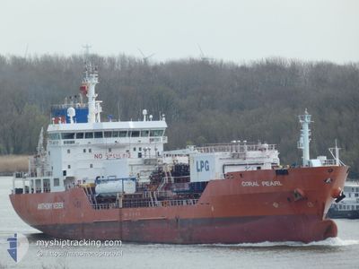
CORAL PEARL
Lpg Tanker
Current Trip
| Time Travelled | 1 day |
|---|---|
| Remaining Time | 10 h, 26 mins |
| Distance Travelled | 418.24 nm |
| Remaining Distance | 148.68 nm |
| AVG Speed | 13.4 Knots |
| MAX Speed | 15.2 Knots |
| AVG Wind | 9.4 knots |
| MAX Wind | 19 knots |
| MIN Temp | 5.8°C / 42.44°F |
| MAX Temp | 9.5°C / 49.1°F |
| Draught | 7.6 m |
| Position Received | 7 m ago |
Current Position
| Longitude | 4.21560° |
|---|---|
| Latitude | 53.06156° |
| Status | Under way using engine |
| Speed | 13.7 Knots |
| Course | 229.6° |
| Area | North Sea |
| Station | T-AIS |
| Position Received | 7 m ago |
Info
Information
The current position of CORAL PEARL is in North Sea with coordinates 53.06156° / 4.21560° as reported on 2024-04-18 19:28 by AIS to our vessel tracker app. The vessel's current speed is 13.7 Knots and is heading at the port of ANTWERP. The estimated time of arrival as calculated by MyShipTracking vessel tracking app is 2024-04-19 06:02 LT
The vessel CORAL PEARL (IMO: 9425253, MMSI: 244870430) is a Lpg Tanker that was built in 2009 ( 15 years old ). It's sailing under the flag of [NL] Netherlands.
In this page you can find informations about the vessels current position, last detected port calls, and current voyage information. If the vessels is not in coverage by AIS you will find the latest position.
The current position of CORAL PEARL is detected by our AIS receivers and we are not responsible for the reliability of the data. The last position was recorded while the vessel was in Coverage by the Ais receivers of our vessel tracking app.
The current draught of CORAL PEARL as reported by AIS is 7.6 meters
Weather
| Temperature | 8.8°C / 47.84°F |
|---|---|
| Wind Speed | 18 knots |
| Direction | 238° WSW |
| Pressure | 1016.9 hPa |
| Humidity | 73.9 % |
| Cloud Coverage | 100 % |
Featured Company
Last Port Calls
| Port | Arrival | Departure | Time In Port |
|---|---|---|---|
| 2024-04-16 14:17 | 2024-04-17 11:48 | 21 h | |
| 2024-04-15 06:22 | 2024-04-16 05:14 | 22 h | |
| 2024-04-12 07:40 | 2024-04-13 09:03 | 1 d | |
| 2024-04-07 21:07 | 2024-04-10 10:45 | 2 d | |
| 2024-04-01 19:48 | 2024-04-04 03:14 | 2 d | |
| 2024-03-26 01:47 | 2024-03-27 05:10 | 1 d | |
| 2024-03-23 11:39 | 2024-03-24 07:40 | 20 h | |
| 2024-03-19 01:08 | 2024-03-20 17:36 | 1 d | |
| 2024-03-13 05:15 | 2024-03-14 07:01 | 1 d | |
| 2024-03-10 04:32 | 2024-03-11 13:47 | 1 d |
Most Visited Ports (Last year)
| Port | Arrivals | |
|---|---|---|
| 25 | ||
| 22 | ||
| 12 | ||
| 5 | ||
| 5 | ||
| 2 |
Last Trips
| Origin | Departure | Destination | Arrival | Distance | |
|---|---|---|---|---|---|
| 2024-04-16 07:14 | 2024-04-16 16:17 | 115.63 nm | |||
| 2024-04-13 10:03 | 2024-04-15 08:22 | 531.45 nm | |||
| 2024-04-10 12:45 | 2024-04-12 08:40 | 454.95 nm | |||
| 2024-04-04 04:14 | 2024-04-07 23:07 | 466.13 nm | |||
| 2024-03-27 06:10 | 2024-04-01 20:48 | 464.63 nm | |||
| 2024-03-24 08:40 | 2024-03-26 02:47 | 585.72 nm | |||
| 2024-03-20 18:36 | 2024-03-23 12:39 | 605.41 nm | |||
| 2024-03-14 07:01 | 2024-03-19 02:08 | 459.78 nm | |||
| 2024-03-11 14:47 | 2024-03-13 05:15 | 449.50 nm | |||
| 2024-03-08 15:11 | 2024-03-10 05:32 | 450.76 nm |
Events
| Time | Event | Details | Position / Dest | Info |
|---|---|---|---|---|
| 2024-04-18 18:50 | Change Sea Area | Dutch part of the North Sea German part of the North Sea |
53.15659 / 4.39262
North Sea
BE ZWL
|
Speed: 14.2 kn Course: 201.1° |
| 2024-04-18 18:50 | IN Coverage |
53.15659 / 4.39262
North Sea
BE ZWL
|
Speed: 14.2 kn Course: 201.1° |
|
| 2024-04-18 11:58 | Status Changed | Default Under way using engine |
54.58167 / 5.42068
BE ZWL
|
Speed: 13.8 kn Course: 208.6° |
| 2024-04-18 11:56 | OUT of Coverage |
54.58925 / 5.42762
North Sea
BE ZWL
|
Speed: 13.8 kn Course: 208.6° |
|
| 2024-04-18 11:53 | ETA Changed | 2024/04/19 02:00 2024/04/19 01:00 |
54.59904 / 5.43701
BE ZWL
|
Speed: 13.9 kn Course: 210.7° |
| 2024-04-18 11:19 | Status Changed | Under way using engine Default |
54.71559 / 5.55149
BE ZWL
|
Speed: 14 kn Course: 210° |
| 2024-04-18 11:19 | IN Coverage |
54.71559 / 5.55149
North Sea
BE ZWL
|
Speed: 14.1 kn Course: 209.9° |
|
| 2024-04-18 09:12 | OUT of Coverage |
55.14822 / 5.94932
North Sea
BE ZWL
|
Speed: 14.1 kn Course: 206.5° |
|
| 2024-04-18 09:12 | Detected in Sea | German part of the North Sea |
55.14822 / 5.94932
North Sea
BE ZWL
|
Speed: 14.1 kn Course: 206.5° |
| 2024-04-18 09:12 | IN Coverage |
55.14822 / 5.94932
North Sea
BE ZWL
|
Speed: 14.1 kn Course: 206.5° |