
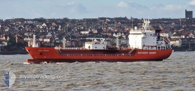
CORAL MEDUSA
Lpg Tanker
Current Trip
| Time Travelled | 1 day |
|---|---|
| Remaining Time | --- |
| Distance Travelled | 268.07 nm |
| Remaining Distance | 26.11 nm |
| AVG Speed | 10.7 Knots |
| MAX Speed | 13.3 Knots |
| AVG Wind | 19 knots |
| MAX Wind | 28.3 knots |
| MIN Temp | 7.5°C / 45.5°F |
| MAX Temp | 12°C / 53.6°F |
| Draught | 5.8 m |
| Position Received | 2 m ago |
Current Position
| Longitude | -0.07872° |
|---|---|
| Latitude | 49.46867° |
| Status | At anchor |
| Speed | 0.1 Knots |
| Course | 19° |
| Area | English Channel |
| Station | T-AIS |
| Position Received | 2 m ago |
Info
Information
The current position of CORAL MEDUSA is in English Channel with coordinates 49.46867° / -0.07872° as reported on 2024-04-20 08:45 by AIS to our vessel tracker app. The vessel's current speed is 0.1 Knots and is heading at the port of PORT JEROME. The estimated time of arrival as calculated by MyShipTracking vessel tracking app is 2024-04-19 16:30 LT
The vessel CORAL MEDUSA (IMO: 9346926, MMSI: 244870427) is a Lpg Tanker that was built in 2007 ( 17 years old ). It's sailing under the flag of [NL] Netherlands.
In this page you can find informations about the vessels current position, last detected port calls, and current voyage information. If the vessels is not in coverage by AIS you will find the latest position.
The current position of CORAL MEDUSA is detected by our AIS receivers and we are not responsible for the reliability of the data. The last position was recorded while the vessel was in Coverage by the Ais receivers of our vessel tracking app.
The current draught of CORAL MEDUSA as reported by AIS is 5.8 meters
Weather
| Temperature | 7.6°C / 45.68°F |
|---|---|
| Wind Speed | 17 knots |
| Direction | 17° NNE |
| Pressure | 1027.5 hPa |
| Humidity | 61 % |
| Cloud Coverage | 6 % |
Featured Company
Last Port Calls
| Port | Arrival | Departure | Time In Port |
|---|---|---|---|
| 2024-04-16 22:05 | 2024-04-18 14:33 | 1 d | |
| 2024-04-11 21:32 | 2024-04-14 11:13 | 2 d | |
| 2024-03-29 20:09 | 2024-03-30 15:31 | 19 h | |
| 2024-03-26 12:56 | 2024-03-28 14:08 | 2 d | |
| 2024-03-21 16:56 | 2024-03-25 02:31 | 3 d | |
| 2024-03-18 02:23 | 2024-03-20 16:20 | 2 d | |
| 2024-03-10 14:53 | 2024-03-12 01:47 | 1 d | |
| 2024-03-07 07:35 | 2024-03-08 03:49 | 20 h | |
| 2024-03-04 03:48 | 2024-03-04 18:27 | 14 h | |
| 2024-02-29 03:32 | 2024-03-01 20:09 | 1 d |
Most Visited Ports (Last year)
| Port | Arrivals | |
|---|---|---|
| 20 | ||
| 18 | ||
| 9 | ||
| 3 | ||
| 3 | ||
| 3 |
Last Trips
| Origin | Departure | Destination | Arrival | Distance | |
|---|---|---|---|---|---|
| 2024-04-14 13:13 | 2024-04-17 00:05 | 342.57 nm | |||
| 2024-03-30 16:31 | 2024-04-11 23:32 | 388.72 nm | |||
| 2024-03-28 15:08 | 2024-03-29 21:09 | 275.79 nm | |||
| 2024-03-25 03:31 | 2024-03-26 13:56 | 289.86 nm | |||
| 2024-03-20 17:20 | 2024-03-21 17:56 | 266.84 nm | |||
| 2024-03-12 02:47 | 2024-03-18 03:23 | 354.00 nm | |||
| 2024-03-08 04:49 | 2024-03-10 15:53 | 531.60 nm | |||
| 2024-03-04 19:27 | 2024-03-07 08:35 | 432.47 nm | |||
| 2024-03-01 20:09 | 2024-03-04 04:48 | 489.74 nm | |||
| 2024-02-27 16:14 | 2024-02-29 03:32 | 422.26 nm |
Events
| Time | Event | Details | Position / Dest | Info |
|---|---|---|---|---|
| 2024-04-20 07:27 | Status Changed | At anchor Default |
49.46866 / -.07833
FR PJE
|
Speed: Course: -1° |
| 2024-04-20 07:25 | Status Changed | Default At anchor |
49.46833 / -.07667
FR PJE
|
Speed: 0.1 kn Course: 345° |
| 2024-04-19 16:24 | Status Changed | At anchor Under way using engine |
49.46934 / -.07558
FR PJE
|
Speed: 0.3 kn Course: 303° |
| 2024-04-19 16:24 | Status Changed | Under way using engine At anchor |
49.46937 / -.07587
FR PJE
|
Speed: 0.6 kn Course: 272° |
| 2024-04-19 16:18 | Status Changed | At anchor Under way using engine |
49.46968 / -.07545
FR PJE
|
Speed: 0.8 kn Course: 312° |
| 2024-04-19 16:14 | STOP Moving | 7.75 nm, West of LE HAVRE |
49.46937 / -.07587
FR PJE
|
Speed: 0.3 kn Course: 303° |
| 2024-04-19 11:55 | Change Sea Area | French part of the English Channel United Kingdom part of the English Channel |
50.21964 / -.14074
English Channel
FR PJE
|
Speed: 12.2 kn Course: 172° |
| 2024-04-19 09:47 | ETA Changed | 2024/04/19 16:30 2024/04/19 16:00 |
50.49894 / .12478
FR PJE
|
Speed: 11.7 kn Course: 254.5° |
| 2024-04-19 05:42 | ETA Changed | 2024/04/19 16:00 2024/04/19 14:00 |
50.82016 / 1.14642
FR PJE
|
Speed: 9.7 kn Course: 235° |
| 2024-04-19 05:03 | Change Sea Area | United Kingdom part of the English Channel French part of the English Channel |
50.88019 / 1.27400
English Channel
FR PJE
|
Speed: 9.7 kn Course: 226.8° |