
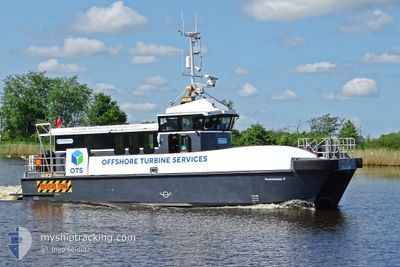
COMMANDER P
Cargo
Current Trip
VORDINGBORG
| Time Travelled | 1 day |
|---|---|
| Remaining Time | --- |
| Distance Travelled | 57.46 nm |
| Remaining Distance | --- |
| AVG Speed | 9.3 Knots |
| MAX Speed | 18.5 Knots |
| AVG Wind | 10.4 knots |
| MAX Wind | 16.1 knots |
| MIN Temp | 1.4°C / 34.52°F |
| MAX Temp | 6°C / 42.8°F |
| Draught | 1.2 m |
| Position Received | Now |
Current Position
| Longitude | 11.85347° |
|---|---|
| Latitude | 54.95862° |
| Status | Under way using engine |
| Speed | |
| Course | 207° |
| Area | Kattegat |
| Station | T-AIS |
| Position Received | Now |
Info
Information
The current position of COMMANDER P is in Kattegat with coordinates 54.95862° / 11.85347° as reported on 2024-04-20 12:25 by AIS to our vessel tracker app. The vessel's current speed is 0 Knots
The vessel COMMANDER P (MMSI: 235097748) is a Cargo It's sailing under the flag of [GB] United Kingdom.
In this page you can find informations about the vessels current position, last detected port calls, and current voyage information. If the vessels is not in coverage by AIS you will find the latest position.
The current position of COMMANDER P is detected by our AIS receivers and we are not responsible for the reliability of the data. The last position was recorded while the vessel was in Coverage by the Ais receivers of our vessel tracking app.
The current draught of COMMANDER P as reported by AIS is 1.2 meters
Weather
| Temperature | 5.7°C / 42.26°F |
|---|---|
| Wind Speed | 9 knots |
| Direction | 277° W |
| Pressure | 1017.5 hPa |
| Humidity | 55.9 % |
| Cloud Coverage | 42 % |
Featured Company
Last Port Calls
| Port | Arrival | Departure | Time In Port |
|---|---|---|---|
| 2024-04-18 14:44 | 2024-04-19 03:30 | 12 h | |
| 2024-04-14 06:02 | 2024-04-14 06:47 | 44 m | |
| 2024-04-07 06:36 | 2024-04-07 07:38 | 1 h | |
| 2024-03-31 06:28 | 2024-03-31 07:04 | 36 m | |
| 2024-03-25 12:10 | 2024-03-25 12:49 | 39 m | |
| 2024-03-22 15:33 | 2024-03-22 15:42 | 9 m | |
| 2024-03-21 15:29 | 2024-03-22 04:28 | 12 h | |
| 2024-03-20 15:31 | 2024-03-21 04:21 | 12 h | |
| 2024-03-19 15:45 | 2024-03-20 04:33 | 12 h | |
| 2024-03-18 15:29 | 2024-03-19 10:51 | 19 h |
Most Visited Ports (Last year)
| Port | Arrivals | |
|---|---|---|
| 34 | ||
| 32 | ||
| 14 | ||
| 9 | ||
| 9 | ||
| 6 |
Last Trips
| Origin | Departure | Destination | Arrival | Distance | |
|---|---|---|---|---|---|
| 2024-04-14 08:47 | 2024-04-18 16:44 | 130.89 nm | |||
| 2024-04-07 09:38 | 2024-04-14 08:02 | 165.70 nm | |||
| 2024-03-31 09:04 | 2024-04-07 08:36 | 205.50 nm | |||
| 2024-03-25 13:49 | 2024-03-31 08:28 | 167.54 nm | |||
| 2024-03-22 16:42 | 2024-03-25 13:10 | 51.52 nm | |||
| 2024-03-22 05:28 | 2024-03-22 16:33 | 37.11 nm | |||
| 2024-03-21 05:21 | 2024-03-21 16:29 | 39.95 nm | |||
| 2024-03-20 05:33 | 2024-03-20 16:31 | 44.52 nm | |||
| 2024-03-19 11:51 | 2024-03-19 16:45 | 25.43 nm | |||
| 2024-03-18 05:35 | 2024-03-18 16:29 | 39.02 nm |
Events
| Time | Event | Details | Position / Dest | Info |
|---|---|---|---|---|
| 2024-04-20 12:04 | STOP Moving | 2.61 nm, South West of VORDINGBORG VESTHAVN |
54.95861 / 11.85349
VORDINGBORG
|
Speed: 0.1 kn Course: 206° |
| 2024-04-20 11:58 | START Moving | 1.86 nm, South West of VORDINGBORG VESTHAVN |
54.96974 / 11.86364
VORDINGBORG
|
Speed: 10.5 kn Course: 206.5° |
| 2024-04-20 11:56 | STOP Moving | 1.72 nm, South West of VORDINGBORG VESTHAVN |
54.97153 / 11.86617
VORDINGBORG
|
Speed: 0.2 kn Course: 109° |
| 2024-04-20 11:50 | START Moving | 2.49 nm, South West of VORDINGBORG VESTHAVN |
54.96028 / 11.85542
VORDINGBORG
|
Speed: 7.5 kn Course: 25.2° |
| 2024-04-20 10:42 | STOP Moving | 2.61 nm, South West of VORDINGBORG VESTHAVN |
54.95863 / 11.85346
VORDINGBORG
|
Speed: 0.3 kn Course: 211° |
| 2024-04-20 10:27 | START Moving | 0.87 nm, South West of VORDINGBORG VESTHAVN |
54.98357 / 11.87926
VORDINGBORG
|
Speed: 11.2 kn Course: 128.7° |
| 2024-04-20 10:26 | STOP Moving | 0.84 nm, South West of VORDINGBORG VESTHAVN |
54.98489 / 11.87711
VORDINGBORG
|
Speed: 0.3 kn Course: 311° |
| 2024-04-20 10:17 | START Moving | 1.62 nm, South West of VORDINGBORG VESTHAVN |
54.97269 / 11.86847
VORDINGBORG
|
Speed: 10.9 kn Course: 69.8° |
| 2024-04-20 10:15 | STOP Moving | 1.72 nm, South West of VORDINGBORG VESTHAVN |
54.97147 / 11.86615
VORDINGBORG
|
Speed: 0.1 kn Course: 75° |
| 2024-04-20 10:07 | START Moving | 2.44 nm, South West of VORDINGBORG VESTHAVN |
54.96113 / 11.85608
VORDINGBORG
|
Speed: 8.2 kn Course: 17.7° |