
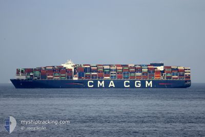
CMA CGM JEAN MERMOZ
Cargo D
Current Trip
| Time Travelled | 6 days |
|---|---|
| Remaining Time | --- |
| Distance Travelled | 3080.12 nm |
| Remaining Distance | --- |
| AVG Speed | 17.4 Knots |
| MAX Speed | 21 Knots |
| AVG Wind | 11 knots |
| MAX Wind | 19.9 knots |
| MIN Temp | 26.8°C / 80.24°F |
| MAX Temp | 30.2°C / 86.36°F |
| Draught | 15.9 m |
| Position Received | 5 d ago |
Current Position
| Longitude | 94.64547° |
|---|---|
| Latitude | 6.07956° |
| Status | Under way using engine |
| Speed | 19 Knots |
| Course | 236° |
| Area | Andaman or Burma Sea |
| Station | T-AIS |
| Position Received | 5 d ago |
Info
Information
The current position of CMA CGM JEAN MERMOZ is in Andaman or Burma Sea with coordinates 6.07956° / 94.64547° as reported on 2024-04-20 14:49 by AIS to our vessel tracker app. The vessel's current speed is 19 Knots and is heading at the port of ALGECIRAS. The estimated time of arrival as calculated by MyShipTracking vessel tracking app is 2024-05-12 15:00 LT
The vessel CMA CGM JEAN MERMOZ (IMO: 9776420, MMSI: 248758000) is a Cargo D It's sailing under the flag of [MT] Malta.
In this page you can find informations about the vessels current position, last detected port calls, and current voyage information. If the vessels is not in coverage by AIS you will find the latest position.
The current position of CMA CGM JEAN MERMOZ is detected by our AIS receivers and we are not responsible for the reliability of the data. The last position was recorded while the vessel was in Coverage by the Ais receivers of our vessel tracking app.
The current draught of CMA CGM JEAN MERMOZ as reported by AIS is 15.9 meters
Weather
| Temperature | 27.1°C / 80.78°F |
|---|---|
| Wind Speed | 18 knots |
| Direction | 97° E |
| Pressure | 1012.5 hPa |
| Humidity | 73.8 % |
| Cloud Coverage | 66 % |
Featured Company
Last Port Calls
| Port | Arrival | Departure | Time In Port |
|---|---|---|---|
| 2024-04-18 00:28 | 2024-04-19 01:32 | 1 d | |
| 2024-04-13 10:01 | 2024-04-14 07:17 | 21 h | |
| 2024-04-07 10:55 | 2024-04-08 23:29 | 1 d | |
| 2024-04-04 05:13 | 2024-04-06 04:17 | 1 d | |
| 2024-03-24 23:33 | 2024-03-28 18:55 | 3 d | |
| 2024-02-24 18:37 | 2024-02-25 22:58 | 1 d | |
| 2024-02-17 20:29 | 2024-02-19 21:17 | 2 d | |
| 2024-02-14 10:37 | 2024-02-16 08:28 | 1 d | |
| 2024-02-11 13:41 | 2024-02-13 12:02 | 1 d | |
| 2024-02-07 17:55 | 2024-02-10 09:42 | 2 d |
Most Visited Ports (Last year)
| Port | Arrivals | |
|---|---|---|
| 5 | ||
| 5 | ||
| 5 | ||
| 4 | ||
| 4 | ||
| 4 |
Last Trips
| Origin | Departure | Destination | Arrival | Distance | |
|---|---|---|---|---|---|
| 2024-04-14 15:17 | 2024-04-18 08:28 | 1476.71 nm | |||
| 2024-04-09 07:29 | 2024-04-13 18:01 | 923.60 nm | |||
| 2024-04-06 12:17 | 2024-04-07 18:55 | 466.76 nm | |||
| 2024-03-29 02:55 | 2024-04-04 13:13 | 2760.88 nm | |||
| 2024-02-25 23:58 | 2024-03-25 07:33 | 10630.49 nm | |||
| 2024-02-19 22:17 | 2024-02-24 19:37 | 1483.32 nm | |||
| 2024-02-16 09:28 | 2024-02-17 21:29 | 286.45 nm | |||
| 2024-02-13 12:02 | 2024-02-14 11:37 | 268.18 nm | |||
| 2024-02-10 10:42 | 2024-02-11 13:41 | 272.48 nm | |||
| 2024-01-29 10:30 | 2024-02-07 18:55 | 1457.40 nm |
Events
| Time | Event | Details | Position / Dest | Info |
|---|---|---|---|---|
| 2024-04-20 14:53 | Status Changed | Default Under way using engine |
6.06667 / 94.62666
SGSIN>ESALG
|
Speed: 19 kn Course: 236° |
| 2024-04-20 14:49 | Status Changed | Under way using engine Default |
6.07956 / 94.64547
SGSIN>ESALG
|
Speed: 19 kn Course: 236° |
| 2024-04-20 14:49 | IN Coverage |
6.07956 / 94.64547
Andaman or Burma Sea
SGSIN>ESALG
|
Speed: 19 kn Course: 236° |
|
| 2024-04-20 14:49 | OUT of Coverage |
6.07956 / 94.64547
Andaman or Burma Sea
SGSIN>ESALG
|
Speed: 19 kn Course: 236° |
|
| 2024-04-20 12:35 | Status Changed | Default Under way using engine |
6.30167 / 95.24500
SGSIN>ESALG
|
Speed: 18.8 kn Course: 289° |
| 2024-04-20 12:24 | Change Sea Area | Indonesian part of the Andaman or Burma Sea Malaysian part of the Malacca Strait |
6.28395 / 95.29630
Andaman or Burma Sea
SGSIN>ESALG
|
Speed: 18.8 kn Course: 289° |
| 2024-04-20 12:24 | Status Changed | Under way using engine Default |
6.28395 / 95.29630
SGSIN>ESALG
|
Speed: 19 kn Course: 288° |
| 2024-04-20 12:24 | OUT of Coverage |
6.28395 / 95.29630
Andaman or Burma Sea
SGSIN>ESALG
|
Speed: 18.8 kn Course: 289° |
|
| 2024-04-20 12:06 | IN Coverage |
6.28395 / 95.29630
Andaman or Burma Sea
SGSIN>ESALG
|
Speed: 18.8 kn Course: 289° |
|
| 2024-04-19 04:28 | OUT of Coverage |
1.22215 / 103.44542
Malacca Strait
SGSIN>ESALG
|
Speed: 17.5 kn Course: 285.4° |