
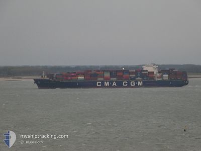
CMA CGM CENDRILLON
Container Ship
Current Trip
| Time Travelled | 17 h, 45 mins |
|---|---|
| Remaining Time | 3 days |
| Distance Travelled | 256.54 nm |
| Remaining Distance | 1371.74 nm |
| AVG Speed | 16.1 Knots |
| MAX Speed | 18 Knots |
| AVG Wind | 10.2 knots |
| MAX Wind | 23 knots |
| MIN Temp | 26.6°C / 79.88°F |
| MAX Temp | 27.9°C / 82.22°F |
| Draught | 14.3 m |
| Position Received | 6 h, 33 m ago |
Current Position
| Longitude | --- |
|---|---|
| Latitude | --- |
| Status | Under way using engine |
| Speed | 16.2 Knots |
| Course | 294.5° |
| Area | Laccadive Sea |
| Station | T-AIS |
| Position Received | 6 h, 33 m ago |
Info
Information
The current position of CMA CGM CENDRILLON is in Laccadive Sea with coordinates 7.77159° / 76.86442° as reported on 2025-12-06 19:00 by AIS to our vessel tracker app. The vessel's current speed is 16.2 Knots and is heading at the port of SALALAH. The estimated time of arrival as calculated by MyShipTracking vessel tracking app is 2025-12-11 00:14 LT
The vessel CMA CGM CENDRILLON (IMO: 9449819, MMSI: 215127000) is a Container Ship that was built in 2009 ( 16 years old ). It's sailing under the flag of [MT] Malta.
In this page you can find informations about the vessels current position, last detected port calls, and current voyage information. If the vessels is not in coverage by AIS you will find the latest position.
The current position of CMA CGM CENDRILLON is detected by our AIS receivers and we are not responsible for the reliability of the data. The last position was recorded while the vessel was in Coverage by the Ais receivers of our vessel tracking app.
The current draught of CMA CGM CENDRILLON as reported by AIS is 14.3 meters
Weather
| Temperature | 27.9°C / 82.22°F |
|---|---|
| Wind Speed | 12 knots |
| Direction | 72° ENE |
| Pressure | 1011.9 hPa |
| Humidity | 72.6 % |
| Cloud Coverage | 100 % |
Featured Company
Last Port Calls
| Port | Arrival | Departure | Time In Port |
|---|---|---|---|
| 2025-12-04 09:39 | 2025-12-06 13:18 | 2 d | |
| 2025-11-28 05:03 | 2025-11-29 08:03 | 1 d | |
| 2025-11-25 20:35 | 2025-11-26 22:18 | 1 d | |
| 2025-11-18 14:37 | 2025-11-19 18:05 | 1 d | |
| 2025-11-10 04:03 | |||
| 2025-11-07 05:43 | 2025-11-07 15:16 | 9 h | |
| 2025-11-04 17:23 | 2025-11-06 01:30 | 1 d | |
| 2025-10-28 05:32 | 2025-10-30 09:26 | 2 d | |
| 2025-10-25 20:28 | 2025-10-27 04:52 | 1 d | |
| 2025-10-24 20:40 | 2025-10-25 08:38 | 11 h |
Most Visited Ports (Last year)
| Port | Arrivals | |
|---|---|---|
| 7 | ||
| 5 | ||
| 5 | ||
| 4 | ||
| 4 | ||
| 4 |
Last Trips
| Origin | Departure | Destination | Arrival | Distance | |
|---|---|---|---|---|---|
| 2025-11-29 08:03 | 2025-12-04 09:39 | 945.02 nm | |||
| 2025-11-26 22:18 | 2025-11-28 05:03 | 486.67 nm | |||
| 2025-11-19 18:05 | 2025-11-25 20:35 | 1090.49 nm | |||
| 2025-11-06 01:30 | 2025-11-10 04:03 | 1000.78 nm | |||
| 2025-11-06 01:30 | 2025-11-07 05:43 | 278.13 nm | |||
| 2025-10-30 09:26 | 2025-11-04 17:23 | 1628.38 nm | |||
| 2025-10-27 04:52 | 2025-10-28 05:32 | 252.08 nm | |||
| 2025-10-25 08:38 | 2025-10-25 20:28 | 205.53 nm | |||
| 2025-10-23 18:05 | 2025-10-24 20:40 | 196.96 nm | |||
| 2025-10-19 03:51 | 2025-10-22 06:19 | 761.03 nm |
Events
| Time | Event | Details | Position / Dest | Info |
|---|---|---|---|---|
| 2025-12-06 19:03 | Status Changed | Default Under way using engine |
7.77775 / 76.85072
OMSLL
|
Speed: 16.2 kn Course: 294.5° |
| 2025-12-06 19:00 | OUT of Coverage |
7.77159 / 76.86442
Laccadive Sea
OMSLL
|
Speed: 16.2 kn Course: 294.5° |
|
| 2025-12-06 17:59 | ETA Changed | 2025/12/10 18:00 2025/12/09 23:00 |
7.66448 / 77.12114
OMSLL
|
Speed: 16.7 kn Course: 290° |
| 2025-12-06 17:40 | Status Changed | Under way using engine Default |
7.63220 / 77.20308
OMSLL
|
Speed: 16.4 kn Course: 286° |
| 2025-12-06 17:35 | Status Changed | Default Under way using engine |
7.62405 / 77.22716
OMSLL
|
Speed: 16.4 kn Course: 286.4° |
| 2025-12-06 17:07 | Status Changed | Under way using engine Default |
7.58910 / 77.34767
OMSLL
|
Speed: 16 kn Course: 286° |
| 2025-12-06 17:03 | Status Changed | Default Under way using engine |
7.58500 / 77.36334
OMSLL
|
Speed: 16.1 kn Course: 286° |
| 2025-12-06 16:50 | Change Sea Area | Indian part of the Laccadive Sea Sri Lankan part of the Laccadive Sea |
7.56769 / 77.42300
Laccadive Sea
OMSLL
|
Speed: 16 kn Course: 283.9° |
| 2025-12-06 16:50 | Status Changed | Under way using engine Default |
7.56769 / 77.42300
OMSLL
|
Speed: 16 kn Course: 282° |
| 2025-12-06 16:50 | IN Coverage |
7.56769 / 77.42300
Laccadive Sea
OMSLL
|
Speed: 16 kn Course: 283.9° |