
CHRISTOPH SCHULTE
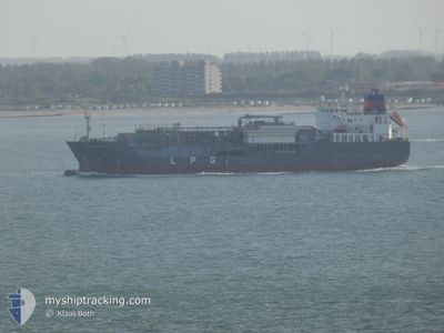
Lpg Tanker
Current Trip
| Time Travelled | 4 days |
|---|---|
| Remaining Time | --- |
| Distance Travelled | 922.66 nm |
| Remaining Distance | --- |
| AVG Speed | 12.4 Knots |
| MAX Speed | 13.9 Knots |
| AVG Wind | 10.3 knots |
| MAX Wind | 25 knots |
| MIN Temp | 10.8°C / 51.44°F |
| MAX Temp | 17.7°C / 63.86°F |
| Draught | 6 m |
| Position Received | 1 d ago |
Current Position
| Longitude | 13.87303° |
|---|---|
| Latitude | 35.73295° |
| Status | Under way using engine |
| Speed | 12.2 Knots |
| Course | 142° |
| Area | Mediterranean Sea - Eastern Basin |
| Station | T-AIS |
| Position Received | 1 d ago |
Info
Information
The current position of CHRISTOPH SCHULTE is in Mediterranean Sea - Eastern Basin with coordinates 35.73295° / 13.87303° as reported on 2024-04-22 20:21 by AIS to our vessel tracker app. The vessel's current speed is 12.2 Knots and is heading at the port of RAS LANUF. The estimated time of arrival as calculated by MyShipTracking vessel tracking app is 2024-04-24 21:00 LT
The vessel CHRISTOPH SCHULTE (IMO: 9368778, MMSI: 565487000) is a Lpg Tanker that was built in 2007 ( 17 years old ). It's sailing under the flag of [SG] Singapore.
In this page you can find informations about the vessels current position, last detected port calls, and current voyage information. If the vessels is not in coverage by AIS you will find the latest position.
The current position of CHRISTOPH SCHULTE is detected by our AIS receivers and we are not responsible for the reliability of the data. The last position was recorded while the vessel was in Coverage by the Ais receivers of our vessel tracking app.
The current draught of CHRISTOPH SCHULTE as reported by AIS is 6 meters
Weather
| Temperature | 17.8°C / 64.04°F |
|---|---|
| Wind Speed | 22 knots |
| Direction | 311° NW |
| Pressure | 1009.4 hPa |
| Humidity | 76.1 % |
| Cloud Coverage | 71 % |
Featured Company
Last Port Calls
| Port | Arrival | Departure | Time In Port |
|---|---|---|---|
| 2024-04-18 19:35 | 2024-04-19 22:07 | 1 d | |
| 2024-04-10 20:53 | 2024-04-12 13:19 | 1 d | |
| 2024-04-07 04:41 | 2024-04-09 05:56 | 2 d | |
| 2024-04-04 08:32 | 2024-04-04 17:34 | 9 h | |
| 2024-04-02 13:22 | 2024-04-04 07:56 | 1 d | |
| 2024-03-23 14:07 | 2024-03-24 16:25 | 1 d | |
| 2024-03-15 01:50 | 2024-03-16 20:50 | 1 d | |
| 2024-03-12 06:24 | 2024-03-12 19:38 | 13 h | |
| 2024-03-01 17:11 | 2024-03-03 13:22 | 1 d | |
| 2024-02-24 22:44 | 2024-02-29 06:26 | 4 d |
Most Visited Ports (Last year)
| Port | Arrivals | |
|---|---|---|
| 8 | ||
| 6 | ||
| 5 | ||
| 5 | ||
| 4 | ||
| 3 |
Last Trips
| Origin | Departure | Destination | Arrival | Distance | |
|---|---|---|---|---|---|
| 2024-04-12 15:19 | 2024-04-18 21:35 | 1908.99 nm | |||
| 2024-04-09 07:56 | 2024-04-10 22:53 | 398.15 nm | |||
| 2024-04-04 19:34 | 2024-04-07 06:41 | 427.27 nm | |||
| 2024-04-04 09:56 | 2024-04-04 10:32 | 7.41 nm | |||
| 2024-03-24 17:25 | 2024-04-02 15:22 | 2124.90 nm | |||
| 2024-03-16 21:50 | 2024-03-23 15:07 | 1911.67 nm | |||
| 2024-03-12 20:38 | 2024-03-15 02:50 | 98.40 nm | |||
| 2024-03-03 14:22 | 2024-03-12 07:24 | 428.57 nm | |||
| 2024-02-29 07:26 | 2024-03-01 18:11 | 409.71 nm | |||
| 2024-02-15 02:16 | 2024-02-24 23:44 | 1281.48 nm |
Events
| Time | Event | Details | Position / Dest | Info |
|---|---|---|---|---|
| 2024-04-22 20:24 | Status Changed | Default Under way using engine |
35.72423 / 13.88130
LYRLA
|
Speed: 12.2 kn Course: 142° |
| 2024-04-22 20:21 | Status Changed | Under way using engine Default |
35.73295 / 13.87303
LYRLA
|
Speed: 12.5 kn Course: 140° |
| 2024-04-22 20:21 | OUT of Coverage |
35.73295 / 13.87303
Mediterranean Sea - Eastern Basin
LYRLA
|
Speed: 12.2 kn Course: 142° |
|
| 2024-04-22 19:29 | Status Changed | Default Under way using engine |
35.87533 / 13.73363
LYRLA
|
Speed: 12.5 kn Course: 140° |
| 2024-04-22 19:25 | Detected in Sea | Maltese part of the Mediterranean Sea - Eastern Basin |
35.88567 / 13.72312
Mediterranean Sea - Eastern Basin
LYRLA
|
Speed: 12.5 kn Course: 140° |
| 2024-04-22 19:25 | Status Changed | Under way using engine Default |
35.88567 / 13.72312
LYRLA
|
Speed: 12.5 kn Course: 140° |
| 2024-04-22 19:15 | IN Coverage |
35.88567 / 13.72312
Mediterranean Sea - Eastern Basin
LYRLA
|
Speed: 12.5 kn Course: 140° |
|
| 2024-04-22 10:29 | Status Changed | Default Under way using engine |
37.38573 / 12.12703
LYRLA
|
Speed: 13.4 kn Course: 127° |
| 2024-04-22 10:27 | OUT of Coverage |
37.38992 / 12.12033
Mediterranean Sea - Eastern Basin
LYRLA
|
Speed: 13.4 kn Course: 127° |
|
| 2024-04-22 10:17 | Status Changed | Under way using engine Default |
37.41328 / 12.08262
LYRLA
|
Speed: 13.4 kn Course: 123° |