
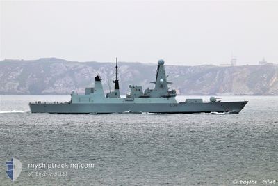
BRITISH WARSHIP
Military ops
Current Trip
Unknown
| Time Travelled | 12 h, 23 mins |
|---|---|
| Remaining Time | --- |
| Distance Travelled | 9.32 nm |
| Remaining Distance | --- |
| AVG Speed | 10.3 Knots |
| MAX Speed | 13.9 Knots |
| AVG Wind | 22 knots |
| MAX Wind | 22.7 knots |
| MIN Temp | 13.1°C / 55.58°F |
| MAX Temp | 13.3°C / 55.94°F |
| Draught | 3.8 m |
| Position Received | 11 h, 28 m ago |
Current Position
| Longitude | --- |
|---|---|
| Latitude | --- |
| Status | Under way using engine |
| Speed | 13.7 Knots |
| Course | 141.5° |
| Area | English Channel |
| Station | T-AIS |
| Position Received | 11 h, 28 m ago |
Info
Information
The current position of BRITISH WARSHIP is in English Channel with coordinates 50.27034° / -4.12088° as reported on 2025-12-08 19:50 by AIS to our vessel tracker app. The vessel's current speed is 13.7 Knots
The vessel BRITISH WARSHIP (IMO: 9752027, MMSI: 232002833) is a Military ops It's sailing under the flag of [GB] United Kingdom.
In this page you can find informations about the vessels current position, last detected port calls, and current voyage information. If the vessels is not in coverage by AIS you will find the latest position.
The current position of BRITISH WARSHIP is detected by our AIS receivers and we are not responsible for the reliability of the data. The last position was recorded while the vessel was in Coverage by the Ais receivers of our vessel tracking app.
The current draught of BRITISH WARSHIP as reported by AIS is 3.8 meters
Weather
| Temperature | 13.1°C / 55.58°F |
|---|---|
| Wind Speed | 21 knots |
| Direction | 208° SSW |
| Pressure | 1007.1 hPa |
| Humidity | 96 % |
| Cloud Coverage | 100 % |
Featured Company
Last Port Calls
| Port | Arrival | Departure | Time In Port |
|---|---|---|---|
| 2025-12-08 18:55 | |||
| 2025-12-05 13:46 | |||
| 2025-11-17 08:33 | |||
| 2025-11-07 18:34 | 2025-11-07 18:59 | 25 m | |
| 2025-11-06 08:56 | |||
| 2025-11-04 12:29 | 2025-11-05 15:15 | 1 d | |
| 2025-11-03 22:24 | 2025-11-04 07:34 | 9 h | |
| 2025-11-03 20:24 | 2025-11-03 20:45 | 21 m | |
| 2025-10-24 09:31 | |||
| 2025-10-23 09:46 |
Most Visited Ports (Last year)
| Port | Arrivals | |
|---|---|---|
| 18 | ||
| 17 | ||
| 9 | ||
| 5 | ||
| 5 | ||
| 4 |
Last Trips
| Origin | Departure | Destination | Arrival | Distance | |
|---|---|---|---|---|---|
| 2025-11-06 08:56 | 2025-11-07 18:34 | 33.20 nm | |||
| 2025-11-04 07:34 | 2025-11-04 12:29 | 15.98 nm | |||
| 2025-11-03 20:45 | 2025-11-03 22:24 | 12.97 nm | |||
| 2025-11-03 20:45 | 2025-11-03 20:24 | 12.97 nm | |||
| 2025-10-16 06:48 | 2025-10-23 09:46 | 840.77 nm | |||
| 2025-10-16 06:48 | 2025-10-22 16:04 | 370.80 nm | |||
| 2025-10-07 16:27 | 2025-10-13 17:24 | 489.04 nm | |||
| 2025-10-06 18:25 | 2025-10-07 09:08 | 398.98 nm | |||
| 2025-09-29 10:29 | 2025-10-02 14:30 | 611.33 nm |
Events
| Time | Event | Details | Position / Dest | Info |
|---|---|---|---|---|
| 2025-12-09 03:29 | Draught Changed | 3.8 25.5 |
50.27034 / -4.12088
|
Speed: 13.7 kn Course: 141.5° |
| 2025-12-08 19:50 | OUT of Coverage |
50.27034 / -4.12088
English Channel
|
Speed: 13.7 kn Course: 141.5° |
|
| 2025-12-08 18:55 | PORT DEPARTURE |
|
50.37022 / -4.18888
|
Speed: 11.2 kn Course: 182° |
| 2025-12-08 18:55 | Change Sea Area | United Kingdom part of the English Channel Bahraini part of the Persian Gulf |
50.37179 / -4.18869
English Channel
|
Speed: 11.4 kn Course: 182.1° |
| 2025-12-08 18:50 | START Moving |
50.38322 / -4.19060
[GB] PLYMOUTH
|
Speed: 3.3 kn Course: 165° |
|
| 2025-12-08 17:30 | Status Changed | Under way using engine Moored |
50.38462 / -4.18879
[GB] PLYMOUTH
|
Speed: 0.4 kn Course: 344° |
| 2025-12-08 11:17 | IN Coverage |
50.38462 / -4.18877
Persian Gulf
[GB] PLYMOUTH
|
Speed: Course: 263.4° |
|
| 2025-12-08 08:47 | Draught Changed | 25.5 20 |
26.20268 / 50.61620
[BH] MINA SULMAN
|
Speed: 0.1 kn Course: 42° |
| 2025-12-05 11:19 | OUT of Coverage |
26.20268 / 50.61620
Persian Gulf
[BH] MINA SULMAN
|
Speed: 0.1 kn Course: 15.1° |
|
| 2025-12-05 10:47 | STOP Moving |
26.20269 / 50.61615
[BH] MINA SULMAN
|
Speed: 0.1 kn Course: 50° |