
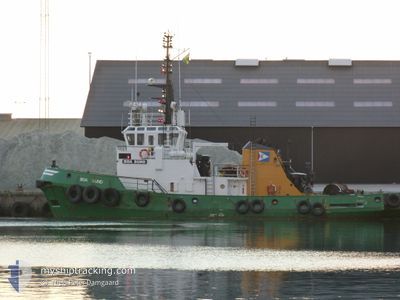
BOA SUND
Tug
Current Trip
| Time Travelled | 2 days |
|---|---|
| Remaining Time | 1 day |
| Distance Travelled | 385.89 nm |
| Remaining Distance | 216.62 nm |
| AVG Speed | 7.9 Knots |
| MAX Speed | 10.9 Knots |
| AVG Wind | 15 knots |
| MAX Wind | 25.9 knots |
| MIN Temp | 2.2°C / 35.96°F |
| MAX Temp | 6.9°C / 44.42°F |
| Draught | 5.2 m |
| Position Received | 11 h, 21 m ago |
Current Position
| Longitude | 5.72490° |
|---|---|
| Latitude | 55.34038° |
| Status | Restricted manoeuverability |
| Speed | 6.2 Knots |
| Course | 211° |
| Area | North Sea |
| Station | T-AIS |
| Position Received | 11 h, 21 m ago |
Info
Information
The current position of BOA SUND is in North Sea with coordinates 55.34038° / 5.72490° as reported on 2024-04-24 13:38 by AIS to our vessel tracker app. The vessel's current speed is 6.2 Knots and is heading at the port of ROTTERDAM. The estimated time of arrival as calculated by MyShipTracking vessel tracking app is 2024-04-26 05:37 LT
The vessel BOA SUND (IMO: 7500798, MMSI: 375378000) is a Tug that was built in 1976 ( 48 years old ). It's sailing under the flag of [VC] St Vincent Grenadines.
In this page you can find informations about the vessels current position, last detected port calls, and current voyage information. If the vessels is not in coverage by AIS you will find the latest position.
The current position of BOA SUND is detected by our AIS receivers and we are not responsible for the reliability of the data. The last position was recorded while the vessel was in Coverage by the Ais receivers of our vessel tracking app.
The current draught of BOA SUND as reported by AIS is 5.2 meters
Weather
| Temperature | 6.3°C / 43.34°F |
|---|---|
| Wind Speed | 16 knots |
| Direction | 342° NNW |
| Pressure | 1008.3 hPa |
| Humidity | 68.3 % |
| Cloud Coverage | 37 % |
Featured Company
Last Port Calls
| Port | Arrival | Departure | Time In Port |
|---|---|---|---|
| 2024-04-21 07:09 | 2024-04-22 09:38 | 1 d | |
| 2024-04-21 05:24 | 2024-04-21 05:48 | 24 m | |
| 2024-04-19 21:19 | 2024-04-21 04:24 | 1 d | |
| 2024-04-19 19:59 | 2024-04-19 20:33 | 33 m | |
| 2024-04-19 09:01 | 2024-04-19 17:10 | 8 h | |
| 2024-04-18 19:20 | 2024-04-18 19:45 | 24 m | |
| 2024-04-17 21:25 | 2024-04-17 21:44 | 18 m | |
| 2024-04-17 11:00 | 2024-04-17 19:08 | 8 h | |
| 2024-04-17 10:09 | 2024-04-17 10:52 | 43 m | |
| 2024-04-13 01:34 | 2024-04-15 22:14 | 2 d |
Last Trips
| Origin | Departure | Destination | Arrival | Distance | |
|---|---|---|---|---|---|
| 2024-04-21 07:48 | 2024-04-21 09:09 | 10.50 nm | |||
| 2024-04-21 06:24 | 2024-04-21 07:24 | 4.33 nm | |||
| 2024-04-19 22:33 | 2024-04-19 23:19 | 5.67 nm | |||
| 2024-04-19 19:10 | 2024-04-19 21:59 | 17.62 nm | |||
| 2024-04-18 21:45 | 2024-04-19 11:01 | 12.83 nm | |||
| 2024-04-17 23:44 | 2024-04-18 21:20 | 6.18 nm | |||
| 2024-04-17 21:08 | 2024-04-17 23:25 | 19.79 nm | |||
| 2024-04-17 12:52 | 2024-04-17 13:00 | 0.54 nm | |||
| 2024-04-16 00:14 | 2024-04-17 12:09 | 127.44 nm | |||
| 2024-04-11 09:33 | 2024-04-13 03:34 | 124.49 nm |
Events
| Time | Event | Details | Position / Dest | Info |
|---|---|---|---|---|
| 2024-04-24 14:21 | Status Changed | Default Restricted manoeuverability |
55.27907 / 5.66128
NLRTM
|
Speed: 6.2 kn Course: 211° |
| 2024-04-24 13:38 | Detected in Sea | German part of the North Sea |
55.34038 / 5.72490
North Sea
NLRTM
|
Speed: 6.2 kn Course: 211° |
| 2024-04-24 13:38 | IN Coverage |
55.34038 / 5.72490
North Sea
NLRTM
|
Speed: 6.2 kn Course: 211° |
|
| 2024-04-24 13:38 | OUT of Coverage |
55.34038 / 5.72490
North Sea
NLRTM
|
Speed: 6.2 kn Course: 211° |
|
| 2024-04-23 19:36 | Status Changed | Default Restricted manoeuverability |
57.20906 / 5.84620
NLRTM
|
Speed: 6.6 kn Course: 183.2° |
| 2024-04-23 19:11 | OUT of Coverage |
57.25430 / 5.85074
North Sea
NLRTM
|
Speed: 6.6 kn Course: 183.2° |
|
| 2024-04-23 08:41 | START Moving | 1.55 nm, South of EGERSUND |
58.42532 / 5.99144
NLRTM
|
Speed: 4.2 kn Course: 166° |
| 2024-04-23 08:18 | Status Changed | Restricted manoeuverability Moored |
58.42628 / 5.98594
NLRTM
|
Speed: 0.2 kn Course: 182° |
| 2024-04-23 07:43 | Destination Changed | NLRTM EGERSUND |
58.42673 / 5.98598
NLRTM
|
Speed: Course: 357° |
| 2024-04-23 07:43 | ETA Changed | 2024/04/26 08:00 2024/04/23 05:00 |
58.42673 / 5.98598
NLRTM
|
Speed: Course: 357° |