
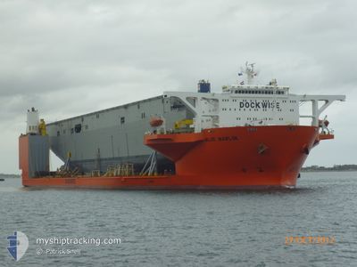
BLUE MARLIN
Heavy Lift Vessel
Current Trip
| Time Travelled | --- |
|---|---|
| Remaining Time | --- |
| Distance Travelled | 8185.20 nm |
| Remaining Distance | --- |
| AVG Speed | 6.6 Knots |
| MAX Speed | 10.2 Knots |
| AVG Wind | 11.3 knots |
| MAX Wind | 28 knots |
| MIN Temp | 17.3°C / 63.14°F |
| MAX Temp | 29.8°C / 85.64°F |
| Draught | 8.2 m |
| Position Received | 2 d ago |
Current Position
| Longitude | 104.30306° |
|---|---|
| Latitude | 1.28282° |
| Status | Under way using engine |
| Speed | 9 Knots |
| Course | 82.2° |
| Area | Singapore Strait |
| Station | T-AIS |
| Position Received | 2 d ago |
Info
Information
The current position of BLUE MARLIN is in Singapore Strait with coordinates 1.28282° / 104.30306° as reported on 2024-04-17 13:14 by AIS to our vessel tracker app. The vessel's current speed is 9 Knots and is heading at the port of LA ROCHELLE. The estimated time of arrival as calculated by MyShipTracking vessel tracking app is 2024-06-05 10:00 LT
The vessel BLUE MARLIN (IMO: 9186338, MMSI: 248314000) is a Heavy Lift Vessel that was built in 2000 ( 24 years old ). It's sailing under the flag of [MT] Malta.
In this page you can find informations about the vessels current position, last detected port calls, and current voyage information. If the vessels is not in coverage by AIS you will find the latest position.
The current position of BLUE MARLIN is detected by our AIS receivers and we are not responsible for the reliability of the data. The last position was recorded while the vessel was in Coverage by the Ais receivers of our vessel tracking app.
The current draught of BLUE MARLIN as reported by AIS is 8.2 meters
Weather
| Temperature | 28.2°C / 82.76°F |
|---|---|
| Wind Speed | 4 knots |
| Direction | 108° ESE |
| Pressure | 1008.3 hPa |
| Humidity | 76.5 % |
| Cloud Coverage | 100 % |
Featured Company
Last Port Calls
Most Visited Ports (Last year)
| Port | Arrivals | |
|---|---|---|
| 1 | ||
| 1 | ||
| 1 |
Last Trips
| Origin | Departure | Destination | Arrival | Distance |
|---|
Events
| Time | Event | Details | Position / Dest | Info |
|---|---|---|---|---|
| 2024-04-17 13:21 | Status Changed | Default Under way using engine |
1.28497 / 104.31857
SGSIN>FRLRH
|
Speed: 9 kn Course: 82.2° |
| 2024-04-17 13:14 | Status Changed | Under way using engine Default |
1.28282 / 104.30306
SGSIN>FRLRH
|
Speed: 8.8 kn Course: 82° |
| 2024-04-17 13:14 | OUT of Coverage |
1.28282 / 104.30306
Singapore Strait
|
Speed: 9 kn Course: 82.2° |
|
| 2024-04-17 13:01 | Status Changed | Default Under way using engine |
1.27814 / 104.27058
SGSIN>FRLRH
|
Speed: 8.5 kn Course: 83.4° |
| 2024-04-17 12:08 | Change Sea Area | Malaysian part of the Singapore Strait Indonesian part of the Singapore Strait |
1.26001 / 104.14397
Singapore Strait
|
Speed: 8.8 kn Course: 80.9° |
| 2024-04-17 10:29 | Change Sea Area | Indonesian part of the Singapore Strait Singaporean part of the Singapore Strait |
1.22052 / 103.91553
Singapore Strait
|
Speed: 5.9 kn Course: 78.3° |
| 2024-04-17 09:57 | START Moving | 2.17 nm, East of SINGAPORE |
1.24896 / 103.88963
SGSIN>FRLRH
|
Speed: 3.1 kn Course: 150° |
| 2024-04-17 09:50 | Status Changed | Under way using engine At anchor |
1.25186 / 103.88786
SGSIN>FRLRH
|
Speed: 0.2 kn Course: 65° |
| 2024-04-17 06:59 | Destination Changed | SGSIN>FRLRH SGSIN |
1.25209 / 103.88836
SGSIN>FRLRH
|
Speed: Course: 152° |
| 2024-04-17 06:59 | ETA Changed | 2024/06/05 10:00 2024/04/16 05:15 |
1.25209 / 103.88836
SGSIN>FRLRH
|
Speed: Course: 152° |