
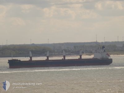
BELFRIEND
Cargo
Current Trip
| Time Travelled | 2 days |
|---|---|
| Remaining Time | --- |
| Distance Travelled | 330.11 nm |
| Remaining Distance | 0.67 nm |
| AVG Speed | 9.2 Knots |
| MAX Speed | 12.8 Knots |
| AVG Wind | 10 knots |
| MAX Wind | 18 knots |
| MIN Temp | 11.2°C / 52.16°F |
| MAX Temp | 22.5°C / 72.5°F |
| Draught | 6.3 m |
| Position Received | Now |
Current Position
| Longitude | -5.37532° |
|---|---|
| Latitude | 36.13607° |
| Status | At anchor |
| Speed | |
| Course | 328° |
| Area | Strait of Gibraltar |
| Station | T-AIS |
| Position Received | Now |
Info
Information
The current position of BELFRIEND is in Strait of Gibraltar with coordinates 36.13607° / -5.37532° as reported on 2024-04-25 18:00 by AIS to our vessel tracker app. The vessel's current speed is 0 Knots and is heading at the port of GIBRALTAR. The estimated time of arrival as calculated by MyShipTracking vessel tracking app is 2024-04-24 16:00 LT
The vessel BELFRIEND (IMO: 9764051, MMSI: 257497000) is a Cargo It's sailing under the flag of [NO] Norway.
In this page you can find informations about the vessels current position, last detected port calls, and current voyage information. If the vessels is not in coverage by AIS you will find the latest position.
The current position of BELFRIEND is detected by our AIS receivers and we are not responsible for the reliability of the data. The last position was recorded while the vessel was in Coverage by the Ais receivers of our vessel tracking app.
The current draught of BELFRIEND as reported by AIS is 6.3 meters
Weather
| Temperature | 18.7°C / 65.66°F |
|---|---|
| Wind Speed | 9 knots |
| Direction | 267° W |
| Pressure | 1009.8 hPa |
| Humidity | 45.5 % |
| Cloud Coverage | 67 % |
Featured Company
Most Visited Ports (Last year)
| Port | Arrivals | |
|---|---|---|
| 2 | ||
| 2 | ||
| 1 | ||
| 1 | ||
| 1 | ||
| 1 |
Last Trips
| Origin | Departure | Destination | Arrival | Distance | |
|---|---|---|---|---|---|
| 2024-04-19 11:32 | 2024-04-20 14:06 | 3.31 nm | |||
| 2024-01-31 14:32 | 2024-04-15 19:09 | 1982.16 nm |
Events
| Time | Event | Details | Position / Dest | Info |
|---|---|---|---|---|
| 2024-04-25 04:57 | Status Changed | At anchor Default |
36.13470 / -5.37667
GIGIB
|
Speed: Course: 353° |
| 2024-04-25 04:48 | Status Changed | Default At anchor |
36.13472 / -5.37671
GIGIB
|
Speed: Course: 355° |
| 2024-04-24 16:30 | Status Changed | At anchor Under way using engine |
36.13564 / -5.37558
GIGIB
|
Speed: 0.1 kn Course: 25° |
| 2024-04-24 16:24 | STOP Moving | 0.96 nm, South West of GIBRALTAR |
36.13555 / -5.37590
GIGIB
|
Speed: 0.3 kn Course: 359° |
| 2024-04-24 15:13 | START Moving | 5.13 nm, South of GIBRALTAR |
36.06453 / -5.33684
GIGIB
|
Speed: 3.1 kn Course: 335° |
| 2024-04-24 14:09 | STOP Moving | 5.17 nm, South of GIBRALTAR |
36.06264 / -5.34293
GIGIB
|
Speed: 0.3 kn Course: 31° |
| 2024-04-24 13:26 | Change Sea Area | Gibraltarian part of the Strait of Gibraltar Spanish part of the Strait of Gibraltar |
36.03503 / -5.34385
Strait of Gibraltar
GIGIB
|
Speed: 8.7 kn Course: 357.1° |
| 2024-04-24 13:05 | Change Sea Area | Spanish part of the Strait of Gibraltar Moroccan part of the Strait of Gibraltar |
35.99133 / -5.37066
Strait of Gibraltar
GIGIB
|
Speed: 10.2 kn Course: 74.4° |
| 2024-04-24 11:20 | Status Changed | Under way using engine Default |
35.91951 / -5.74825
GIGIB
|
Speed: 10 kn Course: 82° |
| 2024-04-24 11:14 | Status Changed | Default Under way using engine |
35.91790 / -5.76689
GIGIB
|
Speed: 10 kn Course: 84.1° |