
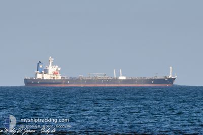
BARON I
Oil Products Tanker
Current Trip
| Time Travelled | 17 days |
|---|---|
| Remaining Time | --- |
| Distance Travelled | 4597.07 nm |
| Remaining Distance | --- |
| AVG Speed | 10.9 Knots |
| MAX Speed | 13.6 Knots |
| AVG Wind | 16.1 knots |
| MAX Wind | 27.7 knots |
| MIN Temp | 2.3°C / 36.14°F |
| MAX Temp | 26.4°C / 79.52°F |
| Draught | 11.8 m |
| Position Received | 6 d ago |
Current Position
| Longitude | -15.57730° |
|---|---|
| Latitude | 38.13730° |
| Status | Under way using engine |
| Speed | 11.6 Knots |
| Course | 214° |
| Area | North Atlantic Ocean |
| Station | T-AIS |
| Position Received | 6 d ago |
Info
Information
The current position of BARON I is in North Atlantic Ocean with coordinates 38.13730° / -15.57730° as reported on 2024-04-18 01:41 by AIS to our vessel tracker app. The vessel's current speed is 11.6 Knots and is heading at the port of SUAPE. The estimated time of arrival as calculated by MyShipTracking vessel tracking app is 2024-04-28 20:00 LT
The vessel BARON I (IMO: 9288370, MMSI: 352980787) is a Oil Products Tanker that was built in 2004 ( 20 years old ). It's sailing under the flag of [PA] Panama.
In this page you can find informations about the vessels current position, last detected port calls, and current voyage information. If the vessels is not in coverage by AIS you will find the latest position.
The current position of BARON I is detected by our AIS receivers and we are not responsible for the reliability of the data. The last position was recorded while the vessel was in Coverage by the Ais receivers of our vessel tracking app.
The current draught of BARON I as reported by AIS is 11.8 meters
Weather
| Temperature | 26.3°C / 79.34°F |
|---|---|
| Wind Speed | 9 knots |
| Direction | 55° NE |
| Pressure | 1013 hPa |
| Humidity | 74.9 % |
| Cloud Coverage | 100 % |
Featured Company
Events
| Time | Event | Details | Position / Dest | Info |
|---|---|---|---|---|
| 2024-04-18 01:47 | Status Changed | Default Under way using engine |
38.12226 / -15.59022
BRSUA
|
Speed: 11.6 kn Course: 214° |
| 2024-04-18 01:41 | OUT of Coverage |
38.13730 / -15.57730
North Atlantic Ocean
BRSUA
|
Speed: 11.6 kn Course: 214° |
|
| 2024-04-18 01:20 | Status Changed | Under way using engine Default |
38.19457 / -15.52785
BRSUA
|
Speed: 11 kn Course: 214° |
| 2024-04-18 00:44 | Status Changed | Default Under way using engine |
38.28833 / -15.44333
BRSUA
|
Speed: 11.4 kn Course: 212° |
| 2024-04-18 00:36 | Status Changed | Under way using engine Default |
38.31215 / -15.42638
BRSUA
|
Speed: 11.3 kn Course: 214° |
| 2024-04-18 00:32 | Status Changed | Default Under way using engine |
38.32188 / -15.41818
BRSUA
|
Speed: 11.3 kn Course: 213° |
| 2024-04-18 00:04 | Status Changed | Under way using engine Default |
38.39747 / -15.35488
BRSUA
|
Speed: 11 kn Course: 213° |
| 2024-04-17 23:59 | Status Changed | Default Under way using engine |
38.41000 / -15.34333
BRSUA
|
Speed: 11.6 kn Course: 214° |
| 2024-04-17 23:44 | Status Changed | Under way using engine Default |
38.45138 / -15.30928
BRSUA
|
Speed: 11 kn Course: 213° |
| 2024-04-17 23:41 | Status Changed | Default Under way using engine |
38.45833 / -15.30167
BRSUA
|
Speed: 11.8 kn Course: 212° |