
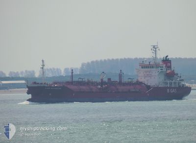
B GAS MARGRETHE
Lpg Tanker
Current Trip
| Trip Time | 1 day |
|---|---|
| Trip Distance | 56.06 nm |
| AVG Speed | 9.1 Knots |
| MAX Speed | 11.8 Knots |
| Draught | 6.1 m |
| AVG Wind | 7.6 knots |
| MAX Wind | 16 knots |
| MIN Temp | 4.3°C / 39.74°F |
| MAX Temp | 5.6°C / 42.08°F |
| Position Received | 14 h, 17 m ago |
Current Position
| Longitude | 11.80503° |
|---|---|
| Latitude | 58.08637° |
| Status | Under way using engine |
| Speed | 0.6 Knots |
| Course | 281° |
| Area | Skaggerak |
| Station | T-AIS |
| Position Received | 14 h, 17 m ago |
Info
Information
The current position of B GAS MARGRETHE is in Skaggerak with coordinates 58.08637° / 11.80503° as reported on 2024-04-24 17:43 by AIS to our vessel tracker app. The vessel's current speed is 0.6 Knots and is currently inside the port of STENUNGSUND.
The vessel B GAS MARGRETHE (IMO: 9346407, MMSI: 249810000) is a Lpg Tanker that was built in 2006 ( 18 years old ). It's sailing under the flag of [MT] Malta.
In this page you can find informations about the vessels current position, last detected port calls, and current voyage information. If the vessels is not in coverage by AIS you will find the latest position.
The current position of B GAS MARGRETHE is detected by our AIS receivers and we are not responsible for the reliability of the data. The last position was recorded while the vessel was in Coverage by the Ais receivers of our vessel tracking app.
The current draught of B GAS MARGRETHE as reported by AIS is 6.1 meters
Weather
| Temperature | 5.1°C / 41.18°F |
|---|---|
| Wind Speed | 5 knots |
| Direction | 104° ESE |
| Pressure | 1005.9 hPa |
| Humidity | 73.2 % |
| Cloud Coverage | 84 % |
Featured Company
Last Port Calls
| Port | Arrival | Departure | Time In Port |
|---|---|---|---|
| 2024-04-24 17:37 | |||
| 2024-04-21 21:33 | 2024-04-23 08:18 | 1 d | |
| 2024-04-09 20:02 | 2024-04-14 04:33 | 4 d | |
| 2024-04-06 15:00 | 2024-04-09 15:58 | 3 d | |
| 2024-04-04 14:31 | 2024-04-05 15:19 | 1 d | |
| 2024-04-02 09:12 | 2024-04-03 15:21 | 1 d | |
| 2024-03-29 21:33 | 2024-03-30 14:12 | 16 h | |
| 2024-03-22 14:09 | 2024-03-23 14:47 | 1 d | |
| 2024-03-14 10:52 | 2024-03-15 12:21 | 1 d | |
| 2024-03-11 18:35 | 2024-03-12 19:52 | 1 d |
Last Trips
| Origin | Departure | Destination | Arrival | Distance | |
|---|---|---|---|---|---|
| 2024-04-23 10:18 | 2024-04-24 19:37 | 56.06 nm | |||
| 2024-04-14 06:33 | 2024-04-21 23:33 | 624.79 nm | |||
| 2024-04-09 17:58 | 2024-04-09 22:02 | 31.36 nm | |||
| 2024-04-05 16:19 | 2024-04-06 17:00 | 267.01 nm | |||
| 2024-04-03 17:21 | 2024-04-04 15:31 | 275.64 nm | |||
| 2024-03-30 15:12 | 2024-04-02 11:12 | 505.90 nm | |||
| 2024-03-23 14:47 | 2024-03-29 22:33 | 1865.04 nm | |||
| 2024-03-15 12:21 | 2024-03-22 14:09 | 1154.14 nm | |||
| 2024-03-12 19:52 | 2024-03-14 10:52 | 145.20 nm | |||
| 2024-03-09 04:44 | 2024-03-11 18:35 | 717.68 nm |
Events
| Time | Event | Details | Position / Dest | Info |
|---|---|---|---|---|
| 2024-04-24 17:48 | Status Changed | Default Under way using engine |
58.08615 / 11.80502
[SE] STENUNGSUND
|
Speed: 0.6 kn Course: 281° |
| 2024-04-24 17:48 | STOP Moving |
58.08615 / 11.80502
[SE] STENUNGSUND
|
Speed: 0.1 kn Course: 285° |
|
| 2024-04-24 17:43 | OUT of Coverage |
58.08637 / 11.80503
Skaggerak
[SE] STENUNGSUND
|
Speed: 0.6 kn Course: 146.1° |
|
| 2024-04-24 17:37 | PORT ARRIVAL |
|
58.08709 / 11.80289
[SE] STENUNGSUND
|
Speed: 1.7 kn Course: 294° |
| 2024-04-24 17:08 | Change Sea Area | Swedish part of the Skaggerak Swedish part of the Kattegat |
58.03636 / 11.78819
Skaggerak
|
Speed: 10 kn Course: 14.5° |
| 2024-04-24 15:23 | Change Sea Area | Swedish part of the Kattegat Swedish part of the Skaggerak |
57.89127 / 11.39327
Kattegat
|
Speed: 5.7 kn Course: 158.6° |
| 2024-04-24 15:03 | START Moving | 6.35 nm, West of STANSVIKS |
57.91828 / 11.37382
STENUNGSUND (SE)
|
Speed: 3.1 kn Course: 161° |
| 2024-04-24 14:58 | Status Changed | Under way using engine At anchor |
57.92080 / 11.37331
STENUNGSUND (SE)
|
Speed: 0.6 kn Course: 187° |
| 2024-04-24 10:49 | Status Changed | At anchor Default |
57.92277 / 11.37449
STENUNGSUND (SE)
|
Speed: Course: 202° |
| 2024-04-24 10:46 | Status Changed | Default At anchor |
57.92278 / 11.37438
STENUNGSUND (SE)
|
Speed: Course: 201° |