
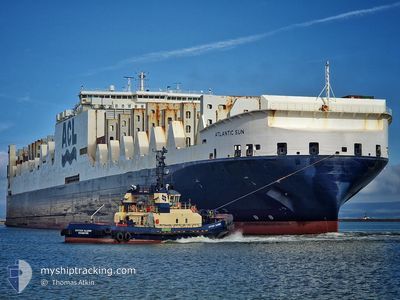
ATLANTIC SUN
Cargo A
Current Trip
| Trip Time | 6 days |
|---|---|
| Trip Distance | 2568.58 nm |
| AVG Speed | 15.6 Knots |
| MAX Speed | 19.8 Knots |
| Draught | 9.6 m |
| AVG Wind | 16 knots |
| MAX Wind | 35 knots |
| MIN Temp | 5.7°C / 42.26°F |
| MAX Temp | 13.8°C / 56.84°F |
| Position Received | 1 m ago |
Current Position
| Longitude | -3.01961° |
|---|---|
| Latitude | 53.46115° |
| Status | Moored |
| Speed | 0.1 Knots |
| Course | 267° |
| Area | Irish Sea and St. George's Channel |
| Station | T-AIS |
| Position Received | 1 m ago |
Info
Information
The current position of ATLANTIC SUN is in Irish Sea and St. George's Channel with coordinates 53.46115° / -3.01961° as reported on 2024-04-20 09:53 by AIS to our vessel tracker app. The vessel's current speed is 0.1 Knots and is currently inside the port of LIVERPOOL.
The vessel ATLANTIC SUN (IMO: 9670614, MMSI: 215801000) is a Cargo A It's sailing under the flag of [MT] Malta.
In this page you can find informations about the vessels current position, last detected port calls, and current voyage information. If the vessels is not in coverage by AIS you will find the latest position.
The current position of ATLANTIC SUN is detected by our AIS receivers and we are not responsible for the reliability of the data. The last position was recorded while the vessel was in Coverage by the Ais receivers of our vessel tracking app.
The current draught of ATLANTIC SUN as reported by AIS is 9.6 meters
Weather
| Temperature | 8.5°C / 47.3°F |
|---|---|
| Wind Speed | 1 knots |
| Direction | 220° SW |
| Pressure | 1029.7 hPa |
| Humidity | 61.9 % |
| Cloud Coverage | 56 % |
Featured Company
Last Port Calls
| Port | Arrival | Departure | Time In Port |
|---|---|---|---|
| 2024-04-19 18:42 | |||
| 2024-04-12 18:32 | 2024-04-13 06:36 | 12 h | |
| 2024-04-10 01:49 | 2024-04-10 19:41 | 17 h | |
| 2024-04-06 11:04 | 2024-04-09 04:30 | 2 d | |
| 2024-04-04 01:06 | 2024-04-04 12:10 | 11 h | |
| 2024-03-25 21:23 | 2024-03-28 00:28 | 2 d | |
| 2024-03-22 09:34 | 2024-03-23 21:03 | 1 d | |
| 2024-03-20 03:59 | 2024-03-20 23:48 | 19 h | |
| 2024-03-10 10:00 | 2024-03-10 18:19 | 8 h | |
| 2024-03-07 23:33 | 2024-03-09 23:23 | 1 d |
Last Trips
| Origin | Departure | Destination | Arrival | Distance | |
|---|---|---|---|---|---|
| 2024-04-13 03:36 | 2024-04-19 19:42 | 2568.58 nm | |||
| 2024-04-10 15:41 | 2024-04-12 15:32 | 776.48 nm | |||
| 2024-04-09 00:30 | 2024-04-09 21:49 | 294.96 nm | |||
| 2024-04-04 09:10 | 2024-04-06 07:04 | 583.33 nm | |||
| 2024-03-28 00:28 | 2024-04-03 22:06 | 2559.40 nm | |||
| 2024-03-23 22:03 | 2024-03-25 21:23 | 702.95 nm | |||
| 2024-03-21 00:48 | 2024-03-22 10:34 | 417.09 nm | |||
| 2024-03-10 14:19 | 2024-03-20 04:59 | 3736.25 nm | |||
| 2024-03-09 18:23 | 2024-03-10 06:00 | 163.30 nm | |||
| 2024-03-07 18:11 | 2024-03-07 18:33 | 0.80 nm |
Events
| Time | Event | Details | Position / Dest | Info |
|---|---|---|---|---|
| 2024-04-19 21:08 | Status Changed | Moored Under way using engine |
53.46122 / -3.01956
[GB] LIVERPOOL
|
Speed: 0.1 kn Course: 267° |
| 2024-04-19 18:42 | PORT ARRIVAL |
|
53.44700 / -3.02176
[GB] LIVERPOOL
|
Speed: 0.3 kn Course: 350° |
| 2024-04-19 18:34 | STOP Moving | 1.37 nm, North of LIVERPOOL |
53.44631 / -3.02205
CAHAL>GBLIV
|
Speed: 0.3 kn Course: 333° |
| 2024-04-19 14:59 | ETA Changed | 2024/04/19 17:00 2024/04/19 16:30 |
53.50596 / -3.91873
CAHAL>GBLIV
|
Speed: 14 kn Course: 88° |
| 2024-04-19 14:27 | Status Changed | Under way using engine Default |
53.50201 / -4.12151
CAHAL>GBLIV
|
Speed: 13.9 kn Course: 88° |
| 2024-04-19 14:21 | Status Changed | Default Under way using engine |
53.50094 / -4.16226
CAHAL>GBLIV
|
Speed: 13.6 kn Course: 87.3° |
| 2024-04-19 10:57 | Draught Changed | 9.6 9.7 |
53.09039 / -5.07846
CAHAL>GBLIV
|
Speed: 13.4 kn Course: 30.6° |
| 2024-04-19 09:07 | Change Sea Area | United Kingdom part of the Irish Sea and St. George's Channel Irish part of the Irish Sea and St. George's Channel |
52.73585 / -5.41743
Irish Sea and St. George's Channel
CAHAL>GBLIV
|
Speed: 13.9 kn Course: 30.3° |
| 2024-04-19 06:10 | Change Sea Area | Irish part of the Irish Sea and St. George's Channel Irish part of the Celtic Sea |
52.10956 / -6.05122
Irish Sea and St. George's Channel
CAHAL>GBLIV
|
Speed: 15.7 kn Course: 56.1° |
| 2024-04-18 20:06 | ETA Changed | 2024/04/19 16:30 2024/04/19 16:00 |
51.27264 / -9.87220
CAHAL>GBLIV
|
Speed: 15.4 kn Course: 89.8° |