
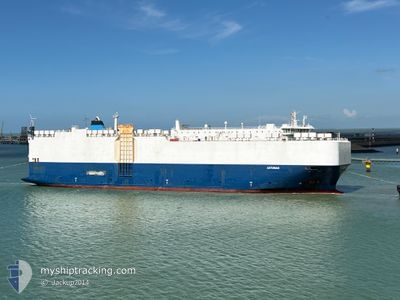
ASTURIAS
Vehicles Carrier
Current Trip
| Time Travelled | 1 day |
|---|---|
| Remaining Time | 16 h, 21 mins |
| Distance Travelled | 391.49 nm |
| Remaining Distance | 605.07 nm |
| AVG Speed | 13.9 Knots |
| MAX Speed | 15 Knots |
| AVG Wind | 10.2 knots |
| MAX Wind | 13 knots |
| MIN Temp | 21.3°C / 70.34°F |
| MAX Temp | 22.7°C / 72.86°F |
| Draught | 7.2 m |
| Position Received | 1 d ago |
Current Position
| Longitude | -14.50453° |
|---|---|
| Latitude | 29.70891° |
| Status | Under way using engine |
| Speed | 13.4 Knots |
| Course | 49.8° |
| Area | North Atlantic Ocean |
| Station | T-AIS |
| Position Received | 1 d ago |
Info
Information
The current position of ASTURIAS is in North Atlantic Ocean with coordinates 29.70891° / -14.50453° as reported on 2024-09-26 09:23 by AIS to our vessel tracker app. The vessel's current speed is 13.4 Knots and is heading at the port of TANGER MED. The estimated time of arrival as calculated by MyShipTracking vessel tracking app is 2024-09-28 04:34 LT
The vessel ASTURIAS (IMO: 9481049, MMSI: 538009723) is a Vehicles Carrier that was built in 2010 ( 14 years old ). It's sailing under the flag of [MH] Marshall Is.
In this page you can find informations about the vessels current position, last detected port calls, and current voyage information. If the vessels is not in coverage by AIS you will find the latest position.
The current position of ASTURIAS is detected by our AIS receivers and we are not responsible for the reliability of the data. The last position was recorded while the vessel was in Coverage by the Ais receivers of our vessel tracking app.
The current draught of ASTURIAS as reported by AIS is 7.2 meters
Weather
| Temperature | 22.4°C / 72.32°F |
|---|---|
| Wind Speed | 3 knots |
| Direction | 153° SSE |
| Pressure | 1019.8 hPa |
| Humidity | 86.6 % |
| Cloud Coverage | 100 % |
Featured Company
Last Port Calls
| Port | Arrival | Departure | Time In Port |
|---|---|---|---|
| 2024-09-25 17:35 | 2024-09-26 01:00 | 7 h | |
| 2024-09-25 06:15 | 2024-09-25 13:46 | 7 h | |
| 2024-09-21 12:49 | 2024-09-22 11:15 | 22 h | |
| 2024-09-16 09:31 | 2024-09-18 23:43 | 2 d | |
| 2024-09-13 23:29 | 2024-09-14 15:34 | 16 h | |
| 2024-09-11 10:11 | 2024-09-11 22:52 | 12 h | |
| 2024-09-08 13:42 | 2024-09-09 18:51 | 1 d | |
| 2024-09-02 18:11 | 2024-09-06 18:29 | 4 d | |
| 2024-08-29 09:29 | 2024-08-31 01:35 | 1 d | |
| 2024-08-27 18:27 | 2024-08-28 13:43 | 19 h |
Most Visited Ports (Last year)
| Port | Arrivals | |
|---|---|---|
| 17 | ||
| 13 | ||
| 8 | ||
| 8 | ||
| 5 | ||
| 3 |
Last Trips
| Origin | Departure | Destination | Arrival | Distance | |
|---|---|---|---|---|---|
| 2024-09-25 14:46 | 2024-09-25 18:35 | 54.71 nm | |||
| 2024-09-22 13:15 | 2024-09-25 07:15 | 911.81 nm | |||
| 2024-09-19 01:43 | 2024-09-21 14:49 | 867.11 nm | |||
| 2024-09-14 17:34 | 2024-09-16 11:31 | 236.51 nm | |||
| 2024-09-12 00:52 | 2024-09-14 01:29 | 700.71 nm | |||
| 2024-09-09 19:51 | 2024-09-11 12:11 | 533.44 nm | |||
| 2024-09-06 20:29 | 2024-09-08 14:42 | 551.48 nm | |||
| 2024-08-31 03:35 | 2024-09-02 20:11 | 871.71 nm | |||
| 2024-08-28 15:43 | 2024-08-29 11:29 | 196.58 nm | |||
| 2024-08-26 12:46 | 2024-08-27 20:27 | 447.95 nm |
Events
| Time | Event | Details | Position / Dest | Info |
|---|---|---|---|---|
| 2024-09-26 09:29 | Status Changed | Default Under way using engine |
29.72190 / -14.48687
MAPTM
|
Speed: 13.4 kn Course: 49.8° |
| 2024-09-26 09:23 | Status Changed | Under way using engine Default |
29.70891 / -14.50453
MAPTM
|
Speed: 13.7 kn Course: 50° |
| 2024-09-26 09:23 | OUT of Coverage |
29.70891 / -14.50453
North Atlantic Ocean
MAPTM
|
Speed: 13.4 kn Course: 49.8° |
|
| 2024-09-26 08:40 | Status Changed | Default Under way using engine |
29.59867 / -14.64942
MAPTM
|
Speed: 14.1 kn Course: 48.5° |
| 2024-09-26 08:20 | Status Changed | Under way using engine Default |
29.54544 / -14.71785
MAPTM
|
Speed: 14.2 kn Course: 48° |
| 2024-09-26 07:36 | Status Changed | Default Under way using engine |
29.42759 / -14.86557
MAPTM
|
Speed: 13.7 kn Course: 47.8° |
| 2024-09-26 07:18 | Status Changed | Under way using engine Default |
29.38165 / -14.92360
MAPTM
|
Speed: 13.4 kn Course: 50° |
| 2024-09-26 07:12 | Status Changed | Default Under way using engine |
29.36753 / -14.94280
MAPTM
|
Speed: 13.4 kn Course: 50.5° |
| 2024-09-26 07:08 | Status Changed | Under way using engine Default |
29.35914 / -14.95422
MAPTM
|
Speed: 13.5 kn Course: 50° |
| 2024-09-26 07:02 | Status Changed | Default Under way using engine |
29.34308 / -14.97634
MAPTM
|
Speed: 13.6 kn Course: 50.5° |