
ARTENOS
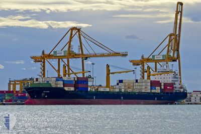
Container Ship
Current Trip
| Time Travelled | 16 days |
|---|---|
| Remaining Time | 5 days |
| Distance Travelled | 3603.59 nm |
| Remaining Distance | 2260.06 nm |
| AVG Speed | 11.9 Knots |
| MAX Speed | 14.3 Knots |
| AVG Wind | 9.4 knots |
| MAX Wind | 20 knots |
| MIN Temp | 22.4°C / 72.32°F |
| MAX Temp | 30.1°C / 86.18°F |
| Draught | 11.7 m |
| Position Received | 3 d ago |
Current Position
| Longitude | 104.33529° |
|---|---|
| Latitude | 1.28732° |
| Status | Under way using engine |
| Speed | 10.7 Knots |
| Course | 49.1° |
| Area | Singapore Strait |
| Station | T-AIS |
| Position Received | 3 d ago |
Info
Information
The current position of ARTENOS is in Singapore Strait with coordinates 1.28732° / 104.33529° as reported on 2024-04-13 15:45 by AIS to our vessel tracker app. The vessel's current speed is 10.7 Knots and is heading at the port of TAICANG. The estimated time of arrival as calculated by MyShipTracking vessel tracking app is 2024-04-22 15:48 LT
The vessel ARTENOS (IMO: 9283021, MMSI: 422039200) is a Container Ship that was built in 2004 ( 20 years old ). It's sailing under the flag of [IR] Iran.
In this page you can find informations about the vessels current position, last detected port calls, and current voyage information. If the vessels is not in coverage by AIS you will find the latest position.
The current position of ARTENOS is detected by our AIS receivers and we are not responsible for the reliability of the data. The last position was recorded while the vessel was in Coverage by the Ais receivers of our vessel tracking app.
The current draught of ARTENOS as reported by AIS is 11.7 meters
Weather
| Temperature | 28.9°C / 84.02°F |
|---|---|
| Wind Speed | 9 knots |
| Direction | 106° ESE |
| Pressure | 1010.8 hPa |
| Humidity | 73.8 % |
| Cloud Coverage | 10 % |
Featured Company
Last Port Calls
| Port | Arrival | Departure | Time In Port |
|---|---|---|---|
| 2024-03-27 19:45 | 2024-03-31 03:10 | 3 d | |
| 2024-02-21 07:25 | 2024-02-24 03:06 | 2 d | |
| 2024-02-17 07:03 | 2024-02-18 20:01 | 1 d | |
| 2024-02-03 12:36 | 2024-02-06 00:00 | 2 d |
Last Trips
| Origin | Departure | Destination | Arrival | Distance | |
|---|---|---|---|---|---|
| 2024-02-24 06:06 | 2024-03-28 00:15 | 3533.82 nm | |||
| 2024-02-18 23:01 | 2024-02-21 10:25 | 4.94 nm | |||
| 2024-02-06 03:00 | 2024-02-17 10:03 | 52.46 nm | |||
| 2024-01-06 18:49 | 2024-02-03 15:36 | 221.61 nm |
Events
| Time | Event | Details | Position / Dest | Info |
|---|---|---|---|---|
| 2024-04-13 15:50 | Status Changed | Default Under way using engine |
1.29731 / 104.34583
CNTAG
|
Speed: 10.7 kn Course: 49.1° |
| 2024-04-13 15:45 | Status Changed | Under way using engine Default |
1.28732 / 104.33529
CNTAG
|
Speed: 10.7 kn Course: 68° |
| 2024-04-13 15:45 | OUT of Coverage |
1.28732 / 104.33529
Singapore Strait
CNTAG
|
Speed: 10.7 kn Course: 49.1° |
|
| 2024-04-13 14:54 | Status Changed | Default Under way using engine |
1.26085 / 104.18454
CNTAG
|
Speed: 10.5 kn Course: 81.8° |
| 2024-04-13 14:48 | Change Sea Area | Malaysian part of the Singapore Strait Indonesian part of the Singapore Strait |
1.25823 / 104.16608
Singapore Strait
CNTAG
|
Speed: 10.5 kn Course: 81.8° |
| 2024-04-13 10:15 | Status Changed | Under way using engine Default |
1.15051 / 103.45314
CNTAG
|
Speed: 11.5 kn Course: 127° |
| 2024-04-13 10:10 | Status Changed | Default Under way using engine |
1.16124 / 103.43986
CNTAG
|
Speed: 11.4 kn Course: 122.1° |
| 2024-04-13 10:03 | Change Sea Area | Indonesian part of the Singapore Strait Indian part of the Laccadive Sea |
1.17257 / 103.42238
Singapore Strait
CNTAG
|
Speed: 11.4 kn Course: 122.1° |
| 2024-04-13 10:03 | Status Changed | Under way using engine Default |
1.17257 / 103.42238
CNTAG
|
Speed: 11.5 kn Course: 123° |
| 2024-04-13 09:54 | IN Coverage |
1.17257 / 103.42238
Singapore Strait
CNTAG
|
Speed: 11.4 kn Course: 122.1° |