
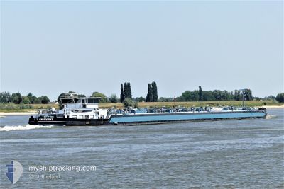
CARITAS
Tanker
Current Trip
SCLESSIN
| Time Travelled | 2 days |
|---|---|
| Remaining Time | --- |
| Distance Travelled | 106.02 nm |
| Remaining Distance | --- |
| AVG Speed | 7.5 Knots |
| MAX Speed | 10 Knots |
| AVG Wind | 8.2 knots |
| MAX Wind | 16 knots |
| MIN Temp | 2.3°C / 36.14°F |
| MAX Temp | 9.5°C / 49.1°F |
| Draught | 2.9 m |
| Position Received | 14 h, 49 m ago |
Current Position
| Longitude | 5.68906° |
|---|---|
| Latitude | 50.79077° |
| Status | Under way using engine |
| Speed | 9.4 Knots |
| Course | 347.6° |
| Area | North Sea |
| Station | T-AIS |
| Position Received | 14 h, 49 m ago |
Info
Information
The current position of CARITAS is in North Sea with coordinates 50.79077° / 5.68906° as reported on 2024-04-19 16:25 by AIS to our vessel tracker app. The vessel's current speed is 9.4 Knots
The vessel CARITAS (IMO: 2332991, MMSI: 244670074) is a Tanker It's sailing under the flag of [NL] Netherlands.
In this page you can find informations about the vessels current position, last detected port calls, and current voyage information. If the vessels is not in coverage by AIS you will find the latest position.
The current position of CARITAS is detected by our AIS receivers and we are not responsible for the reliability of the data. The last position was recorded while the vessel was in Coverage by the Ais receivers of our vessel tracking app.
The current draught of CARITAS as reported by AIS is 2.9 meters
Weather
| Temperature | 6.7°C / 44.06°F |
|---|---|
| Wind Speed | 10 knots |
| Direction | 336° NNW |
| Pressure | 1021 hPa |
| Humidity | 80.8 % |
| Cloud Coverage | 68 % |
Featured Company
Last Port Calls
| Port | Arrival | Departure | Time In Port |
|---|---|---|---|
| 2024-04-17 06:44 | 2024-04-17 09:16 | 2 h | |
| 2024-04-16 20:21 | 2024-04-17 04:49 | 8 h | |
| 2024-04-16 07:03 | 2024-04-16 19:03 | 11 h | |
| 2024-04-16 03:49 | 2024-04-16 04:07 | 17 m | |
| 2024-04-14 18:13 | 2024-04-15 13:58 | 19 h | |
| 2024-04-08 16:28 | 2024-04-08 20:10 | 3 h | |
| 2024-04-07 14:22 | 2024-04-07 15:05 | 42 m | |
| 2024-04-02 08:56 | 2024-04-06 15:30 | 4 d | |
| 2024-04-01 15:24 | 2024-04-02 03:40 | 12 h | |
| 2024-03-27 20:09 | 2024-04-01 10:23 | 4 d |
Most Visited Ports (Last year)
| Port | Arrivals | |
|---|---|---|
| 67 | ||
| 45 | ||
| 20 | ||
| 17 | ||
| 17 | ||
| 15 |
Last Trips
| Origin | Departure | Destination | Arrival | Distance | |
|---|---|---|---|---|---|
| 2024-04-17 06:49 | 2024-04-17 08:44 | 21.45 nm | |||
| 2024-04-16 21:03 | 2024-04-16 22:21 | 9.57 nm | |||
| 2024-04-16 06:07 | 2024-04-16 09:03 | 21.30 nm | |||
| 2024-04-15 15:58 | 2024-04-16 05:49 | 42.57 nm | |||
| 2024-04-08 22:10 | 2024-04-14 20:13 | 394.34 nm | |||
| 2024-04-07 17:05 | 2024-04-08 18:28 | 90.24 nm | |||
| 2024-04-06 17:30 | 2024-04-07 16:22 | 95.68 nm | |||
| 2024-04-02 05:40 | 2024-04-02 10:56 | 40.63 nm | |||
| 2024-04-01 12:23 | 2024-04-01 17:24 | 31.96 nm | |||
| 2024-03-27 17:01 | 2024-03-27 21:09 | 40.36 nm |
Events
| Time | Event | Details | Position / Dest | Info |
|---|---|---|---|---|
| 2024-04-19 16:57 | Status Changed | Default Under way using engine |
50.86333 / 5.63833
SCLESSIN
|
Speed: 9.4 kn Course: 347.6° |
| 2024-04-19 16:25 | Status Changed | Under way using engine Default |
50.79077 / 5.68906
SCLESSIN
|
Speed: 10 kn Course: 11° |
| 2024-04-19 16:25 | OUT of Coverage |
50.79077 / 5.68906
North Sea
|
Speed: 9.4 kn Course: 347.6° |
|
| 2024-04-19 16:12 | IN Coverage |
50.79077 / 5.68906
North Sea
|
Speed: 9.4 kn Course: 347.6° |
|
| 2024-04-17 19:45 | OUT of Coverage |
50.78277 / 5.68860
North Sea
|
Speed: 6 kn Course: 189° |
|
| 2024-04-17 19:29 | IN Coverage |
50.81046 / 5.67084
North Sea
|
Speed: 3.6 kn Course: 120.7° |
|
| 2024-04-17 18:23 | START Moving | 0.58 nm, South East of ZUTENDAAL |
50.90833 / 5.55333
SCLESSIN
|
Speed: 7 kn Course: 124° |
| 2024-04-17 17:41 | STOP Moving | 0.35 nm, South West of GENK |
50.93500 / 5.49167
SCLESSIN
|
Speed: Course: -1° |
| 2024-04-17 17:35 | START Moving | 0.71 nm, West of GENK |
50.93500 / 5.48167
SCLESSIN
|
Speed: 6 kn Course: 94° |
| 2024-04-17 17:08 | STOP Moving | 2.59 nm, West of GENK |
50.93833 / 5.43167
SCLESSIN
|
Speed: Course: -1° |