
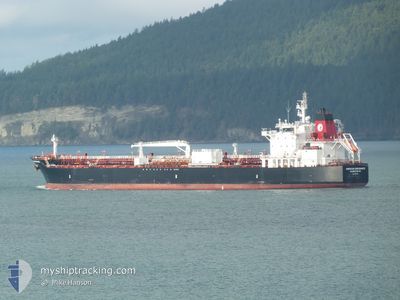
AMERICAN ENDURANCE
Tanker
Current Trip
| Time Travelled | 1 day |
|---|---|
| Remaining Time | 7 h, 32 mins |
| Distance Travelled | 305.62 nm |
| Remaining Distance | 77.31 nm |
| AVG Speed | 11.3 Knots |
| MAX Speed | 16.6 Knots |
| AVG Wind | 8.3 knots |
| MAX Wind | 16 knots |
| MIN Temp | 4.6°C / 40.28°F |
| MAX Temp | 12.1°C / 53.78°F |
| Draught | 9.4 m |
| Position Received | Now |
Current Position
| Longitude | -123.86219° |
|---|---|
| Latitude | 46.19272° |
| Status | Under way using engine |
| Speed | 8.2 Knots |
| Course | 84.7° |
| Area | North Pacific Ocean |
| Station | T-AIS |
| Position Received | Now |
Info
Information
The current position of AMERICAN ENDURANCE is in North Pacific Ocean with coordinates 46.19272° / -123.86219° as reported on 2024-04-19 09:34 by AIS to our vessel tracker app. The vessel's current speed is 8.2 Knots and is heading at the port of PORTLAND. The estimated time of arrival as calculated by MyShipTracking vessel tracking app is 2024-04-19 17:07 LT
The vessel AMERICAN ENDURANCE (IMO: 9759886, MMSI: 369040000) is a Tanker It's sailing under the flag of [US] USA.
In this page you can find informations about the vessels current position, last detected port calls, and current voyage information. If the vessels is not in coverage by AIS you will find the latest position.
The current position of AMERICAN ENDURANCE is detected by our AIS receivers and we are not responsible for the reliability of the data. The last position was recorded while the vessel was in Coverage by the Ais receivers of our vessel tracking app.
The current draught of AMERICAN ENDURANCE as reported by AIS is 9.4 meters
Weather
| Temperature | 7.3°C / 45.14°F |
|---|---|
| Wind Speed | 7 knots |
| Direction | 74° ENE |
| Pressure | 1020.7 hPa |
| Humidity | 64 % |
| Cloud Coverage | 17 % |
Featured Company
Last Port Calls
| Port | Arrival | Departure | Time In Port |
|---|---|---|---|
| 2024-04-16 22:05 | 2024-04-18 09:30 | 1 d | |
| 2024-04-04 14:27 | 2024-04-07 17:22 | 3 d | |
| 2024-03-21 14:30 | 2024-03-24 08:39 | 2 d | |
| 2024-03-12 12:34 | 2024-03-15 16:19 | 3 d | |
| 2024-03-07 21:43 | 2024-03-08 17:55 | 20 h | |
| 2024-03-06 21:56 | 2024-03-07 17:51 | 19 h | |
| 2024-03-03 02:55 | 2024-03-05 11:46 | 2 d | |
| 2024-03-01 11:29 | 2024-03-02 22:33 | 1 d | |
| 2024-02-23 21:41 | 2024-02-26 01:33 | 2 d | |
| 2024-02-16 04:45 | 2024-02-17 09:09 | 1 d |
Most Visited Ports (Last year)
| Port | Arrivals | |
|---|---|---|
| 24 | ||
| 12 | ||
| 9 | ||
| 8 | ||
| 3 | ||
| 3 |
Last Trips
| Origin | Departure | Destination | Arrival | Distance | |
|---|---|---|---|---|---|
| 2024-04-07 10:22 | 2024-04-16 15:05 | 1826.21 nm | |||
| 2024-03-24 01:39 | 2024-04-04 07:27 | 1928.13 nm | |||
| 2024-03-15 09:19 | 2024-03-21 07:30 | 1385.50 nm | |||
| 2024-03-08 09:55 | 2024-03-12 05:34 | 1088.05 nm | |||
| 2024-03-07 09:51 | 2024-03-07 13:43 | 41.46 nm | |||
| 2024-03-05 03:46 | 2024-03-06 13:56 | 356.48 nm | |||
| 2024-03-02 14:33 | 2024-03-02 18:55 | 42.74 nm | |||
| 2024-02-25 16:33 | 2024-03-01 03:29 | 1370.13 nm | |||
| 2024-02-17 01:09 | 2024-02-23 12:41 | 1508.03 nm | |||
| 2024-02-13 08:20 | 2024-02-15 20:45 | 417.78 nm |
Events
| Time | Event | Details | Position / Dest | Info |
|---|---|---|---|---|
| 2024-04-19 01:55 | Draught Changed | 9.4 9.2 |
46.89392 / -125.48242
US PDX
|
Speed: 13 kn Course: 162° |
| 2024-04-19 01:25 | Status Changed | Under way using engine Default |
47.00046 / -125.52966
US PDX
|
Speed: 13.1 kn Course: 163° |
| 2024-04-19 01:14 | IN Coverage |
46.99800 / -125.52862
North Pacific Ocean
US PDX
|
Speed: 13.1 kn Course: 163° |
|
| 2024-04-18 21:07 | Status Changed | Default Under way using engine |
47.82500 / -125.57166
US PDX
|
Speed: 12.9 kn Course: 200.9° |
| 2024-04-18 20:46 | OUT of Coverage |
47.89592 / -125.53517
North Pacific Ocean
US PDX
|
Speed: 12.9 kn Course: 200.9° |
|
| 2024-04-18 17:47 | Change Sea Area | United States part of the North Pacific Ocean Canadian part of the North Pacific Ocean |
48.48678 / -125.02878
North Pacific Ocean
US PDX
|
Speed: 14.1 kn Course: 227.9° |
| 2024-04-18 17:36 | Status Changed | Under way using engine Default |
48.50908 / -124.97748
US PDX
|
Speed: 13.9 kn Course: 270° |
| 2024-04-18 17:35 | Status Changed | Default Under way using engine |
48.50899 / -124.96797
US PDX
|
Speed: 14.2 kn Course: 273.1° |
| 2024-04-18 17:21 | Detected in Sea | Canadian part of the North Pacific Ocean |
48.50640 / -124.88402
North Pacific Ocean
US PDX
|
Speed: 14.5 kn Course: 273.4° |
| 2024-04-18 17:21 | Status Changed | Under way using engine Default |
48.50640 / -124.88402
US PDX
|
Speed: 14 kn Course: 269° |